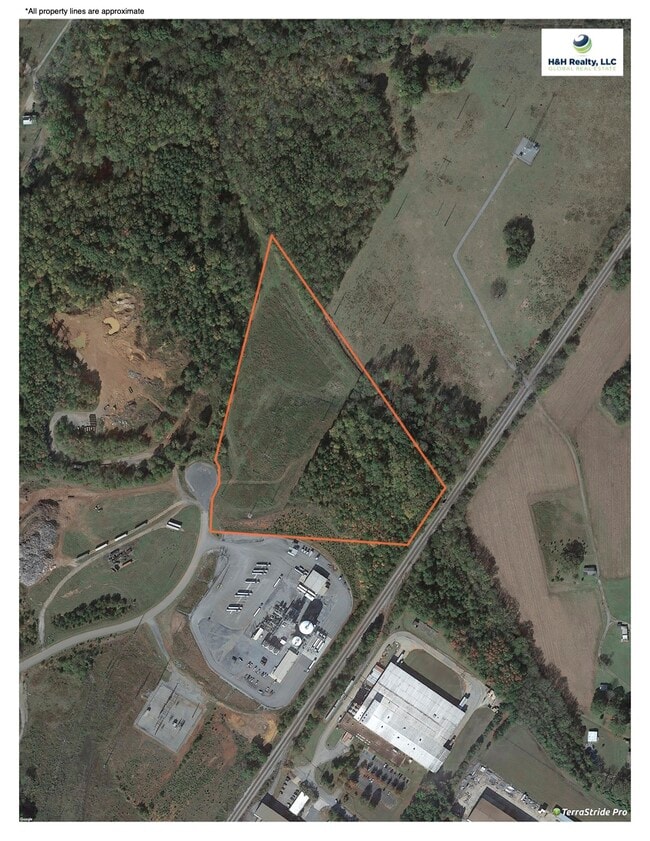
Property Record
73 Guyton Ind Dr Ne, Cartersville, GA 30121

Property Detail
73 Guyton Ind Dr Ne
0079-0200-007
LL 200 LD 5 GUYTON INDUSTRIAL PARK
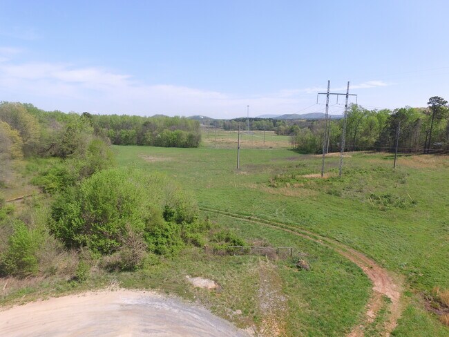
Officebuilding
Bartow
A1
Georgia
AE The base floodplain where base flood elevations are provided. AE Zones are now used on new format FIRMs instead of A1-A30 Zones.
200
2025
48.04 AC
2025
Bartow County
960403
Atlanta
800 SF
Atlanta-Sandy Springs-Roswell, GA
NEARBY LISTINGS FOR SALE OR LEASE
DEMOGRAPHICS near 73 Guyton Ind Dr Ne
1 mile
3 mile
5 mile
2025 Total Population
2,090
27,314
55,199
2030 Population
2,262
29,198
59,023
Pop Growth 2025-2030
+ 8.23%
+ 6.90%
+ 6.93%
Average Age
39
39
39
2025 Total Households
864
10,448
20,688
HH Growth 2025-2030
+ 8.22%
+ 7.02%
+ 6.98%
Median Household Inc
$60,949
$74,531
$78,610
Avg Household Size
2.40
2.50
2.60
2025 Avg HH Vehicles
2.00
2.00
2.00
Median Home Value
$302,059
$280,536
$312,803
Median Year Built
2003
1995
1995
Nearby Places
Map Layers
Map Styles
 Street
 Aerial
Layers
 Traffic
 Biking
Places
Listings with unknown addresses are not visible on the map
- Restaurants
- Banks
- Shops
- Fitness
- Groceries
SALE & LEASE HISTORY
LISTING DATE
SALE/LEASE

Mar 31, 2021
For Sale
Dec 07, 2022
For Sale
Nearby Properties
Address
Land Use
TOTAL SIZE
Lot Size
Zoning
Address
Land Use
TOTAL SIZE
Lot Size
Zoning
144,208 SF
585.38 AC
IN
Address
Land Use
TOTAL SIZE
Lot Size
Zoning
141,651 SF
181.89 AC
I1
Address
Land Use
TOTAL SIZE
Lot Size
Zoning
107,992 SF
46 AC
IN
Address
Land Use
TOTAL SIZE
Lot Size
Zoning
67,428 SF
36.96 AC
Address
Land Use
TOTAL SIZE
Lot Size
Zoning
7,488 SF
38.49 AC
IN
Address
Land Use
TOTAL SIZE
Lot Size
Zoning
90,497 SF
24.36 AC
Address
Land Use
TOTAL SIZE
Lot Size
Zoning
250,701 SF
15.17 AC
C1
Address
Land Use
TOTAL SIZE
Lot Size
Zoning
148,808 SF
30.74 AC
A1
Address
Land Use
TOTAL SIZE
Lot Size
Zoning
33,096 SF
15.80 AC
Address
Land Use
TOTAL SIZE
Lot Size
Zoning
683.23 AC
Address
Land Use
TOTAL SIZE
Lot Size
Zoning
766,373 SF
267.91 AC
I2
Address
Land Use
TOTAL SIZE
Lot Size
Zoning
51,681 SF
16 AC
Address
Land Use
TOTAL SIZE
Lot Size
Zoning
526,400 SF
64.52 AC
Address
Land Use
TOTAL SIZE
Lot Size
Zoning
84,852 SF
6.78 AC
A1
Address
Land Use
TOTAL SIZE
Lot Size
Zoning
91,110 SF
17.09 AC
Address
Land Use
TOTAL SIZE
Lot Size
Zoning
151,571 SF
25.82 AC
Address
Land Use
TOTAL SIZE
Lot Size
Zoning
24,256 SF
11.87 AC
R3WC
Address
Land Use
TOTAL SIZE
Lot Size
Zoning
267,558 SF
28.14 AC
A1
Address
Land Use
TOTAL SIZE
Lot Size
Zoning
3,696 SF
12 AC
IN
Address
Land Use
TOTAL SIZE
Lot Size
Zoning
211,821 SF
20.32 AC
Address
Land Use
TOTAL SIZE
Lot Size
Zoning
144,416 SF
40.01 AC
A1
Address
Land Use
TOTAL SIZE
Lot Size
Zoning
328,000 SF
43.09 AC
Address
Land Use
TOTAL SIZE
Lot Size
Zoning
8,064 SF
36.63 AC
IN
Address
Land Use
TOTAL SIZE
Lot Size
Zoning
60,361 SF
13.66 AC
A1
Address
Land Use
TOTAL SIZE
Lot Size
Zoning
20.79 AC
RESIDENTIA
Address
Land Use
TOTAL SIZE
Lot Size
Zoning
8,760 SF
151.31 AC
IN
Address
Land Use
TOTAL SIZE
Lot Size
Zoning
196,426 SF
37.60 AC
IN
Address
Land Use
TOTAL SIZE
Lot Size
Zoning
28,736 SF
8.53 AC
C1
Address
Land Use
TOTAL SIZE
Lot Size
Zoning
9,560 SF
12 AC
R3
Address
Land Use
TOTAL SIZE
Lot Size
Zoning
12,769 SF
4.44 AC
C1
The World's #1 Commercial Real Estate Marketplace
Connect with us
© 2026 CoStar Group
The information above has been obtained from sources believed reliable. While we do not doubt its accuracy we have not verified it and make no guarantee, warranty or representation about it. It is your responsibility to independently confirm its accuracy and completeness. Any projections, opinions, assumptions, or estimates used are for example only and do not represent the current or future performance of the property. The value of this transaction to you depends on tax and other factors which should be evaluated by your tax, financial, and legal advisors. You and your advisors should conduct a careful, independent investigation of the property to determine to your satisfaction the suitability of the property for your needs.