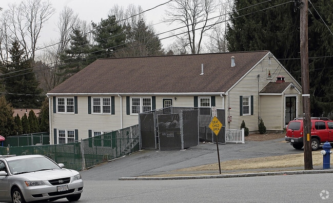
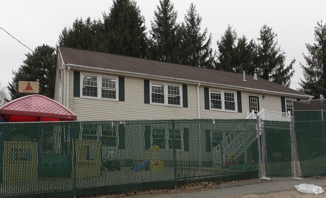
Property Record
73 Harrington Rd, Framingham, MA 01701

Property Detail
73 Harrington Rd
FRAM-000009-000040-003801
Middlesex
Daycare
Massachusetts
R3
3801
B and X Area of moderate flood hazard, usually the area between the limits of the 100-year and 500-year floods.
0.46 AC
2025
Framingham/Natick
2025
Boston
383904
Boston-Cambridge-Newton, MA-NH
2,400 SF
NEARBY LISTINGS FOR SALE OR LEASE
DEMOGRAPHICS near 73 Harrington Rd
1 mile
3 mile
5 mile
2025 Total Population
3,925
38,874
121,371
2030 Population
4,076
40,470
126,705
Pop Growth 2025-2030
+ 3.85%
+ 4.11%
+ 4.39%
Average Age
45
43
42
2025 Total Households
1,575
14,753
46,687
HH Growth 2025-2030
+ 3.94%
+ 4.23%
+ 4.54%
Median Household Inc
$126,479
$145,903
$120,863
Avg Household Size
2.40
2.60
2.50
2025 Avg HH Vehicles
2.00
2.00
2.00
Median Home Value
$710,955
$748,255
$749,151
Median Year Built
1964
1965
1969
Nearby Places
Map Layers
Map Styles
 Street
 Aerial
Layers
 Traffic
 Biking
Places
Listings with unknown addresses are not visible on the map
- Restaurants
- Banks
- Shops
- Fitness
- Groceries
PUBLIC TRANSPORTATION
COMMUTER RAIL
Framingham (Framingham/Worcester Line - Massachusetts Bay Transportation Authority Commuter Rail (Purple Line))
Drive
Walk
Distance
Framingham (Framingham/Worcester Line - Massachusetts Bay Transportation Authority Commuter Rail (Purple Line))
12 min
5.4 mi
West Natick (Framingham/Worcester Line - Massachusetts Bay Transportation Authority Commuter Rail (Purple Line))
Drive
Walk
Distance
West Natick (Framingham/Worcester Line - Massachusetts Bay Transportation Authority Commuter Rail (Purple Line))
15 min
6.7 mi
AIRPORT
General Edward Lawrence Logan International
Drive
Walk
Distance
General Edward Lawrence Logan International
43 min
28.3 mi
Worcester Regional
Drive
Walk
Distance
Worcester Regional
48 min
30.4 mi
Freight Ports
Port of Boston
Drive
Walk
Distance
Port of Boston
42 min
26.6 mi
Nearby Properties
Address
Land Use
TOTAL SIZE
Lot Size
Zoning
Address
Land Use
TOTAL SIZE
Lot Size
Zoning
396,002 SF
44.44 AC
R1
Address
Land Use
TOTAL SIZE
Lot Size
Zoning
24.78 AC
LID
Address
Land Use
TOTAL SIZE
Lot Size
Zoning
87,102 SF
8.26 AC
R40
Address
Land Use
TOTAL SIZE
Lot Size
Zoning
136,919 SF
13.42 AC
M
Address
Land Use
TOTAL SIZE
Lot Size
Zoning
157.48 AC
LI
Address
Land Use
TOTAL SIZE
Lot Size
Zoning
182,524 SF
3.60 AC
B2
Address
Land Use
TOTAL SIZE
Lot Size
Zoning
182,736 SF
7.30 AC
B2
Address
Land Use
TOTAL SIZE
Lot Size
Zoning
139,397 SF
9.15 AC
M
Address
Land Use
TOTAL SIZE
Lot Size
Zoning
350,935 SF
25.51 AC
M
Address
Land Use
TOTAL SIZE
Lot Size
Zoning
183,338 SF
4.85 AC
B2
Address
Land Use
TOTAL SIZE
Lot Size
Zoning
114,000 SF
31.53 AC
PRD
Address
Land Use
TOTAL SIZE
Lot Size
Zoning
239,454 SF
12.65 AC
R3
Address
Land Use
TOTAL SIZE
Lot Size
Zoning
126,828 SF
8.81 AC
R4
Address
Land Use
TOTAL SIZE
Lot Size
Zoning
162,704 SF
26.50 AC
RESA
Address
Land Use
TOTAL SIZE
Lot Size
Zoning
26.16 AC
LID
Address
Land Use
TOTAL SIZE
Lot Size
Zoning
27.16 AC
RESA
Address
Land Use
TOTAL SIZE
Lot Size
Zoning
28.26 AC
LID
Address
Land Use
TOTAL SIZE
Lot Size
Zoning
194,372 SF
35.72 AC
R3
Address
Land Use
TOTAL SIZE
Lot Size
Zoning
75,638 SF
23.51 AC
R3
Address
Land Use
TOTAL SIZE
Lot Size
Zoning
53.75 AC
Address
Land Use
TOTAL SIZE
Lot Size
Zoning
61,500 SF
13.67 AC
R3
Address
Land Use
TOTAL SIZE
Lot Size
Zoning
9.26 AC
LBD
Address
Land Use
TOTAL SIZE
Lot Size
Zoning
60,193 SF
15.67 AC
ID
Address
Land Use
TOTAL SIZE
Lot Size
Zoning
44,300 SF
16.94 AC
R1
Address
Land Use
TOTAL SIZE
Lot Size
Zoning
63,600 SF
12.75 AC
R3
Address
Land Use
TOTAL SIZE
Lot Size
Zoning
74,133 SF
7.32 AC
ID
Address
Land Use
TOTAL SIZE
Lot Size
Zoning
166,800 SF
8.43 AC
M
Address
Land Use
TOTAL SIZE
Lot Size
Zoning
9.66 AC
LBD
Address
Land Use
TOTAL SIZE
Lot Size
Zoning
59,600 SF
3.19 AC
R1
Address
Land Use
TOTAL SIZE
Lot Size
Zoning
285.64 AC
R3
The World's #1 Commercial Real Estate Marketplace
Connect with us
© 2026 CoStar Group
The information above has been obtained from sources believed reliable. While we do not doubt its accuracy we have not verified it and make no guarantee, warranty or representation about it. It is your responsibility to independently confirm its accuracy and completeness. Any projections, opinions, assumptions, or estimates used are for example only and do not represent the current or future performance of the property. The value of this transaction to you depends on tax and other factors which should be evaluated by your tax, financial, and legal advisors. You and your advisors should conduct a careful, independent investigation of the property to determine to your satisfaction the suitability of the property for your needs.