Property Record
73 Hope Ln, Saint Marks, FL 32355

Save to a Folder
{{folder.Name}}
{{folder.ListingIds.length}} Properties
{{folder.ListingIds.length}} Property
Create a New Folder
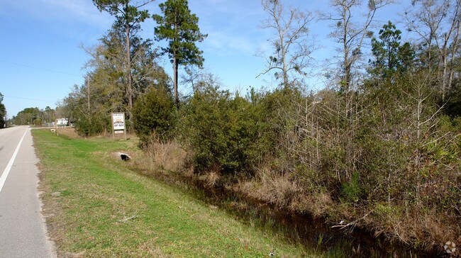
Property Detail
73 Hope Ln
Tallahassee, FL
P-19-12-M-83B 9.90 AC M/L IN THE NW 1/4 OF SECT 2 BEING ON EAST SIDE OF PORT LEON DR OR 409 P 478 OR 452 P 800
02-4S-01E-000-05565-014
WAKULLA
Timberlandforesttreesagricultural
Florida
VE and V1-30 Coastal areas with a 1% or greater chance of flooding and an additional hazard associated with storm waves. These areas have a 26% chance of flooding over the life of a 30-year mortgage.
27.07 AC
2025
Wakulla County
2025
Tallahassee
010207
NEARBY LISTINGS FOR SALE OR LEASE
-
-
View all Saint Marks listings for sale on LoopNet.com
DEMOGRAPHICS near 73 Hope Ln
1 mile
3 mile
5 mile
2025 Total Population
0
654
2,964
2030 Population
0
689
3,147
Pop Growth 2025-2030
0.00%
+ 5.35%
+ 6.17%
Average Age
0
47
46
2025 Total Households
0
145
752
HH Growth 2025-2030
0.00%
+ 6.90%
+ 7.85%
Median Household Inc
$0
$70,312
$71,965
Avg Household Size
.00
2.40
2.40
2025 Avg HH Vehicles
.00
3.00
2.00
Median Home Value
$0
$335,000
$308,919
Median Year Built
0
1996
1997
Nearby Places
Map Layers
Map Styles
 Street
 Aerial
Layers
 Traffic
 Biking
Places
Listings with unknown addresses are not visible on the map
- Restaurants
- Banks
- Shops
- Fitness
- Groceries
PUBLIC TRANSPORTATION
AIRPORT
Tallahassee International
Drive
Walk
Distance
Tallahassee International
35 min
21.2 mi
Freight Ports
Port of Panama City
Drive
Walk
Distance
Port of Panama City
154 min
110.3 mi
Nearby Properties
Address
Land Use
TOTAL SIZE
Lot Size
Zoning
Address
Land Use
TOTAL SIZE
Lot Size
Zoning
330,500 SF
729 AC
Address
Land Use
TOTAL SIZE
Lot Size
Zoning
576 SF
1.87 AC
Address
Land Use
TOTAL SIZE
Lot Size
Zoning
52.15 AC
Address
Land Use
TOTAL SIZE
Lot Size
Zoning
14,934 SF
0.40 AC
Address
Land Use
TOTAL SIZE
Lot Size
Zoning
4,042 SF
47 AC
Address
Land Use
TOTAL SIZE
Lot Size
Zoning
19,647 SF
4 AC
Address
Land Use
TOTAL SIZE
Lot Size
Zoning
29.73 AC
Address
Land Use
TOTAL SIZE
Lot Size
Zoning
Address
Land Use
TOTAL SIZE
Lot Size
Zoning
5,122 SF
930.27 AC
Address
Land Use
TOTAL SIZE
Lot Size
Zoning
34,452 SF
0.69 AC
Address
Land Use
TOTAL SIZE
Lot Size
Zoning
16,680 SF
0.55 AC
Address
Land Use
TOTAL SIZE
Lot Size
Zoning
4,219 SF
20 AC
Address
Land Use
TOTAL SIZE
Lot Size
Zoning
325.63 AC
Address
Land Use
TOTAL SIZE
Lot Size
Zoning
34,457 SF
5 AC
Address
Land Use
TOTAL SIZE
Lot Size
Zoning
9,814 SF
4.17 AC
Address
Land Use
TOTAL SIZE
Lot Size
Zoning
1.85 AC
Address
Land Use
TOTAL SIZE
Lot Size
Zoning
8,710 SF
1 AC
Address
Land Use
TOTAL SIZE
Lot Size
Zoning
4,324 SF
0.22 AC
Address
Land Use
TOTAL SIZE
Lot Size
Zoning
2,112 SF
4.42 AC
Address
Land Use
TOTAL SIZE
Lot Size
Zoning
5,460 SF
1 AC
C3
Address
Land Use
TOTAL SIZE
Lot Size
Zoning
5,742 SF
0.35 AC
Address
Land Use
TOTAL SIZE
Lot Size
Zoning
4,284 SF
7.71 AC
Address
Land Use
TOTAL SIZE
Lot Size
Zoning
5,340 SF
7.70 AC
Address
Land Use
TOTAL SIZE
Lot Size
Zoning
5,894 SF
0.09 AC
Address
Land Use
TOTAL SIZE
Lot Size
Zoning
6,756 SF
0.03 AC
Address
Land Use
TOTAL SIZE
Lot Size
Zoning
14.40 AC
AG
Address
Land Use
TOTAL SIZE
Lot Size
Zoning
5,606 SF
20 AC
Address
Land Use
TOTAL SIZE
Lot Size
Zoning
3,000 SF
0.97 AC
Address
Land Use
TOTAL SIZE
Lot Size
Zoning
12,110 SF
6.68 AC
Address
Land Use
TOTAL SIZE
Lot Size
Zoning
111.01 AC
The World's #1 Commercial Real Estate Marketplace
Connect with us
© 2026 CoStar Group
The information above has been obtained from sources believed reliable. While we do not doubt its accuracy we have not verified it and make no guarantee, warranty or representation about it. It is your responsibility to independently confirm its accuracy and completeness. Any projections, opinions, assumptions, or estimates used are for example only and do not represent the current or future performance of the property. The value of this transaction to you depends on tax and other factors which should be evaluated by your tax, financial, and legal advisors. You and your advisors should conduct a careful, independent investigation of the property to determine to your satisfaction the suitability of the property for your needs.