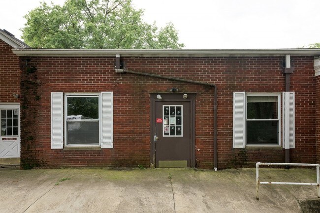
Property Record
73 Madison Rd, Mansfield, OH 44905


Current Lease Availabilities
Property Detail
73 Madison Rd
Mansfield, OH
MADISON TWP SW A 2.12 LT 12 PT
025-09-038-02-000
Richland
Retirementnursinghomecombined
Ohio
AE The base floodplain where base flood elevations are provided. AE Zones are now used on new format FIRMs instead of A1-A30 Zones.
12
2024
2.12 AC
2025
Richland County
000900
Cleveland
22,429 SF
NEARBY LISTINGS FOR SALE OR LEASE
-
-
View all Mansfield listings for lease on LoopNet.com
DEMOGRAPHICS near 73 Madison Rd
1 mile
3 mile
5 mile
2025 Total Population
5,282
46,777
70,909
2030 Population
5,290
46,719
70,689
Pop Growth 2025-2030
+ 0.15%
(0.12%)
(0.31%)
Average Age
39
40
42
2025 Total Households
2,258
18,063
28,804
HH Growth 2025-2030
+ 0.09%
(0.22%)
(0.39%)
Median Household Inc
$43,420
$44,736
$50,277
Avg Household Size
2.20
2.20
2.20
2025 Avg HH Vehicles
2.00
2.00
2.00
Median Home Value
$73,333
$113,007
$146,692
Median Year Built
1954
1956
1960
Nearby Places
Map Layers
Map Styles
 Street
 Aerial
Layers
 Traffic
 Biking
Places
Listings with unknown addresses are not visible on the map
- Restaurants
- Banks
- Shops
- Fitness
- Groceries
Nearby Properties
Address
Land Use
TOTAL SIZE
Lot Size
Zoning
Address
Land Use
TOTAL SIZE
Lot Size
Zoning
456.50 AC
Address
Land Use
TOTAL SIZE
Lot Size
Zoning
492,672 SF
6.83 AC
Address
Land Use
TOTAL SIZE
Lot Size
Zoning
354,710 SF
7.07 AC
Address
Land Use
TOTAL SIZE
Lot Size
Zoning
114,931 SF
17.86 AC
Address
Land Use
TOTAL SIZE
Lot Size
Zoning
139,809 SF
0.99 AC
Address
Land Use
TOTAL SIZE
Lot Size
Zoning
0.06 AC
Address
Land Use
TOTAL SIZE
Lot Size
Zoning
148,135 SF
6.89 AC
Address
Land Use
TOTAL SIZE
Lot Size
Zoning
2.31 AC
Address
Land Use
TOTAL SIZE
Lot Size
Zoning
107,456 SF
50.78 AC
Address
Land Use
TOTAL SIZE
Lot Size
Zoning
92,587 SF
48.78 AC
Address
Land Use
TOTAL SIZE
Lot Size
Zoning
52.67 AC
Address
Land Use
TOTAL SIZE
Lot Size
Zoning
15,490 SF
89.80 AC
Address
Land Use
TOTAL SIZE
Lot Size
Zoning
32,728 SF
56.23 AC
Address
Land Use
TOTAL SIZE
Lot Size
Zoning
66,940 SF
12.40 AC
Address
Land Use
TOTAL SIZE
Lot Size
Zoning
1.69 AC
Address
Land Use
TOTAL SIZE
Lot Size
Zoning
28,638 SF
24.86 AC
Address
Land Use
TOTAL SIZE
Lot Size
Zoning
47.90 AC
Address
Land Use
TOTAL SIZE
Lot Size
Zoning
44,718 SF
0.47 AC
Address
Land Use
TOTAL SIZE
Lot Size
Zoning
30,306 SF
5.63 AC
Address
Land Use
TOTAL SIZE
Lot Size
Zoning
106,361 SF
5.06 AC
Address
Land Use
TOTAL SIZE
Lot Size
Zoning
82,695 SF
40.16 AC
Address
Land Use
TOTAL SIZE
Lot Size
Zoning
75,157 SF
0.41 AC
Address
Land Use
TOTAL SIZE
Lot Size
Zoning
31,064 SF
9 AC
Address
Land Use
TOTAL SIZE
Lot Size
Zoning
78,288 SF
20.76 AC
Address
Land Use
TOTAL SIZE
Lot Size
Zoning
103,000 SF
17.38 AC
Address
Land Use
TOTAL SIZE
Lot Size
Zoning
1,035 SF
12.53 AC
Address
Land Use
TOTAL SIZE
Lot Size
Zoning
94,920 SF
0.27 AC
Address
Land Use
TOTAL SIZE
Lot Size
Zoning
79,731 SF
10.32 AC
Address
Land Use
TOTAL SIZE
Lot Size
Zoning
3,235 SF
29.02 AC
Address
Land Use
TOTAL SIZE
Lot Size
Zoning
43,356 SF
5.30 AC
The World's #1 Commercial Real Estate Marketplace
Connect with us
© 2026 CoStar Group
The information above has been obtained from sources believed reliable. While we do not doubt its accuracy we have not verified it and make no guarantee, warranty or representation about it. It is your responsibility to independently confirm its accuracy and completeness. Any projections, opinions, assumptions, or estimates used are for example only and do not represent the current or future performance of the property. The value of this transaction to you depends on tax and other factors which should be evaluated by your tax, financial, and legal advisors. You and your advisors should conduct a careful, independent investigation of the property to determine to your satisfaction the suitability of the property for your needs.