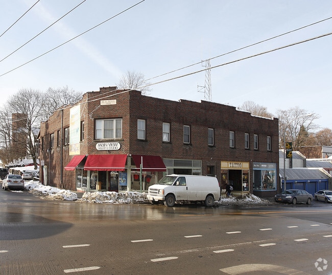
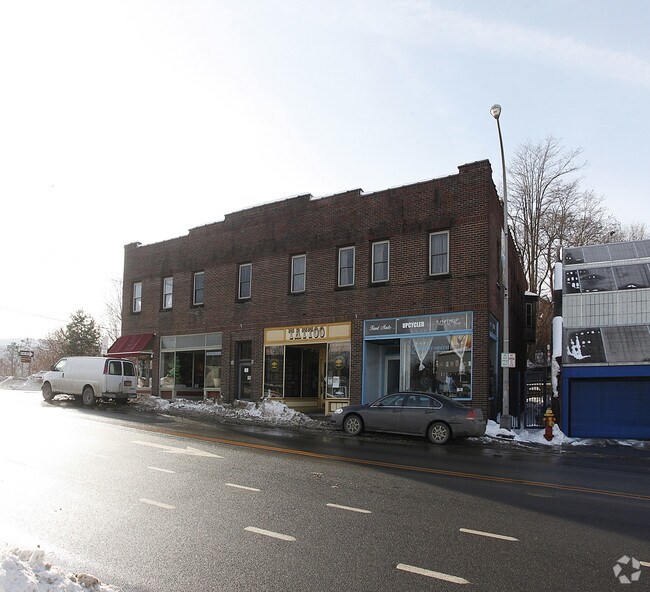
Property Record
73 Main St, Oneonta, NY 13820
NEARBY LISTINGS FOR SALE OR LEASE
Property Detail
73 Main St
361200-300-005-0005-055-000-0000
Otsego
Commercialofficeresidentialmixeduse
New York
X
55.000
36077C0654E
0.16 AC
2025
Otsego County
2024
Albany/Schenectady/Troy
591100
Oneonta, NY
6,880 SF
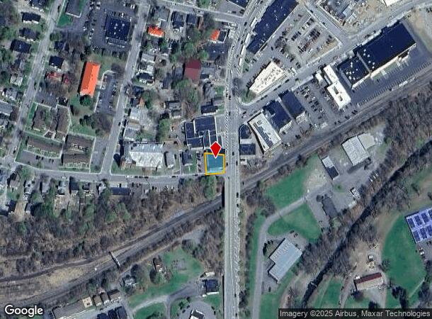
DEMOGRAPHICS near 73 Main St
1 mile
3 mile
5 mile
2024 Total Population
12,111
20,053
23,556
2029 Population
12,109
20,035
23,487
Pop Growth 2024-2029
(0.02%)
(0.09%)
(0.29%)
Average Age
34
36
37
2024 Total Households
3,620
5,990
7,437
HH Growth 2024-2029
+ 0.28%
(0.23%)
(0.51%)
Median Household Inc
$54,680
$57,615
$58,391
Avg Household Size
2.00
2.10
2.10
2024 Avg HH Vehicles
1.00
1.00
2.00
Median Home Value
$164,898
$169,237
$169,619
Median Year Built
1947
1948
1951
Nearby Places
Map Layers
Map Styles
 Street
 Aerial
Transit
 Traffic
 Biking
Places
Listings with unknown addresses are not visible on the map
- Restaurants
- Banks
- Shops
- Fitness
- Groceries
Nearby Properties
Address
Land Use
TOTAL SIZE
Lot Size
Zoning
Address
Land Use
TOTAL SIZE
Lot Size
Zoning
44,216 SF
106.49 AC
610
Address
Land Use
TOTAL SIZE
Lot Size
Zoning
10,927 SF
142.34 AC
610
Address
Land Use
TOTAL SIZE
Lot Size
Zoning
204.26 AC
01
Address
Land Use
TOTAL SIZE
Lot Size
Zoning
216,150 SF
3.04 AC
610
Address
Land Use
TOTAL SIZE
Lot Size
Zoning
103.77 AC
01
Address
Land Use
TOTAL SIZE
Lot Size
Zoning
456,905 SF
73.89 AC
620
Address
Land Use
TOTAL SIZE
Lot Size
Zoning
126,759 SF
0.97 AC
610
Address
Land Use
TOTAL SIZE
Lot Size
Zoning
170,000 SF
15.79 AC
120
Address
Land Use
TOTAL SIZE
Lot Size
Zoning
130,300 SF
20.06 AC
PDD-R
Address
Land Use
TOTAL SIZE
Lot Size
Zoning
275,240 SF
28.08 AC
Address
Land Use
TOTAL SIZE
Lot Size
Zoning
141,104 SF
17.85 AC
01
Address
Land Use
TOTAL SIZE
Lot Size
Zoning
Address
Land Use
TOTAL SIZE
Lot Size
Zoning
179,626 SF
21.80 AC
01
Address
Land Use
TOTAL SIZE
Lot Size
Zoning
134,563 SF
33.59 AC
Address
Land Use
TOTAL SIZE
Lot Size
Zoning
8,400 SF
65.53 AC
510
Address
Land Use
TOTAL SIZE
Lot Size
Zoning
55,551 SF
6 AC
Address
Land Use
TOTAL SIZE
Lot Size
Zoning
42,000 SF
2.06 AC
230
Address
Land Use
TOTAL SIZE
Lot Size
Zoning
80,492 SF
9.32 AC
Address
Land Use
TOTAL SIZE
Lot Size
Zoning
71,504 SF
4.09 AC
Address
Land Use
TOTAL SIZE
Lot Size
Zoning
36,629 SF
2.11 AC
610
Address
Land Use
TOTAL SIZE
Lot Size
Zoning
113.33 AC
520
Address
Land Use
TOTAL SIZE
Lot Size
Zoning
83,256 SF
1.30 AC
620
Address
Land Use
TOTAL SIZE
Lot Size
Zoning
84,790 SF
2.11 AC
150
Address
Land Use
TOTAL SIZE
Lot Size
Zoning
7,980 SF
63.84 AC
01
Address
Land Use
TOTAL SIZE
Lot Size
Zoning
64,072 SF
1.53 AC
330
Address
Land Use
TOTAL SIZE
Lot Size
Zoning
67,224 SF
8.11 AC
Address
Land Use
TOTAL SIZE
Lot Size
Zoning
34,560 SF
5.74 AC
110
Address
Land Use
TOTAL SIZE
Lot Size
Zoning
0.01 AC
Address
Land Use
TOTAL SIZE
Lot Size
Zoning
55,648 SF
9.90 AC
Address
Land Use
TOTAL SIZE
Lot Size
Zoning
83,384 SF
10.45 AC
The World's #1 Commercial Real Estate Marketplace
Connect with us
© 2026 CoStar Group
The information above has been obtained from sources believed reliable. While we do not doubt its accuracy we have not verified it and make no guarantee, warranty or representation about it. It is your responsibility to independently confirm its accuracy and completeness. Any projections, opinions, assumptions, or estimates used are for example only and do not represent the current or future performance of the property. The value of this transaction to you depends on tax and other factors which should be evaluated by your tax, financial, and legal advisors. You and your advisors should conduct a careful, independent investigation of the property to determine to your satisfaction the suitability of the property for your needs.