Property Record
73 Old Dublin Pike, Doylestown, PA 18901
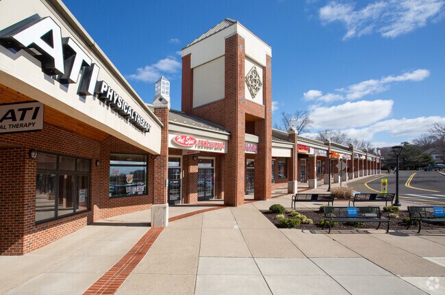

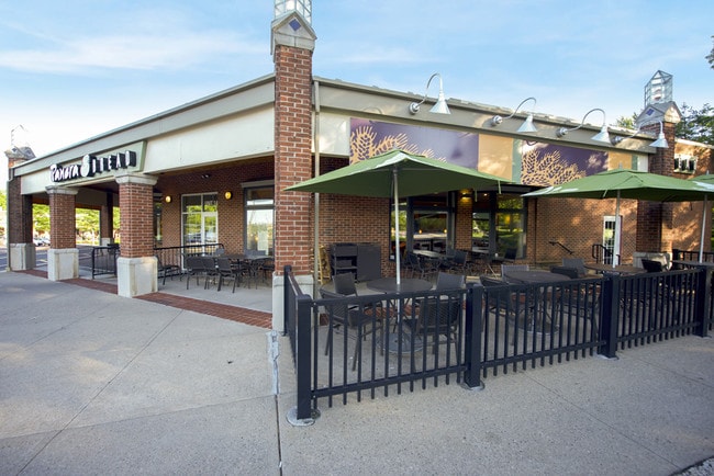

Property Detail
73 Old Dublin Pike
09-009-021
13.746AC N W COR US611 & OLD DUBLIN PIKE
Regionalshoppingcenterormallwithanchorstore
Bucks
R2
Pennsylvania
AE The base floodplain where base flood elevations are provided. AE Zones are now used on new format FIRMs instead of A1-A30 Zones.
13.75 AC
2025
Upper Bucks County
2026
Philadelphia
104604
Philadelphia-Camden-Wilmington, PA-NJ-DE-MD
91,222 SF
NEARBY LISTINGS FOR SALE OR LEASE
DEMOGRAPHICS near 73 Old Dublin Pike
1 mile
3 mile
5 mile
2025 Total Population
11,269
38,738
82,369
2030 Population
11,798
39,326
83,196
Pop Growth 2025-2030
+ 4.69%
+ 1.52%
+ 1.00%
Average Age
47
45
43
2025 Total Households
5,203
15,416
30,157
HH Growth 2025-2030
+ 5.29%
+ 1.97%
+ 1.31%
Median Household Inc
$95,728
$121,019
$137,895
Avg Household Size
2.10
2.40
2.60
2025 Avg HH Vehicles
2.00
2.00
2.00
Median Home Value
$495,578
$633,147
$642,641
Median Year Built
1981
1981
1986
Nearby Places
Map Layers
Map Styles
 Street
 Aerial
Layers
 Traffic
 Biking
Places
Listings with unknown addresses are not visible on the map
- Restaurants
- Banks
- Shops
- Fitness
- Groceries
PUBLIC TRANSPORTATION
COMMUTER RAIL
Doylestown (R5 - Southeastern Pennsylvania Transportation Authority Regional Rail (SEPTA Regional Rail))
Drive
Walk
Distance
Doylestown (R5 - Southeastern Pennsylvania Transportation Authority Regional Rail (SEPTA Regional Rail))
5 min
1.5 mi
Delaware Valley College (R5 - Southeastern Pennsylvania Transportation Authority Regional Rail (SEPTA Regional Rail))
Drive
Walk
Distance
Delaware Valley College (R5 - Southeastern Pennsylvania Transportation Authority Regional Rail (SEPTA Regional Rail))
8 min
3.4 mi
AIRPORT
Trenton Mercer
Drive
Walk
Distance
Trenton Mercer
39 min
22.7 mi
Lehigh Valley International
Drive
Walk
Distance
Lehigh Valley International
59 min
34.0 mi
Freight Ports
Port of Philadelphia
Drive
Walk
Distance
Port of Philadelphia
51 min
29.5 mi
SALE & LEASE HISTORY
LISTING DATE
SALE/LEASE

Sep 24, 2016
For Lease
Nearby Properties
Address
Land Use
TOTAL SIZE
Lot Size
Zoning
Address
Land Use
TOTAL SIZE
Lot Size
Zoning
72,937 SF
42.19 AC
CR
Address
Land Use
TOTAL SIZE
Lot Size
Zoning
254,611 SF
22.06 AC
RC
Address
Land Use
TOTAL SIZE
Lot Size
Zoning
200,220 SF
30.81 AC
C2
Address
Land Use
TOTAL SIZE
Lot Size
Zoning
8,120 SF
56.80 AC
C3
Address
Land Use
TOTAL SIZE
Lot Size
Zoning
30,939 SF
28.69 AC
I
Address
Land Use
TOTAL SIZE
Lot Size
Zoning
30,904 SF
3.32 AC
PI
Address
Land Use
TOTAL SIZE
Lot Size
Zoning
344,604 SF
6.95 AC
LI
Address
Land Use
TOTAL SIZE
Lot Size
Zoning
90,000 SF
7.25 AC
R2
Address
Land Use
TOTAL SIZE
Lot Size
Zoning
77,630 SF
28.53 AC
R2B
Address
Land Use
TOTAL SIZE
Lot Size
Zoning
109,660 SF
9.81 AC
R3
Address
Land Use
TOTAL SIZE
Lot Size
Zoning
97,496 SF
12.67 AC
R3
Address
Land Use
TOTAL SIZE
Lot Size
Zoning
60,500 SF
5.90 AC
C2
Address
Land Use
TOTAL SIZE
Lot Size
Zoning
230,150 SF
12.10 AC
CR-H
Address
Land Use
TOTAL SIZE
Lot Size
Zoning
77,964 SF
9.79 AC
R3
Address
Land Use
TOTAL SIZE
Lot Size
Zoning
54,090 SF
7.25 AC
R4
Address
Land Use
TOTAL SIZE
Lot Size
Zoning
32,319 SF
7.30 AC
C1
Address
Land Use
TOTAL SIZE
Lot Size
Zoning
114,588 SF
0.82 AC
FC
Address
Land Use
TOTAL SIZE
Lot Size
Zoning
50,049 SF
5.45 AC
PC1
Address
Land Use
TOTAL SIZE
Lot Size
Zoning
16,828 SF
3.28 AC
R2
Address
Land Use
TOTAL SIZE
Lot Size
Zoning
42,587 SF
12.09 AC
R1
Address
Land Use
TOTAL SIZE
Lot Size
Zoning
21,285 SF
118.88 AC
R1
Address
Land Use
TOTAL SIZE
Lot Size
Zoning
32,298 SF
3.97 AC
R3
Address
Land Use
TOTAL SIZE
Lot Size
Zoning
25,479 SF
15.35 AC
I
Address
Land Use
TOTAL SIZE
Lot Size
Zoning
234,274 SF
24.12 AC
C4
Address
Land Use
TOTAL SIZE
Lot Size
Zoning
36,635 SF
2.97 AC
CR-H
Address
Land Use
TOTAL SIZE
Lot Size
Zoning
85,416 SF
4.30 AC
PC1
Address
Land Use
TOTAL SIZE
Lot Size
Zoning
34,068 SF
1.09 AC
R2
Address
Land Use
TOTAL SIZE
Lot Size
Zoning
31,925 SF
9.10 AC
R3
Address
Land Use
TOTAL SIZE
Lot Size
Zoning
38,530 SF
2.38 AC
RC1
The World's #1 Commercial Real Estate Marketplace
Connect with us
© 2026 CoStar Group
The information above has been obtained from sources believed reliable. While we do not doubt its accuracy we have not verified it and make no guarantee, warranty or representation about it. It is your responsibility to independently confirm its accuracy and completeness. Any projections, opinions, assumptions, or estimates used are for example only and do not represent the current or future performance of the property. The value of this transaction to you depends on tax and other factors which should be evaluated by your tax, financial, and legal advisors. You and your advisors should conduct a careful, independent investigation of the property to determine to your satisfaction the suitability of the property for your needs.