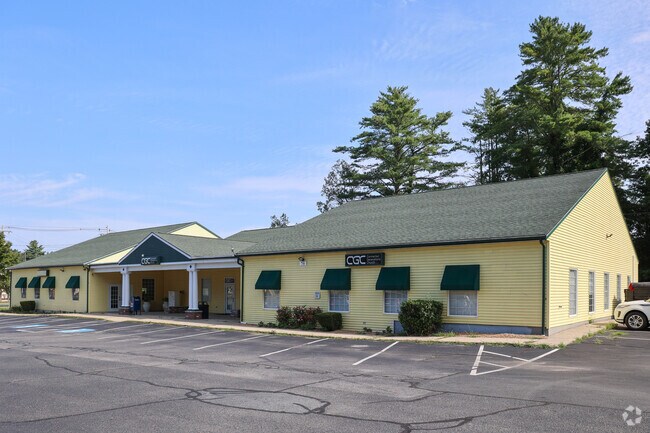
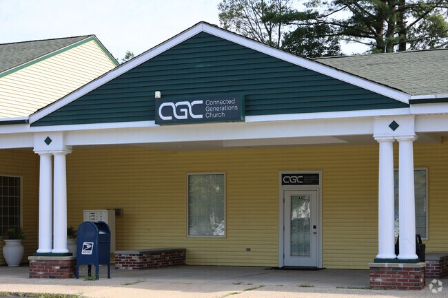
Property Record
73 Turnpike Rd, Ipswich, MA 01938

Property Detail
73 Turnpike Rd
IPSW-000027C-000024-B000000
Essex
Commercialnec
Massachusetts
PC
3.70 AC
B and X Area of moderate flood hazard, usually the area between the limits of the 100-year and 500-year floods.
Amesbury/Ipswich
2025
Boston
2025
Boston-Cambridge-Newton, MA-NH
223300
NEARBY LISTINGS FOR SALE OR LEASE
-
-
View all Ipswich listings for lease on LoopNet.com
DEMOGRAPHICS near 73 Turnpike Rd
1 mile
3 mile
5 mile
2025 Total Population
1,615
12,071
41,246
2030 Population
1,673
12,502
42,591
Pop Growth 2025-2030
+ 3.59%
+ 3.57%
+ 3.26%
Average Age
45
44
44
2025 Total Households
609
4,446
15,476
HH Growth 2025-2030
+ 3.45%
+ 3.53%
+ 3.20%
Median Household Inc
$149,323
$143,510
$145,592
Avg Household Size
2.70
2.70
2.60
2025 Avg HH Vehicles
2.00
2.00
2.00
Median Home Value
$779,154
$763,258
$762,766
Median Year Built
1982
1979
1974
Nearby Places
Map Layers
Map Styles
 Street
 Aerial
Layers
 Traffic
 Biking
Places
Listings with unknown addresses are not visible on the map
- Restaurants
- Banks
- Shops
- Fitness
- Groceries
SALE & LEASE HISTORY
LISTING DATE
SALE/LEASE

Sep 25, 2016
For Lease
Apr 18, 2022
For Lease
Nearby Properties
Address
Land Use
TOTAL SIZE
Lot Size
Zoning
Address
Land Use
TOTAL SIZE
Lot Size
Zoning
1,520 AC
RRA
Address
Land Use
TOTAL SIZE
Lot Size
Zoning
Address
Land Use
TOTAL SIZE
Lot Size
Zoning
86,812 SF
27.80 AC
Address
Land Use
TOTAL SIZE
Lot Size
Zoning
385,746 SF
7.79 AC
Address
Land Use
TOTAL SIZE
Lot Size
Zoning
106,342 SF
22.38 AC
Address
Land Use
TOTAL SIZE
Lot Size
Zoning
284.17 AC
RRA
Address
Land Use
TOTAL SIZE
Lot Size
Zoning
2,394 SF
63.04 AC
Address
Land Use
TOTAL SIZE
Lot Size
Zoning
130,204 SF
40.90 AC
Address
Land Use
TOTAL SIZE
Lot Size
Zoning
55,946 SF
20.50 AC
Address
Land Use
TOTAL SIZE
Lot Size
Zoning
198.01 AC
ORA
Address
Land Use
TOTAL SIZE
Lot Size
Zoning
108,934 SF
7.64 AC
LI
Address
Land Use
TOTAL SIZE
Lot Size
Zoning
36,838 SF
13.93 AC
HB
Address
Land Use
TOTAL SIZE
Lot Size
Zoning
159 AC
RRA
Address
Land Use
TOTAL SIZE
Lot Size
Zoning
1,863 SF
9.67 AC
RRA
Address
Land Use
TOTAL SIZE
Lot Size
Zoning
65,044 SF
10.74 AC
Address
Land Use
TOTAL SIZE
Lot Size
Zoning
57,011 SF
14.14 AC
IRA
Address
Land Use
TOTAL SIZE
Lot Size
Zoning
163.54 AC
Address
Land Use
TOTAL SIZE
Lot Size
Zoning
78,740 SF
14.54 AC
Address
Land Use
TOTAL SIZE
Lot Size
Zoning
10,255 SF
6.39 AC
Address
Land Use
TOTAL SIZE
Lot Size
Zoning
14,240 SF
51.38 AC
PC
Address
Land Use
TOTAL SIZE
Lot Size
Zoning
64,500 SF
6.93 AC
PC
Address
Land Use
TOTAL SIZE
Lot Size
Zoning
212.80 AC
RRA
Address
Land Use
TOTAL SIZE
Lot Size
Zoning
264 SF
232.27 AC
PC
Address
Land Use
TOTAL SIZE
Lot Size
Zoning
46,186 SF
9.08 AC
RRA
Address
Land Use
TOTAL SIZE
Lot Size
Zoning
56,998 SF
17.23 AC
RRA
Address
Land Use
TOTAL SIZE
Lot Size
Zoning
57,400 SF
7.79 AC
LI
Address
Land Use
TOTAL SIZE
Lot Size
Zoning
61 AC
ORA
Address
Land Use
TOTAL SIZE
Lot Size
Zoning
2,286 SF
3.82 AC
Address
Land Use
TOTAL SIZE
Lot Size
Zoning
19,665 SF
17.01 AC
PC
The World's #1 Commercial Real Estate Marketplace
Connect with us
© 2026 CoStar Group
The information above has been obtained from sources believed reliable. While we do not doubt its accuracy we have not verified it and make no guarantee, warranty or representation about it. It is your responsibility to independently confirm its accuracy and completeness. Any projections, opinions, assumptions, or estimates used are for example only and do not represent the current or future performance of the property. The value of this transaction to you depends on tax and other factors which should be evaluated by your tax, financial, and legal advisors. You and your advisors should conduct a careful, independent investigation of the property to determine to your satisfaction the suitability of the property for your needs.