Property Record
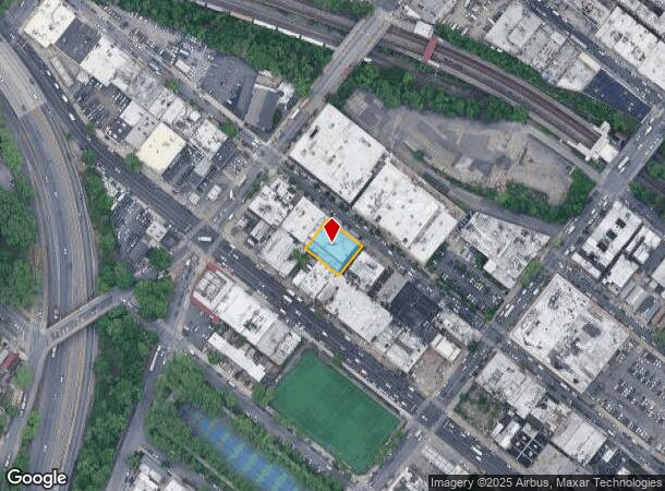
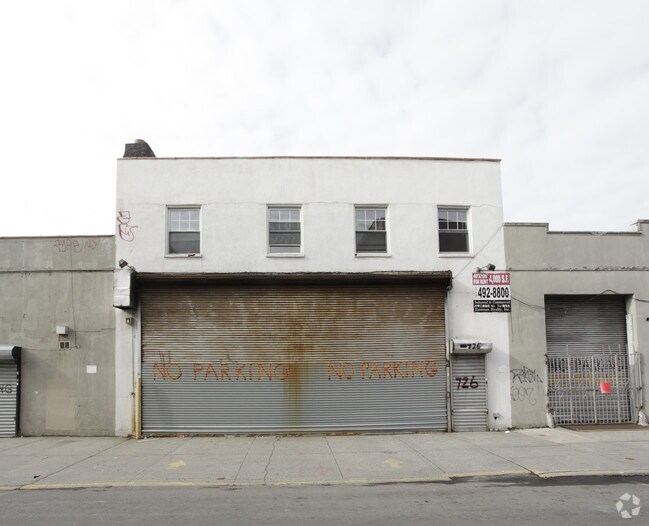
730 64Th St, Brooklyn, NY 11220

NEARBY LISTINGS FOR SALE OR LEASE
Property Detail
730 64Th St
New York-Jersey City-White Plains, NY-NJ
New Utrecht Map
05821-0018
DOCID-2022090800053001
Officebuilding
Kings
X
New York
3604970194F
18
2024
0.28 AC
2025
South Brooklyn
012000
Long Island (New York)
50,760 SF
DEMOGRAPHICS near 730 64Th St
1 mile
3 mile
5 mile
2024 Total Population
157,877
703,805
1,784,304
2029 Population
142,590
651,324
1,677,057
Pop Growth 2024-2029
(9.68%)
(7.46%)
(6.01%)
Average Age
38
38
40
2024 Total Households
49,115
236,316
659,887
HH Growth 2024-2029
(9.97%)
(7.78%)
(6.24%)
Median Household Inc
$62,957
$68,081
$73,733
Avg Household Size
3.00
2.80
2.60
2024 Avg HH Vehicles
1.00
1.00
1.00
Median Home Value
$966,345
$951,238
$833,871
Median Year Built
1946
1947
1948
Nearby Places
Map Layers
Map Styles
 Street
 Aerial
Transit
 Traffic
 Biking
Places
Listings with unknown addresses are not visible on the map
- Restaurants
- Banks
- Shops
- Fitness
- Groceries
PUBLIC TRANSPORTATION
TRANSIT/SUBWAY
8 Avenue (N - New York MTA Subway (The Subway))
Drive
Walk
Distance
8 Avenue (N - New York MTA Subway (The Subway))
1 min
4 min
0.2 mi
Fort Hamilton Parkway (N Line) (N - New York MTA Subway (The Subway))
Drive
Walk
Distance
Fort Hamilton Parkway (N Line) (N - New York MTA Subway (The Subway))
2 min
10 min
0.5 mi
Bay Ridge Avenue (R - New York MTA Subway (The Subway))
Drive
Walk
Distance
Bay Ridge Avenue (R - New York MTA Subway (The Subway))
3 min
14 min
0.7 mi
59 Street (N,R Line) (N - New York MTA Subway (The Subway), R - New York MTA Subway (The Subway))
Drive
Walk
Distance
59 Street (N,R Line) (N - New York MTA Subway (The Subway), R - New York MTA Subway (The Subway))
3 min
15 min
0.8 mi
COMMUTER RAIL
Drive
Walk
Distance
14 min
5.6 mi
Clifton (Staten Island Railway - New York MTA Subway (The Subway))
Drive
Walk
Distance
Clifton (Staten Island Railway - New York MTA Subway (The Subway))
12 min
6.0 mi
AIRPORT
John F Kennedy International
Drive
Walk
Distance
John F Kennedy International
30 min
14.9 mi
LaGuardia
Drive
Walk
Distance
LaGuardia
28 min
15.7 mi
Newark Liberty International
Drive
Walk
Distance
Newark Liberty International
32 min
19.3 mi
Freight Ports
NY - Red Hook Container Terminal
Drive
Walk
Distance
NY - Red Hook Container Terminal
8 min
4.7 mi
Nearby Properties
Address
Land Use
TOTAL SIZE
Lot Size
Zoning
Address
Land Use
TOTAL SIZE
Lot Size
Zoning
92,440 SF
466.23 AC
R5
Address
Land Use
TOTAL SIZE
Lot Size
Zoning
1,524,659 SF
170.96 AC
R4
Address
Land Use
TOTAL SIZE
Lot Size
Zoning
577,381 SF
3.19 AC
R6
Address
Land Use
TOTAL SIZE
Lot Size
Zoning
902,000 SF
6.44 AC
M3-1
Address
Land Use
TOTAL SIZE
Lot Size
Zoning
965,600 SF
6.65 AC
R5
Address
Land Use
TOTAL SIZE
Lot Size
Zoning
460,000 SF
3.21 AC
R6
Address
Land Use
TOTAL SIZE
Lot Size
Zoning
305,093 SF
0.60 AC
C1-9
Address
Land Use
TOTAL SIZE
Lot Size
Zoning
335,800 SF
1.51 AC
R6
Address
Land Use
TOTAL SIZE
Lot Size
Zoning
340,837 SF
0.61 AC
C1-9
Address
Land Use
TOTAL SIZE
Lot Size
Zoning
1,324,592 SF
5.13 AC
M3-1
Address
Land Use
TOTAL SIZE
Lot Size
Zoning
397,354 SF
0.61 AC
C5-2
Address
Land Use
TOTAL SIZE
Lot Size
Zoning
340,068 SF
0.58 AC
C2-8
Address
Land Use
TOTAL SIZE
Lot Size
Zoning
340,068 SF
0.58 AC
C2-8
Address
Land Use
TOTAL SIZE
Lot Size
Zoning
427,208 SF
1.30 AC
R6
Address
Land Use
TOTAL SIZE
Lot Size
Zoning
537,885 SF
2.98 AC
R8
Address
Land Use
TOTAL SIZE
Lot Size
Zoning
393,092 SF
1.07 AC
R8A
Address
Land Use
TOTAL SIZE
Lot Size
Zoning
371,139 SF
3.22 AC
R5
Address
Land Use
TOTAL SIZE
Lot Size
Zoning
808,372 SF
0.18 AC
R6
Address
Land Use
TOTAL SIZE
Lot Size
Zoning
5,359,400 SF
59.07 AC
M2-1
Address
Land Use
TOTAL SIZE
Lot Size
Zoning
286,000 SF
12.63 AC
PARK
Address
Land Use
TOTAL SIZE
Lot Size
Zoning
370,248 SF
0.52 AC
C1-9
Address
Land Use
TOTAL SIZE
Lot Size
Zoning
418,000 SF
0.78 AC
R10A
Address
Land Use
TOTAL SIZE
Lot Size
Zoning
3,970,000 SF
91.14 AC
M3-1
Address
Land Use
TOTAL SIZE
Lot Size
Zoning
1,466,751 SF
24.79 AC
R5
Address
Land Use
TOTAL SIZE
Lot Size
Zoning
689,850 SF
3.08 AC
M3-1
Address
Land Use
TOTAL SIZE
Lot Size
Zoning
301,400 SF
22.27 AC
M3-1
Address
Land Use
TOTAL SIZE
Lot Size
Zoning
336,534 SF
47.78 AC
M1-1
Address
Land Use
TOTAL SIZE
Lot Size
Zoning
673,895 SF
3.22 AC
M3-1
Address
Land Use
TOTAL SIZE
Lot Size
Zoning
310,068 SF
0.58 AC
C2-8
Address
Land Use
TOTAL SIZE
Lot Size
Zoning
1,112,855 SF
3.52 AC
M3-1
The World's #1 Commercial Real Estate Marketplace
Connect with us
© 2026 CoStar Group
The information above has been obtained from sources believed reliable. While we do not doubt its accuracy we have not verified it and make no guarantee, warranty or representation about it. It is your responsibility to independently confirm its accuracy and completeness. Any projections, opinions, assumptions, or estimates used are for example only and do not represent the current or future performance of the property. The value of this transaction to you depends on tax and other factors which should be evaluated by your tax, financial, and legal advisors. You and your advisors should conduct a careful, independent investigation of the property to determine to your satisfaction the suitability of the property for your needs.