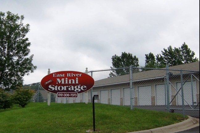
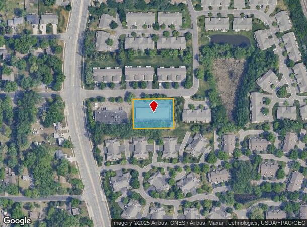
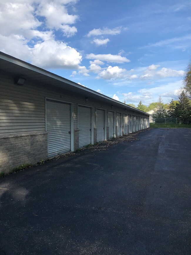
Property Record
730 86Th Ave Nw, Minneapolis, MN 55433
NEARBY LISTINGS FOR SALE OR LEASE
-
-
View all Minneapolis listings for sale on LoopNet.com
Property Detail
730 86Th Ave Nw
Minneapolis-St. Paul-Bloomington, MN-WI
W G Doty Industrial Park
36-31-24-33-0011
LOT 2 BLOCK 1 W G DOTY INDUSTRIAL PARK
Commercialnec
Anoka
X
Minnesota
27053C0093F
2
2025
0.82 AC
2025
Suburban St Paul
050607
Minneapolis/St Paul
8,600 SF
DEMOGRAPHICS near 730 86Th Ave Nw
1 Mile
3 Mile
5 Mile
2024 Total Population
4,172
84,739
244,146
2029 Population
4,285
85,997
246,405
Pop Growth 2024-2029
+ 2.71%
+ 1.48%
+ 0.93%
Average Age
43
39
39
2024 Total Households
1,708
30,908
88,494
HH Growth 2024-2029
+ 2.93%
+ 1.78%
+ 1.05%
Median Household Inc
$85,204
$80,267
$77,670
Avg Household Size
2.40
2.70
2.70
2024 Avg HH Vehicles
2.00
2.00
2.00
Median Home Value
$257,800
$257,821
$261,015
Median Year Built
1980
1981
1978
Nearby Places
Map Layers
Map Styles
 Street
 Aerial
- Restaurants
- Banks
- Shops
- Fitness
- Groceries
PUBLIC TRANSPORTATION
COMMUTER RAIL
Fridley Station (Northstar Corridor - Northstar Commuter Rail)
DRIVE
WALK
Distance
Fridley Station (Northstar Corridor - Northstar Commuter Rail)
8 min
3.8 mi
Coon Rapids-Riverdale Station (Northstar Corridor - Northstar Commuter Rail)
DRIVE
WALK
Distance
Coon Rapids-Riverdale Station (Northstar Corridor - Northstar Commuter Rail)
13 min
6.2 mi
AIRPORT
Minneapolis-St Paul International/Wold-Chamberlain
DRIVE
WALK
Distance
Minneapolis-St Paul International/Wold-Chamberlain
39 min
23.3 mi
SALE & LEASE HISTORY
LISTING DATE
SALE/LEASE

Sep 04, 2019
For Sale
Oct 09, 2019
For Sale
Nearby Properties
Address
Land Use
TOTAL SIZE
Lot Size
Zoning
Address
Land Use
TOTAL SIZE
Lot Size
Zoning
47,727 SF
17.03 AC
Address
Land Use
TOTAL SIZE
Lot Size
Zoning
35,488 SF
39.07 AC
Address
Land Use
TOTAL SIZE
Lot Size
Zoning
Address
Land Use
TOTAL SIZE
Lot Size
Zoning
417,810 SF
20.60 AC
Address
Land Use
TOTAL SIZE
Lot Size
Zoning
66,342 SF
8.85 AC
Address
Land Use
TOTAL SIZE
Lot Size
Zoning
10.39 AC
Address
Land Use
TOTAL SIZE
Lot Size
Zoning
229,420 SF
4.14 AC
Address
Land Use
TOTAL SIZE
Lot Size
Zoning
214,300 SF
9.15 AC
Address
Land Use
TOTAL SIZE
Lot Size
Zoning
13,588 SF
129.03 AC
Address
Land Use
TOTAL SIZE
Lot Size
Zoning
Address
Land Use
TOTAL SIZE
Lot Size
Zoning
12.37 AC
Address
Land Use
TOTAL SIZE
Lot Size
Zoning
14,908 SF
28.38 AC
Address
Land Use
TOTAL SIZE
Lot Size
Zoning
342,686 SF
13.60 AC
Address
Land Use
TOTAL SIZE
Lot Size
Zoning
368,545 SF
18.09 AC
Address
Land Use
TOTAL SIZE
Lot Size
Zoning
122,498 SF
31.67 AC
Address
Land Use
TOTAL SIZE
Lot Size
Zoning
262,452 SF
Address
Land Use
TOTAL SIZE
Lot Size
Zoning
2.95 AC
Address
Land Use
TOTAL SIZE
Lot Size
Zoning
286,519 SF
24.51 AC
Address
Land Use
TOTAL SIZE
Lot Size
Zoning
287,568 SF
8.01 AC
Address
Land Use
TOTAL SIZE
Lot Size
Zoning
160 SF
11.54 AC
Address
Land Use
TOTAL SIZE
Lot Size
Zoning
376,275 SF
16.50 AC
Address
Land Use
TOTAL SIZE
Lot Size
Zoning
191,881 SF
9.40 AC
Address
Land Use
TOTAL SIZE
Lot Size
Zoning
116,452 SF
8.68 AC
Address
Land Use
TOTAL SIZE
Lot Size
Zoning
125,850 SF
3.27 AC
Address
Land Use
TOTAL SIZE
Lot Size
Zoning
77,523 SF
9.81 AC
Address
Land Use
TOTAL SIZE
Lot Size
Zoning
102 SF
3.77 AC
Address
Land Use
TOTAL SIZE
Lot Size
Zoning
110 SF
3.53 AC
Address
Land Use
TOTAL SIZE
Lot Size
Zoning
119,829 SF
6.40 AC
Address
Land Use
TOTAL SIZE
Lot Size
Zoning
85,417 SF
3 AC
The World's #1 Commercial Real Estate Marketplace
Connect with us
© 2025 CoStar Group
The information above has been obtained from sources believed reliable. While we do not doubt its accuracy we have not verified it and make no guarantee, warranty or representation about it. It is your responsibility to independently confirm its accuracy and completeness. Any projections, opinions, assumptions, or estimates used are for example only and do not represent the current or future performance of the property. The value of this transaction to you depends on tax and other factors which should be evaluated by your tax, financial, and legal advisors. You and your advisors should conduct a careful, independent investigation of the property to determine to your satisfaction the suitability of the property for your needs.