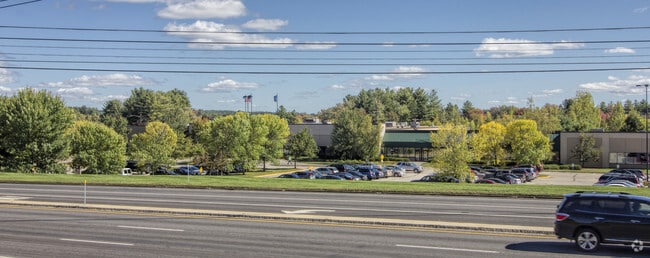
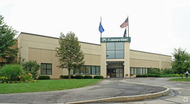
Property Record
730 Milford Rd, Merrimack, NH 03054

NEARBY LISTINGS FOR SALE OR LEASE
Property Detail
730 Milford Rd
MRMK-000002B-000006
Hillsborough
Commercialnec
New Hampshire
AE
6
33011C0491D
18.38 AC
2024
Hillsborough
2024
Boston
014302
Manchester-Nashua, NH
110,892 SF
DEMOGRAPHICS near 730 Milford Rd
1 Mile
3 Mile
5 Mile
2024 Total Population
1,088
17,051
66,150
2029 Population
1,110
17,552
67,856
Pop Growth 2024-2029
+ 2.02%
+ 2.94%
+ 2.58%
Average Age
42
42
43
2024 Total Households
379
6,913
26,983
HH Growth 2024-2029
+ 2.11%
+ 3.05%
+ 2.62%
Median Household Inc
$135,714
$115,985
$107,328
Avg Household Size
2.80
2.40
2.40
2024 Avg HH Vehicles
3.00
2.00
2.00
Median Home Value
$456,410
$421,496
$385,638
Median Year Built
1983
1983
1980
Nearby Places
Map Layers
Map Styles
 Street
 Aerial
- Restaurants
- Banks
- Shops
- Fitness
- Groceries
PUBLIC TRANSPORTATION
AIRPORT
Manchester Boston Regional
DRIVE
WALK
Distance
Manchester Boston Regional
24 min
12.7 mi
General Edward Lawrence Logan International
DRIVE
WALK
Distance
General Edward Lawrence Logan International
71 min
47.6 mi
Freight Ports
Port of Boston
DRIVE
WALK
Distance
Port of Boston
72 min
47.4 mi
Nearby Properties
Address
Land Use
TOTAL SIZE
Lot Size
Zoning
Address
Land Use
TOTAL SIZE
Lot Size
Zoning
29,295 SF
143.99 AC
INDUST
Address
Land Use
TOTAL SIZE
Lot Size
Zoning
325.08 AC
AI
Address
Land Use
TOTAL SIZE
Lot Size
Zoning
6.28 AC
INDUST
Address
Land Use
TOTAL SIZE
Lot Size
Zoning
576,827 SF
446.22 AC
INDUST
Address
Land Use
TOTAL SIZE
Lot Size
Zoning
621,927 SF
106.62 AC
INDUST
Address
Land Use
TOTAL SIZE
Lot Size
Zoning
183,432 SF
16.40 AC
GB
Address
Land Use
TOTAL SIZE
Lot Size
Zoning
124,048 SF
23.43 AC
PI
Address
Land Use
TOTAL SIZE
Lot Size
Zoning
259,644 SF
42.18 AC
RR
Address
Land Use
TOTAL SIZE
Lot Size
Zoning
66 AC
R18
Address
Land Use
TOTAL SIZE
Lot Size
Zoning
337,000 SF
24.26 AC
PI
Address
Land Use
TOTAL SIZE
Lot Size
Zoning
326,755 SF
43 AC
INDUST
Address
Land Use
TOTAL SIZE
Lot Size
Zoning
9.50 AC
AI
Address
Land Use
TOTAL SIZE
Lot Size
Zoning
360,491 SF
40.23 AC
IND
Address
Land Use
TOTAL SIZE
Lot Size
Zoning
142,207 SF
4.72 AC
PI
Address
Land Use
TOTAL SIZE
Lot Size
Zoning
10.30 AC
RC
Address
Land Use
TOTAL SIZE
Lot Size
Zoning
9.01 AC
RC
Address
Land Use
TOTAL SIZE
Lot Size
Zoning
193,749 SF
54.34 AC
INDUST
Address
Land Use
TOTAL SIZE
Lot Size
Zoning
8.85 AC
RC
Address
Land Use
TOTAL SIZE
Lot Size
Zoning
8.38 AC
RC
Address
Land Use
TOTAL SIZE
Lot Size
Zoning
52.88 AC
R30
Address
Land Use
TOTAL SIZE
Lot Size
Zoning
140,258 SF
8.02 AC
PI
Address
Land Use
TOTAL SIZE
Lot Size
Zoning
125,916 SF
10.05 AC
GB
Address
Land Use
TOTAL SIZE
Lot Size
Zoning
227,260 SF
35 AC
PI
Address
Land Use
TOTAL SIZE
Lot Size
Zoning
93,448 SF
10 AC
RC
Address
Land Use
TOTAL SIZE
Lot Size
Zoning
7.92 AC
RC
Address
Land Use
TOTAL SIZE
Lot Size
Zoning
307,560 SF
23 AC
PI
Address
Land Use
TOTAL SIZE
Lot Size
Zoning
85,760 SF
PI
Address
Land Use
TOTAL SIZE
Lot Size
Zoning
200,012 SF
31.83 AC
C
Address
Land Use
TOTAL SIZE
Lot Size
Zoning
132,836 SF
8.61 AC
GB
Address
Land Use
TOTAL SIZE
Lot Size
Zoning
44,520 SF
8.51 AC
PI
The World's #1 Commercial Real Estate Marketplace
Connect with us
© 2026 CoStar Group
The information above has been obtained from sources believed reliable. While we do not doubt its accuracy we have not verified it and make no guarantee, warranty or representation about it. It is your responsibility to independently confirm its accuracy and completeness. Any projections, opinions, assumptions, or estimates used are for example only and do not represent the current or future performance of the property. The value of this transaction to you depends on tax and other factors which should be evaluated by your tax, financial, and legal advisors. You and your advisors should conduct a careful, independent investigation of the property to determine to your satisfaction the suitability of the property for your needs.