Property Record
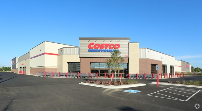
7300 State Route 161 E, Plain City, OH 43064


Property Detail
7300 State Route 161 E
15-0031018-0050
THIS PARCEL IS TIF'D VMS 6748 201603090001705
Wholesaleoutletdiscountstore
UNION
B and X Area of moderate flood hazard, usually the area between the limits of the 100-year and 500-year floods.
Ohio
2025
15.97 AC
2025
Union County
050601
Columbus
150,380 SF
Columbus, OH
NEARBY LISTINGS FOR SALE OR LEASE
-
-
View all Plain City listings for sale on LoopNet.com
DEMOGRAPHICS near 7300 State Route 161 E
1 mile
3 mile
5 mile
2025 Total Population
1,585
30,633
103,840
2030 Population
1,828
32,194
109,189
Pop Growth 2025-2030
+ 15.33%
+ 5.10%
+ 5.15%
Average Age
36
39
39
2025 Total Households
483
10,637
39,902
HH Growth 2025-2030
+ 15.94%
+ 5.05%
+ 4.91%
Median Household Inc
$210,196
$150,157
$121,806
Avg Household Size
3.30
2.80
2.60
2025 Avg HH Vehicles
2.00
2.00
2.00
Median Home Value
$680,034
$551,783
$489,379
Median Year Built
2010
1998
1999
Nearby Places
Map Layers
Map Styles
 Street
 Aerial
Layers
 Traffic
 Biking
Places
Listings with unknown addresses are not visible on the map
- Restaurants
- Banks
- Shops
- Fitness
- Groceries
PUBLIC TRANSPORTATION
AIRPORT
John Glenn Columbus International
Drive
Walk
Distance
John Glenn Columbus International
35 min
25.0 mi
Rickenbacker International
Drive
Walk
Distance
Rickenbacker International
42 min
30.4 mi
Nearby Properties
Address
Land Use
TOTAL SIZE
Lot Size
Zoning
Address
Land Use
TOTAL SIZE
Lot Size
Zoning
464,088 SF
45.57 AC
Address
Land Use
TOTAL SIZE
Lot Size
Zoning
768,498 SF
66.96 AC
Address
Land Use
TOTAL SIZE
Lot Size
Zoning
256,984 SF
10.49 AC
Address
Land Use
TOTAL SIZE
Lot Size
Zoning
86.18 AC
Address
Land Use
TOTAL SIZE
Lot Size
Zoning
Address
Land Use
TOTAL SIZE
Lot Size
Zoning
4,788 SF
96.85 AC
Address
Land Use
TOTAL SIZE
Lot Size
Zoning
95,447 SF
58.80 AC
Address
Land Use
TOTAL SIZE
Lot Size
Zoning
129,283 SF
56.69 AC
Address
Land Use
TOTAL SIZE
Lot Size
Zoning
143,277 SF
15.54 AC
Address
Land Use
TOTAL SIZE
Lot Size
Zoning
59,144 SF
87.61 AC
Address
Land Use
TOTAL SIZE
Lot Size
Zoning
131,940 SF
34.46 AC
Address
Land Use
TOTAL SIZE
Lot Size
Zoning
133,091 SF
15.01 AC
Address
Land Use
TOTAL SIZE
Lot Size
Zoning
105,694 SF
14.51 AC
Address
Land Use
TOTAL SIZE
Lot Size
Zoning
134,901 SF
15.51 AC
Address
Land Use
TOTAL SIZE
Lot Size
Zoning
121,104 SF
Address
Land Use
TOTAL SIZE
Lot Size
Zoning
57,876 SF
15.56 AC
Address
Land Use
TOTAL SIZE
Lot Size
Zoning
58,481 SF
26.99 AC
Address
Land Use
TOTAL SIZE
Lot Size
Zoning
64,147 SF
28.90 AC
Address
Land Use
TOTAL SIZE
Lot Size
Zoning
55,622 SF
8.98 AC
Address
Land Use
TOTAL SIZE
Lot Size
Zoning
130,839 SF
13.35 AC
Address
Land Use
TOTAL SIZE
Lot Size
Zoning
1,642 SF
92.78 AC
Address
Land Use
TOTAL SIZE
Lot Size
Zoning
50,238 SF
5 AC
Address
Land Use
TOTAL SIZE
Lot Size
Zoning
148,906 SF
13.46 AC
Address
Land Use
TOTAL SIZE
Lot Size
Zoning
44,648 SF
38.47 AC
Address
Land Use
TOTAL SIZE
Lot Size
Zoning
103,368 SF
13.48 AC
Address
Land Use
TOTAL SIZE
Lot Size
Zoning
18,325 SF
19.45 AC
Address
Land Use
TOTAL SIZE
Lot Size
Zoning
190,783 SF
15.59 AC
Address
Land Use
TOTAL SIZE
Lot Size
Zoning
9,720 SF
13.18 AC
Address
Land Use
TOTAL SIZE
Lot Size
Zoning
486,569 SF
96.85 AC
Address
Land Use
TOTAL SIZE
Lot Size
Zoning
52,451 SF
13.95 AC
The World's #1 Commercial Real Estate Marketplace
Connect with us
© 2026 CoStar Group
The information above has been obtained from sources believed reliable. While we do not doubt its accuracy we have not verified it and make no guarantee, warranty or representation about it. It is your responsibility to independently confirm its accuracy and completeness. Any projections, opinions, assumptions, or estimates used are for example only and do not represent the current or future performance of the property. The value of this transaction to you depends on tax and other factors which should be evaluated by your tax, financial, and legal advisors. You and your advisors should conduct a careful, independent investigation of the property to determine to your satisfaction the suitability of the property for your needs.