Property Record
3740 N Drinkwater Blvd, Scottsdale, AZ 85251
NEARBY LISTINGS FOR SALE OR LEASE
Property Detail
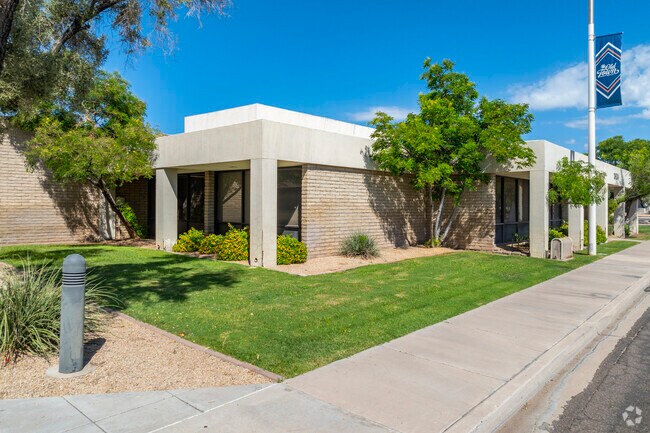
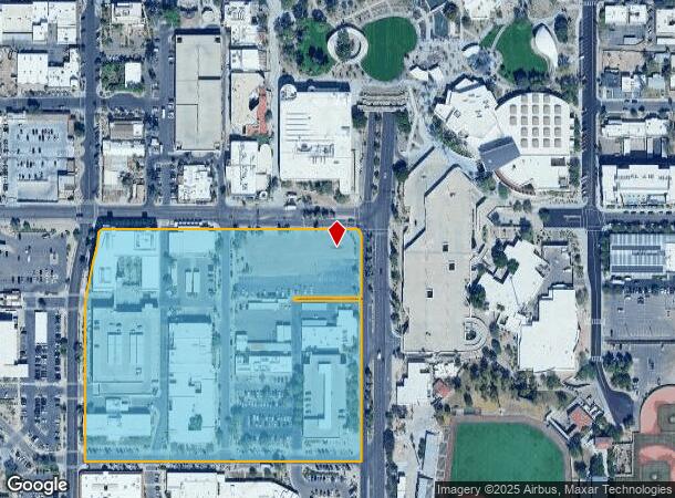
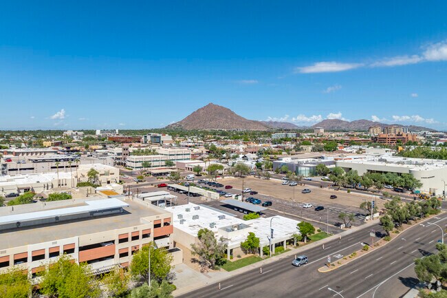
3740 N Drinkwater Blvd
Phoenix-Mesa-Chandler, AZ
Honor Health Osborn Medical Center
130-22-127
HONOR HEALTH OSBORN MEDICAL CENTER MCR 1308-21
Medicalbuilding
Maricopa
X
Arizona
04013C2235M
3
2025
12.66 AC
2025
Scottsdale South
217201
Phoenix
326,134 SF
DEMOGRAPHICS near 3740 N Drinkwater Blvd
1 mile
3 mile
5 mile
2024 Total Population
24,686
112,563
232,286
2029 Population
27,616
124,183
255,345
Pop Growth 2024-2029
+ 11.87%
+ 10.32%
+ 9.93%
Average Age
39
42
39
2024 Total Households
13,878
56,421
110,867
HH Growth 2024-2029
+ 12.08%
+ 10.62%
+ 10.17%
Median Household Inc
$73,566
$84,003
$75,232
Avg Household Size
1.70
1.90
2.00
2024 Avg HH Vehicles
1.00
2.00
2.00
Median Home Value
$430,458
$477,599
$510,954
Median Year Built
1983
1976
1980
Nearby Places
Map Layers
Map Styles
 Street
 Aerial
Transit
 Traffic
 Biking
Places
Listings with unknown addresses are not visible on the map
- Restaurants
- Banks
- Shops
- Fitness
- Groceries
PUBLIC TRANSPORTATION
AIRPORT
Phoenix Sky Harbor International
Drive
Walk
Distance
Phoenix Sky Harbor International
15 min
8.8 mi
Phoenix-Mesa Gateway
Drive
Walk
Distance
Phoenix-Mesa Gateway
40 min
27.4 mi
Freight Ports
Port of San Diego
Drive
Walk
Distance
Port of San Diego
410 min
365.4 mi
Nearby Properties
Address
Land Use
TOTAL SIZE
Lot Size
Zoning
Address
Land Use
TOTAL SIZE
Lot Size
Zoning
Address
Land Use
TOTAL SIZE
Lot Size
Zoning
1,870,689 SF
46.77 AC
I-P
Address
Land Use
TOTAL SIZE
Lot Size
Zoning
2,636,740 SF
21.88 AC
C-DT
Address
Land Use
TOTAL SIZE
Lot Size
Zoning
33,483 SF
7.82 AC
PF
Address
Land Use
TOTAL SIZE
Lot Size
Zoning
1,457,213 SF
41.78 AC
PUD
Address
Land Use
TOTAL SIZE
Lot Size
Zoning
9,160 SF
2.57 AC
DDMU2
Address
Land Use
TOTAL SIZE
Lot Size
Zoning
649,656 SF
10.19 AC
PAD
Address
Land Use
TOTAL SIZE
Lot Size
Zoning
981,325 SF
8.31 AC
Address
Land Use
TOTAL SIZE
Lot Size
Zoning
3.77 AC
PNC
Address
Land Use
TOTAL SIZE
Lot Size
Zoning
44,971 SF
2.06 AC
C-R
Address
Land Use
TOTAL SIZE
Lot Size
Zoning
3,010 SF
35.44 AC
R110
Address
Land Use
TOTAL SIZE
Lot Size
Zoning
307,604 SF
37.83 AC
R-7
Address
Land Use
TOTAL SIZE
Lot Size
Zoning
301,376 SF
8.77 AC
PAD
Address
Land Use
TOTAL SIZE
Lot Size
Zoning
688,550 SF
149.95 AC
R-6
Address
Land Use
TOTAL SIZE
Lot Size
Zoning
776,898 SF
27.32 AC
C-R
Address
Land Use
TOTAL SIZE
Lot Size
Zoning
1,229,384 SF
4.81 AC
Address
Land Use
TOTAL SIZE
Lot Size
Zoning
457,979 SF
9.26 AC
CO
Address
Land Use
TOTAL SIZE
Lot Size
Zoning
392,172 SF
7.50 AC
DM2
Address
Land Use
TOTAL SIZE
Lot Size
Zoning
62,497 SF
130.73 AC
R-6
Address
Land Use
TOTAL SIZE
Lot Size
Zoning
439,600 SF
8.52 AC
DDCC2
Address
Land Use
TOTAL SIZE
Lot Size
Zoning
8,051 SF
3.19 AC
R-43
Address
Land Use
TOTAL SIZE
Lot Size
Zoning
617,776 SF
4.53 AC
DDMU2
Address
Land Use
TOTAL SIZE
Lot Size
Zoning
639,643 SF
5.43 AC
PAD
Address
Land Use
TOTAL SIZE
Lot Size
Zoning
289,633 SF
9.11 AC
R-10
Address
Land Use
TOTAL SIZE
Lot Size
Zoning
530,384 SF
5.24 AC
C-DT
Address
Land Use
TOTAL SIZE
Lot Size
Zoning
Address
Land Use
TOTAL SIZE
Lot Size
Zoning
590,903 SF
9.41 AC
C-DT
Address
Land Use
TOTAL SIZE
Lot Size
Zoning
438,373 SF
11.35 AC
Address
Land Use
TOTAL SIZE
Lot Size
Zoning
245,175 SF
6.94 AC
DDRU2
Address
Land Use
TOTAL SIZE
Lot Size
Zoning
18,758 SF
312
The World's #1 Commercial Real Estate Marketplace
Connect with us
© 2026 CoStar Group
The information above has been obtained from sources believed reliable. While we do not doubt its accuracy we have not verified it and make no guarantee, warranty or representation about it. It is your responsibility to independently confirm its accuracy and completeness. Any projections, opinions, assumptions, or estimates used are for example only and do not represent the current or future performance of the property. The value of this transaction to you depends on tax and other factors which should be evaluated by your tax, financial, and legal advisors. You and your advisors should conduct a careful, independent investigation of the property to determine to your satisfaction the suitability of the property for your needs.