Property Record
7301 W Maple St, Wichita, KS 67209


NEARBY LISTINGS FOR SALE OR LEASE
Property Detail
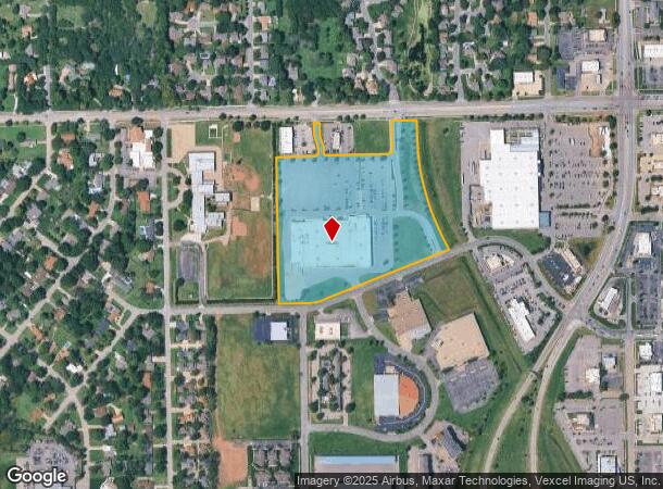
7301 W Maple St
Wichita, KS
Ashley Park Towne Centre Add
138-28-0-12-03-001.00
LOT 1 EXC PT DEEDED TO CITY BLOCK 1 ASHLEY PARK TOWNE CENTRE ADD.
Departmentstore
Sedgwick
AE
Kansas
20173C0341G
1
2024
15.72 AC
2025
Goddard/West
009200
Wichita
127,204 SF
DEMOGRAPHICS near 7301 W Maple St
1 Mile
3 Mile
5 Mile
2024 Total Population
6,318
55,858
148,422
2029 Population
6,388
56,438
150,414
Pop Growth 2024-2029
+ 1.11%
+ 1.04%
+ 1.34%
Average Age
40
40
39
2024 Total Households
2,820
23,155
59,769
HH Growth 2024-2029
+ 1.10%
+ 1.08%
+ 1.41%
Median Household Inc
$52,868
$63,138
$63,893
Avg Household Size
2.10
2.30
2.40
2024 Avg HH Vehicles
2.00
2.00
2.00
Median Home Value
$190,259
$162,822
$171,895
Median Year Built
1980
1981
1978
Nearby Places
Map Layers
Map Styles
 Street
 Aerial
- Restaurants
- Banks
- Shops
- Fitness
- Groceries
PUBLIC TRANSPORTATION
AIRPORT
Wichita Dwight D Eisenhower Ntl
DRIVE
WALK
Distance
Wichita Dwight D Eisenhower Ntl
6 min
2.1 mi
SALE & LEASE HISTORY
LISTING DATE
SALE/LEASE

Sep 24, 2016
For Sale
Nearby Properties
Address
Land Use
TOTAL SIZE
Lot Size
Zoning
Address
Land Use
TOTAL SIZE
Lot Size
Zoning
1,675,141 SF
1,753.52 AC
LI
Address
Land Use
TOTAL SIZE
Lot Size
Zoning
456,792 SF
155.67 AC
LI
Address
Land Use
TOTAL SIZE
Lot Size
Zoning
303,559 SF
123.23 AC
SF-5
Address
Land Use
TOTAL SIZE
Lot Size
Zoning
203,580 SF
15.51 AC
B
Address
Land Use
TOTAL SIZE
Lot Size
Zoning
84,959 SF
2 AC
LI
Address
Land Use
TOTAL SIZE
Lot Size
Zoning
395,143 SF
3.58 AC
LI
Address
Land Use
TOTAL SIZE
Lot Size
Zoning
108,283 SF
14.80 AC
SF-5
Address
Land Use
TOTAL SIZE
Lot Size
Zoning
192,027 SF
117.94 AC
SF-20,GC,L
Address
Land Use
TOTAL SIZE
Lot Size
Zoning
62,535 SF
8.34 AC
B
Address
Land Use
TOTAL SIZE
Lot Size
Zoning
35,097 SF
2.82 AC
U
Address
Land Use
TOTAL SIZE
Lot Size
Zoning
172,486 SF
25.68 AC
SF-5
Address
Land Use
TOTAL SIZE
Lot Size
Zoning
167,923 SF
18.01 AC
SF-5
Address
Land Use
TOTAL SIZE
Lot Size
Zoning
55,930 SF
10.28 AC
LI
Address
Land Use
TOTAL SIZE
Lot Size
Zoning
102,794 SF
14.78 AC
SF-5
Address
Land Use
TOTAL SIZE
Lot Size
Zoning
143,704 SF
19.22 AC
SF-5
Address
Land Use
TOTAL SIZE
Lot Size
Zoning
68,468 SF
7.17 AC
B,SF-5,GO
Address
Land Use
TOTAL SIZE
Lot Size
Zoning
136,717 SF
11.18 AC
SF-5
Address
Land Use
TOTAL SIZE
Lot Size
Zoning
1,677,015 SF
49.80 AC
LI,SF-20
Address
Land Use
TOTAL SIZE
Lot Size
Zoning
60,900 SF
281.77 AC
SF-5
Address
Land Use
TOTAL SIZE
Lot Size
Zoning
193,680 SF
4.31 AC
LI
Address
Land Use
TOTAL SIZE
Lot Size
Zoning
56,081 SF
3.75 AC
U
Address
Land Use
TOTAL SIZE
Lot Size
Zoning
56,519 SF
84.45 AC
SF-20,LI
Address
Land Use
TOTAL SIZE
Lot Size
Zoning
79,775 SF
7.94 AC
SF-5
Address
Land Use
TOTAL SIZE
Lot Size
Zoning
58,392 SF
6.34 AC
LI
Address
Land Use
TOTAL SIZE
Lot Size
Zoning
65,504 SF
6.81 AC
SF-5
Address
Land Use
TOTAL SIZE
Lot Size
Zoning
62,321 SF
13.21 AC
SF-5
Address
Land Use
TOTAL SIZE
Lot Size
Zoning
51,845 SF
5.51 AC
SF-5
Address
Land Use
TOTAL SIZE
Lot Size
Zoning
52,262 SF
28.84 AC
B
Address
Land Use
TOTAL SIZE
Lot Size
Zoning
49,970 SF
110.38 AC
LI
Address
Land Use
TOTAL SIZE
Lot Size
Zoning
56,627 SF
14.01 AC
SF-5
The World's #1 Commercial Real Estate Marketplace
Connect with us
© 2025 CoStar Group
The information above has been obtained from sources believed reliable. While we do not doubt its accuracy we have not verified it and make no guarantee, warranty or representation about it. It is your responsibility to independently confirm its accuracy and completeness. Any projections, opinions, assumptions, or estimates used are for example only and do not represent the current or future performance of the property. The value of this transaction to you depends on tax and other factors which should be evaluated by your tax, financial, and legal advisors. You and your advisors should conduct a careful, independent investigation of the property to determine to your satisfaction the suitability of the property for your needs.