Property Record
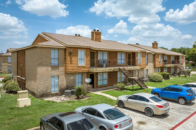
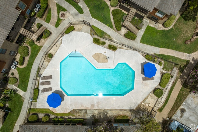
7302 Alabonson Rd, Houston, TX 77088

Property Detail
7302 Alabonson Rd
1158470000003
TRS C & C1 INWOOD COLONY
Apartment
HARRIS
AE The base floodplain where base flood elevations are provided. AE Zones are now used on new format FIRMs instead of A1-A30 Zones.
Texas
2024
13 AC
2025
Brookhollow/Inwood
532700
Houston
283,375 SF
Houston-Pasadena-The Woodlands, TX
NEARBY LISTINGS FOR SALE OR LEASE
DEMOGRAPHICS near 7302 Alabonson Rd
1 mile
3 mile
5 mile
2025 Total Population
16,455
127,314
327,739
2030 Population
17,366
135,064
348,459
Pop Growth 2025-2030
+ 5.54%
+ 6.09%
+ 6.32%
Average Age
37
36
36
2025 Total Households
5,442
43,182
110,533
HH Growth 2025-2030
+ 5.71%
+ 6.30%
+ 6.56%
Median Household Inc
$57,980
$54,546
$58,948
Avg Household Size
3.00
2.90
2.90
2025 Avg HH Vehicles
2.00
2.00
2.00
Median Home Value
$219,437
$227,944
$252,892
Median Year Built
1976
1982
1979
Nearby Places
Map Layers
Map Styles
 Street
 Aerial
Layers
 Traffic
 Biking
Places
Listings with unknown addresses are not visible on the map
- Restaurants
- Banks
- Shops
- Fitness
- Groceries
PUBLIC TRANSPORTATION
AIRPORT
George Bush Intcntl/Houston
Drive
Walk
Distance
George Bush Intcntl/Houston
25 min
16.9 mi
William P Hobby
Drive
Walk
Distance
William P Hobby
44 min
25.8 mi
Freight Ports
Port of Houston
Drive
Walk
Distance
Port of Houston
36 min
21.4 mi
Nearby Properties
Address
Land Use
TOTAL SIZE
Lot Size
Zoning
Address
Land Use
TOTAL SIZE
Lot Size
Zoning
350,655 SF
16.76 AC
Address
Land Use
TOTAL SIZE
Lot Size
Zoning
643,804 SF
31.40 AC
Address
Land Use
TOTAL SIZE
Lot Size
Zoning
397,248 SF
26.37 AC
Address
Land Use
TOTAL SIZE
Lot Size
Zoning
456,294 SF
19.02 AC
Address
Land Use
TOTAL SIZE
Lot Size
Zoning
308,168 SF
21.34 AC
Address
Land Use
TOTAL SIZE
Lot Size
Zoning
426,748 SF
26.09 AC
Address
Land Use
TOTAL SIZE
Lot Size
Zoning
401,600 SF
20.48 AC
Address
Land Use
TOTAL SIZE
Lot Size
Zoning
409,271 SF
20.70 AC
Address
Land Use
TOTAL SIZE
Lot Size
Zoning
447,480 SF
18.48 AC
Address
Land Use
TOTAL SIZE
Lot Size
Zoning
357,300 SF
23.38 AC
Address
Land Use
TOTAL SIZE
Lot Size
Zoning
185,252 SF
17.14 AC
Address
Land Use
TOTAL SIZE
Lot Size
Zoning
292,112 SF
4.41 AC
Address
Land Use
TOTAL SIZE
Lot Size
Zoning
330,161 SF
20.90 AC
Address
Land Use
TOTAL SIZE
Lot Size
Zoning
268,678 SF
14 AC
Address
Land Use
TOTAL SIZE
Lot Size
Zoning
257,400 SF
13.34 AC
Address
Land Use
TOTAL SIZE
Lot Size
Zoning
299,640 SF
13.95 AC
Address
Land Use
TOTAL SIZE
Lot Size
Zoning
206,777 SF
8.77 AC
Address
Land Use
TOTAL SIZE
Lot Size
Zoning
252,080 SF
13.92 AC
Address
Land Use
TOTAL SIZE
Lot Size
Zoning
287,510 SF
19.43 AC
Address
Land Use
TOTAL SIZE
Lot Size
Zoning
201,947 SF
8.80 AC
Address
Land Use
TOTAL SIZE
Lot Size
Zoning
244,727 SF
10.49 AC
Address
Land Use
TOTAL SIZE
Lot Size
Zoning
217,700 SF
16.16 AC
Address
Land Use
TOTAL SIZE
Lot Size
Zoning
437,052 SF
15.90 AC
Address
Land Use
TOTAL SIZE
Lot Size
Zoning
397,012 SF
35.38 AC
Address
Land Use
TOTAL SIZE
Lot Size
Zoning
282,024 SF
13.13 AC
Address
Land Use
TOTAL SIZE
Lot Size
Zoning
232,702 SF
14.75 AC
Address
Land Use
TOTAL SIZE
Lot Size
Zoning
211,344 SF
13.32 AC
Address
Land Use
TOTAL SIZE
Lot Size
Zoning
194,196 SF
62.19 AC
Address
Land Use
TOTAL SIZE
Lot Size
Zoning
333,286 SF
13.95 AC
Address
Land Use
TOTAL SIZE
Lot Size
Zoning
220,177 SF
21.73 AC
The World's #1 Commercial Real Estate Marketplace
Connect with us
© 2026 CoStar Group
The information above has been obtained from sources believed reliable. While we do not doubt its accuracy we have not verified it and make no guarantee, warranty or representation about it. It is your responsibility to independently confirm its accuracy and completeness. Any projections, opinions, assumptions, or estimates used are for example only and do not represent the current or future performance of the property. The value of this transaction to you depends on tax and other factors which should be evaluated by your tax, financial, and legal advisors. You and your advisors should conduct a careful, independent investigation of the property to determine to your satisfaction the suitability of the property for your needs.