Property Record
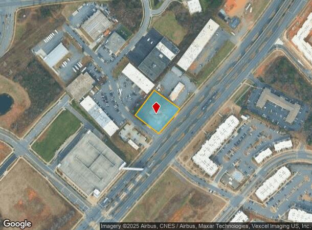
7305 N Tryon St, Charlotte, NC 28262

This Property Is For Sale
NEARBY LISTINGS FOR SALE OR LEASE
Property Detail
7305 N Tryon St
047-221-20
N TRYON ST
Commercialnec
Mecklenburg
X
North Carolina
3710457600K
20
0
0.89 AC
2025
University
005536
Charlotte
2,981 SF
Charlotte-Concord-Gastonia, NC-SC
DEMOGRAPHICS near 7305 N Tryon St
1 Mile
3 Mile
5 Mile
2024 Total Population
9,878
88,346
224,936
2029 Population
10,928
94,269
239,117
Pop Growth 2024-2029
+ 10.63%
+ 6.70%
+ 6.30%
Average Age
33
34
35
2024 Total Households
3,500
34,354
88,585
HH Growth 2024-2029
+ 10.49%
+ 6.71%
+ 6.41%
Median Household Inc
$44,590
$51,111
$57,831
Avg Household Size
2.60
2.50
2.40
2024 Avg HH Vehicles
2.00
2.00
2.00
Median Home Value
$163,322
$207,139
$253,969
Median Year Built
2003
1995
1995
Nearby Places
- Restaurants
- Banks
- Shops
- Fitness
- Groceries
PUBLIC TRANSPORTATION
COMMUTER RAIL
DRIVE
WALK
Distance
12 min
5.9 mi
AIRPORT
Concord-Padgett Regional
DRIVE
WALK
Distance
Concord-Padgett Regional
16 min
9.4 mi
Charlotte/Douglas International
DRIVE
WALK
Distance
Charlotte/Douglas International
26 min
15.3 mi
Nearby Properties
Address
Land Use
TOTAL SIZE
Lot Size
Zoning
Address
Land Use
TOTAL SIZE
Lot Size
Zoning
2,022,784 SF
654.80 AC
INST
Address
Land Use
TOTAL SIZE
Lot Size
Zoning
2,534,387 SF
135.23 AC
RE2
Address
Land Use
TOTAL SIZE
Lot Size
Zoning
2,215,042 SF
68.45 AC
RE2
Address
Land Use
TOTAL SIZE
Lot Size
Zoning
1,474,585 SF
30.93 AC
Address
Land Use
TOTAL SIZE
Lot Size
Zoning
1,532,477 SF
92.30 AC
RE1
Address
Land Use
TOTAL SIZE
Lot Size
Zoning
628,300 SF
197.32 AC
INST
Address
Land Use
TOTAL SIZE
Lot Size
Zoning
727,169 SF
6.07 AC
INST
Address
Land Use
TOTAL SIZE
Lot Size
Zoning
419,364 SF
17.40 AC
Address
Land Use
TOTAL SIZE
Lot Size
Zoning
315,076 SF
21.16 AC
RE1
Address
Land Use
TOTAL SIZE
Lot Size
Zoning
412,078 SF
27.46 AC
R17MFCD
Address
Land Use
TOTAL SIZE
Lot Size
Zoning
333,683 SF
24.11 AC
RE2
Address
Land Use
TOTAL SIZE
Lot Size
Zoning
16,601 SF
7.42 AC
R-12MF(CD)
Address
Land Use
TOTAL SIZE
Lot Size
Zoning
401,069 SF
31.52 AC
R12MFCD
Address
Land Use
TOTAL SIZE
Lot Size
Zoning
346,666 SF
26.53 AC
R17MFCD
Address
Land Use
TOTAL SIZE
Lot Size
Zoning
164,809 SF
94.60 AC
Address
Land Use
TOTAL SIZE
Lot Size
Zoning
389,680 SF
28.83 AC
R17MFCD
Address
Land Use
TOTAL SIZE
Lot Size
Zoning
324,898 SF
22.31 AC
R17MFCD
Address
Land Use
TOTAL SIZE
Lot Size
Zoning
215,899 SF
4.86 AC
B-2(CD)
Address
Land Use
TOTAL SIZE
Lot Size
Zoning
335,688 SF
22.54 AC
Address
Land Use
TOTAL SIZE
Lot Size
Zoning
549,120 SF
5.29 AC
NS
Address
Land Use
TOTAL SIZE
Lot Size
Zoning
358,524 SF
23.80 AC
R17MFCD
Address
Land Use
TOTAL SIZE
Lot Size
Zoning
306,269 SF
9.44 AC
MUDD-O
Address
Land Use
TOTAL SIZE
Lot Size
Zoning
464,520 SF
3.43 AC
Address
Land Use
TOTAL SIZE
Lot Size
Zoning
325,799 SF
37.65 AC
R9MFCD
Address
Land Use
TOTAL SIZE
Lot Size
Zoning
306,583 SF
24.15 AC
Address
Land Use
TOTAL SIZE
Lot Size
Zoning
357,469 SF
49.75 AC
Address
Land Use
TOTAL SIZE
Lot Size
Zoning
19.62 AC
Address
Land Use
TOTAL SIZE
Lot Size
Zoning
352,085 SF
23.50 AC
NS
Address
Land Use
TOTAL SIZE
Lot Size
Zoning
276,596 SF
41.26 AC
Address
Land Use
TOTAL SIZE
Lot Size
Zoning
330,598 SF
20.29 AC
The World's #1 Commercial Real Estate Marketplace
Connect with us
© 2025 CoStar Group
The information above has been obtained from sources believed reliable. While we do not doubt its accuracy we have not verified it and make no guarantee, warranty or representation about it. It is your responsibility to independently confirm its accuracy and completeness. Any projections, opinions, assumptions, or estimates used are for example only and do not represent the current or future performance of the property. The value of this transaction to you depends on tax and other factors which should be evaluated by your tax, financial, and legal advisors. You and your advisors should conduct a careful, independent investigation of the property to determine to your satisfaction the suitability of the property for your needs.