Property Record
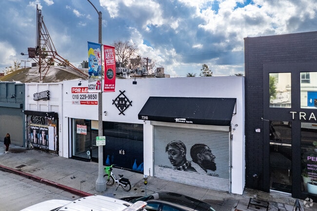
7308 Melrose Ave, Los Angeles, CA 90046


Current Lease Availabilities
NEARBY LISTINGS FOR SALE OR LEASE
Property Detail
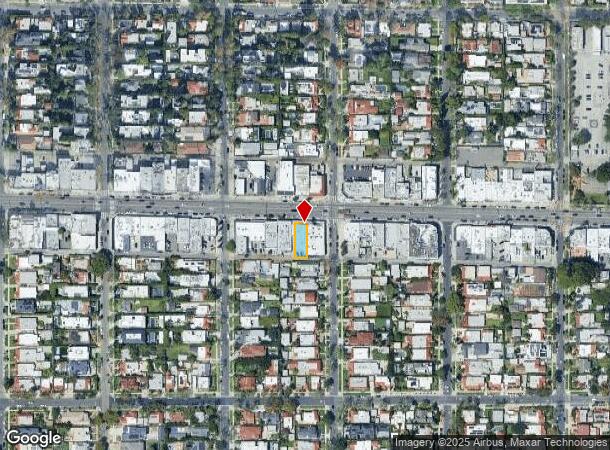
7308 Melrose Ave
Los Angeles-Long Beach-Glendale, CA
6078
5526-021-002
TRACT # 6078 LOT 54
Storemultistory
Los Angeles
X
California
06037C1605F
54
2024
0.10 AC
2025
West Hollywood
192002
Los Angeles
3,620 SF
DEMOGRAPHICS near 7308 Melrose Ave
1 Mile
3 Mile
5 Mile
2024 Total Population
47,138
403,997
946,057
2029 Population
46,259
396,746
925,027
Pop Growth 2024-2029
(1.86%)
(1.79%)
(2.22%)
Average Age
40
41
40
2024 Total Households
25,141
197,261
414,906
HH Growth 2024-2029
(2.11%)
(1.94%)
(2.35%)
Median Household Inc
$81,556
$72,258
$67,356
Avg Household Size
1.80
2.00
2.20
2024 Avg HH Vehicles
1.00
1.00
1.00
Median Home Value
$1,114,497
$1,085,284
$1,067,593
Median Year Built
1960
1962
1960
Nearby Places
Map Layers
Map Styles
 Street
 Aerial
- Restaurants
- Banks
- Shops
- Fitness
- Groceries
PUBLIC TRANSPORTATION
COMMUTER RAIL
DRIVE
WALK
Distance
15 min
7.2 mi
Union Station (91 Line - Southern California Regional Rail Authority (Metrolink), Antelope Valley Line - Southern California Regional Rail Authority (Metrolink), Orange County Line - Southern California Regional Rail Authority (Metrolink), Riverside Line - Southern California Regional Rail Authority (Metrolink), San Bernardino Line - Southern California Regional Rail Authority (Metrolink), Ventura County Line - Southern California Regional Rail Authority (Metrolink))
DRIVE
WALK
Distance
Union Station (91 Line - Southern California Regional Rail Authority (Metrolink), Antelope Valley Line - Southern California Regional Rail Authority (Metrolink), Orange County Line - Southern California Regional Rail Authority (Metrolink), Riverside Line - Southern California Regional Rail Authority (Metrolink), San Bernardino Line - Southern California Regional Rail Authority (Metrolink), Ventura County Line - Southern California Regional Rail Authority (Metrolink))
17 min
7.3 mi
AIRPORT
Bob Hope
DRIVE
WALK
Distance
Bob Hope
22 min
10.3 mi
Los Angeles International
DRIVE
WALK
Distance
Los Angeles International
26 min
11.9 mi
Long Beach (Daugherty Field)
DRIVE
WALK
Distance
Long Beach (Daugherty Field)
43 min
29.7 mi
Freight Ports
Port of Long Beach
DRIVE
WALK
Distance
Port of Long Beach
47 min
31.3 mi
Nearby Properties
Address
Land Use
TOTAL SIZE
Lot Size
Zoning
Address
Land Use
TOTAL SIZE
Lot Size
Zoning
2,529,036 SF
8.48 AC
LAC2
Address
Land Use
TOTAL SIZE
Lot Size
Zoning
1,447,077 SF
10.63 AC
LAC2
Address
Land Use
TOTAL SIZE
Lot Size
Zoning
436,774 SF
1.49 AC
LAC2
Address
Land Use
TOTAL SIZE
Lot Size
Zoning
1,002,990 SF
8.42 AC
LAC4
Address
Land Use
TOTAL SIZE
Lot Size
Zoning
252,523 SF
2.26 AC
LAC2
Address
Land Use
TOTAL SIZE
Lot Size
Zoning
161,046 SF
6.88 AC
LAM1
Address
Land Use
TOTAL SIZE
Lot Size
Zoning
476,779 SF
1.57 AC
LAC4
Address
Land Use
TOTAL SIZE
Lot Size
Zoning
754,581 SF
3.75 AC
LAC1
Address
Land Use
TOTAL SIZE
Lot Size
Zoning
728,063 SF
2.08 AC
LAC4
Address
Land Use
TOTAL SIZE
Lot Size
Zoning
67,126 SF
48.09 AC
LAM1
Address
Land Use
TOTAL SIZE
Lot Size
Zoning
472,363 SF
3.24 AC
LAC4
Address
Land Use
TOTAL SIZE
Lot Size
Zoning
515,531 SF
14.65 AC
LAC2
Address
Land Use
TOTAL SIZE
Lot Size
Zoning
497,377 SF
3.29 AC
LAC4
Address
Land Use
TOTAL SIZE
Lot Size
Zoning
793,274 SF
7.80 AC
LAR4
Address
Land Use
TOTAL SIZE
Lot Size
Zoning
110,580 SF
6.88 AC
LAC2
Address
Land Use
TOTAL SIZE
Lot Size
Zoning
125,170 SF
Address
Land Use
TOTAL SIZE
Lot Size
Zoning
724,958 SF
5.88 AC
LAC2
Address
Land Use
TOTAL SIZE
Lot Size
Zoning
416,078 SF
2.88 AC
WDC4*
Address
Land Use
TOTAL SIZE
Lot Size
Zoning
289,633 SF
1.55 AC
LAP
Address
Land Use
TOTAL SIZE
Lot Size
Zoning
453,182 SF
2.76 AC
LAC4
Address
Land Use
TOTAL SIZE
Lot Size
Zoning
255,868 SF
9.58 AC
WDC2C*
Address
Land Use
TOTAL SIZE
Lot Size
Zoning
8.93 AC
LAC2
Address
Land Use
TOTAL SIZE
Lot Size
Zoning
679,557 SF
6.41 AC
LAC2
Address
Land Use
TOTAL SIZE
Lot Size
Zoning
786,423 SF
11.74 AC
LAC2
Address
Land Use
TOTAL SIZE
Lot Size
Zoning
556,235 SF
4.22 AC
LAC4
Address
Land Use
TOTAL SIZE
Lot Size
Zoning
238,361 SF
1.45 AC
WDC2A*
Address
Land Use
TOTAL SIZE
Lot Size
Zoning
449,603 SF
2.56 AC
BHM2YY
Address
Land Use
TOTAL SIZE
Lot Size
Zoning
209,438 SF
1.37 AC
WDR2
Address
Land Use
TOTAL SIZE
Lot Size
Zoning
490,689 SF
3.60 AC
LAM1
Address
Land Use
TOTAL SIZE
Lot Size
Zoning
256,032 SF
4.69 AC
LAC4
The World's #1 Commercial Real Estate Marketplace
Connect with us
© 2026 CoStar Group
The information above has been obtained from sources believed reliable. While we do not doubt its accuracy we have not verified it and make no guarantee, warranty or representation about it. It is your responsibility to independently confirm its accuracy and completeness. Any projections, opinions, assumptions, or estimates used are for example only and do not represent the current or future performance of the property. The value of this transaction to you depends on tax and other factors which should be evaluated by your tax, financial, and legal advisors. You and your advisors should conduct a careful, independent investigation of the property to determine to your satisfaction the suitability of the property for your needs.