Property Record
7309 Old Compton Rd, Manassas, VA 20109

Save to a Folder
{{folder.Name}}
{{folder.ListingIds.length}} Properties
{{folder.ListingIds.length}} Property
Create a New Folder
Property Detail
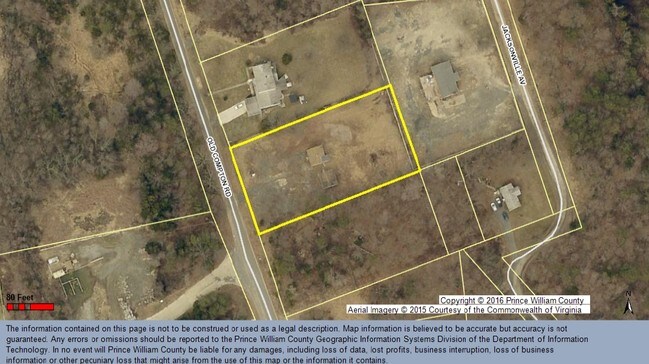
7309 Old Compton Rd
7597-74-2292
BEG AT POINT E SIDE OFOLD GROVETON RD MARKING NWLY COR LOT CHARLES JACKSON TO NEWMAN THENCE E SIDE N 12 DEG 47 MINUTES W 150.25 FT
Vacantlandnec
Prince William
A1
Virginia
B and X Area of moderate flood hazard, usually the area between the limits of the 100-year and 500-year floods.
2292
2024
1.03 AC
2025
Route 29/I-66 Corridor
901407
Washington, DC
812 SF
Washington-Arlington-Alexandria, DC-VA-MD-WV
NEARBY LISTINGS FOR SALE OR LEASE
DEMOGRAPHICS near 7309 Old Compton Rd
1 mile
3 mile
5 mile
2025 Total Population
8,331
49,583
165,353
2030 Population
8,650
50,974
168,996
Pop Growth 2025-2030
+ 3.83%
+ 2.81%
+ 2.20%
Average Age
33
35
37
2025 Total Households
2,767
16,104
51,530
HH Growth 2025-2030
+ 3.94%
+ 2.83%
+ 2.24%
Median Household Inc
$81,571
$97,888
$127,008
Avg Household Size
3.00
3.00
3.10
2025 Avg HH Vehicles
2.00
2.00
2.00
Median Home Value
$438,889
$456,962
$543,400
Median Year Built
1991
1990
1993
Nearby Places
Map Layers
Map Styles
 Street
 Aerial
Layers
 Traffic
 Biking
Places
Listings with unknown addresses are not visible on the map
- Restaurants
- Banks
- Shops
- Fitness
- Groceries
PUBLIC TRANSPORTATION
COMMUTER RAIL
Drive
Walk
Distance
13 min
5.9 mi
Drive
Walk
Distance
14 min
7.0 mi
AIRPORT
Washington Dulles International
Drive
Walk
Distance
Washington Dulles International
32 min
19.4 mi
Ronald Reagan Washington Ntl
Drive
Walk
Distance
Ronald Reagan Washington Ntl
46 min
34.0 mi
Freight Ports
Port of Baltimore
Drive
Walk
Distance
Port of Baltimore
90 min
69.6 mi
SALE & LEASE HISTORY
LISTING DATE
SALE/LEASE

Sep 24, 2016
For Sale
Feb 12, 2024
For Lease
Nearby Properties
Address
Land Use
TOTAL SIZE
Lot Size
Zoning
Address
Land Use
TOTAL SIZE
Lot Size
Zoning
866,820 SF
253.92 AC
M2
Address
Land Use
TOTAL SIZE
Lot Size
Zoning
482,223 SF
28.10 AC
PBD
Address
Land Use
TOTAL SIZE
Lot Size
Zoning
389,649 SF
11.82 AC
M2
Address
Land Use
TOTAL SIZE
Lot Size
Zoning
325,918 SF
41.38 AC
M2
Address
Land Use
TOTAL SIZE
Lot Size
Zoning
181.29 AC
M1
Address
Land Use
TOTAL SIZE
Lot Size
Zoning
230,706 SF
13.94 AC
PMD
Address
Land Use
TOTAL SIZE
Lot Size
Zoning
117.22 AC
M1
Address
Land Use
TOTAL SIZE
Lot Size
Zoning
719,742 SF
62.13 AC
M2
Address
Land Use
TOTAL SIZE
Lot Size
Zoning
115,600 SF
10.06 AC
M1
Address
Land Use
TOTAL SIZE
Lot Size
Zoning
123,534 SF
7.85 AC
M1
Address
Land Use
TOTAL SIZE
Lot Size
Zoning
824,085 SF
120.07 AC
MIXED
Address
Land Use
TOTAL SIZE
Lot Size
Zoning
312,931 SF
83 AC
M2
Address
Land Use
TOTAL SIZE
Lot Size
Zoning
127,700 SF
7.92 AC
M1
Address
Land Use
TOTAL SIZE
Lot Size
Zoning
409,252 SF
18.75 AC
M2
Address
Land Use
TOTAL SIZE
Lot Size
Zoning
258,716 SF
58.54 AC
M1
Address
Land Use
TOTAL SIZE
Lot Size
Zoning
165,230 SF
12 AC
M2
Address
Land Use
TOTAL SIZE
Lot Size
Zoning
270,540 SF
13.65 AC
PBD
Address
Land Use
TOTAL SIZE
Lot Size
Zoning
311,198 SF
23.50 AC
M2
Address
Land Use
TOTAL SIZE
Lot Size
Zoning
58.30 AC
M1
Address
Land Use
TOTAL SIZE
Lot Size
Zoning
40.47 AC
PBD
Address
Land Use
TOTAL SIZE
Lot Size
Zoning
52.69 AC
M2
Address
Land Use
TOTAL SIZE
Lot Size
Zoning
482,200 SF
29.18 AC
PBD
Address
Land Use
TOTAL SIZE
Lot Size
Zoning
402,166 SF
16.72 AC
M2
Address
Land Use
TOTAL SIZE
Lot Size
Zoning
395,617 SF
19.08 AC
PMD
Address
Land Use
TOTAL SIZE
Lot Size
Zoning
51.84 AC
MIXED
Address
Land Use
TOTAL SIZE
Lot Size
Zoning
75,816 SF
29.15 AC
R16
Address
Land Use
TOTAL SIZE
Lot Size
Zoning
29,500 SF
21.97 AC
M1
Address
Land Use
TOTAL SIZE
Lot Size
Zoning
327,574 SF
34.13 AC
R16
Address
Land Use
TOTAL SIZE
Lot Size
Zoning
380,264 SF
15.25 AC
PMD
Address
Land Use
TOTAL SIZE
Lot Size
Zoning
240,103 SF
19.93 AC
R16
The World's #1 Commercial Real Estate Marketplace
Connect with us
© 2026 CoStar Group
The information above has been obtained from sources believed reliable. While we do not doubt its accuracy we have not verified it and make no guarantee, warranty or representation about it. It is your responsibility to independently confirm its accuracy and completeness. Any projections, opinions, assumptions, or estimates used are for example only and do not represent the current or future performance of the property. The value of this transaction to you depends on tax and other factors which should be evaluated by your tax, financial, and legal advisors. You and your advisors should conduct a careful, independent investigation of the property to determine to your satisfaction the suitability of the property for your needs.