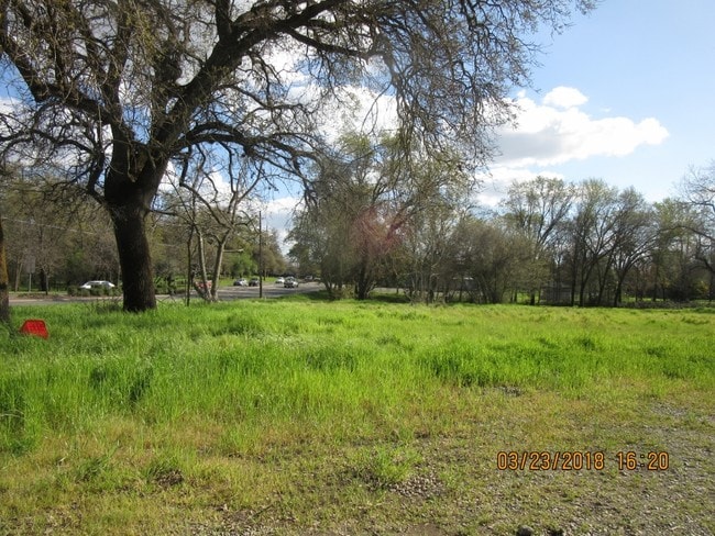
Property Record
7309 Sunrise Blvd, Citrus Heights, CA 95610

NEARBY LISTINGS FOR SALE OR LEASE
Property Detail
7309 Sunrise Blvd
Sacramento--Roseville--Arden-Arcade, CA
Cit Hts Add
211-0062-054
PORTION LOT199&200
Residentialacreage
Sacramento
X
California
06067C0084J
200
2024
0.94 AC
2025
Citrus Heights/Orangevale
008140
Sacramento
1,483 SF
DEMOGRAPHICS near 7309 Sunrise Blvd
1 Mile
3 Mile
5 Mile
2024 Total Population
17,959
137,181
332,498
2029 Population
18,012
139,345
338,754
Pop Growth 2024-2029
+ 0.30%
+ 1.58%
+ 1.88%
Average Age
40
42
41
2024 Total Households
6,690
53,374
127,448
HH Growth 2024-2029
+ 0.25%
+ 1.59%
+ 1.88%
Median Household Inc
$80,247
$78,758
$85,300
Avg Household Size
2.60
2.50
2.50
2024 Avg HH Vehicles
2.00
2.00
2.00
Median Home Value
$433,699
$447,652
$475,908
Median Year Built
1976
1976
1978
Nearby Places
Map Layers
Map Styles
 Street
 Aerial
- Restaurants
- Banks
- Shops
- Fitness
- Groceries
PUBLIC TRANSPORTATION
COMMUTER RAIL
Roseville (California Zephyr - Amtrak, Capitol Corridor - Amtrak)
DRIVE
WALK
Distance
Roseville (California Zephyr - Amtrak, Capitol Corridor - Amtrak)
12 min
5.4 mi
Rocklin Amtrak Station (Capitol Corridor - Amtrak)
DRIVE
WALK
Distance
Rocklin Amtrak Station (Capitol Corridor - Amtrak)
13 min
7.2 mi
AIRPORT
Sacramento International
DRIVE
WALK
Distance
Sacramento International
33 min
24.1 mi
Freight Ports
Port of Stockton
DRIVE
WALK
Distance
Port of Stockton
75 min
64.3 mi
SALE & LEASE HISTORY
LISTING DATE
SALE/LEASE

Mar 16, 2018
For Sale
Nearby Properties
Address
Land Use
TOTAL SIZE
Lot Size
Zoning
Address
Land Use
TOTAL SIZE
Lot Size
Zoning
210,380 SF
14.26 AC
Address
Land Use
TOTAL SIZE
Lot Size
Zoning
187,369 SF
15.24 AC
RD20
Address
Land Use
TOTAL SIZE
Lot Size
Zoning
251,225 SF
23.54 AC
SC
Address
Land Use
TOTAL SIZE
Lot Size
Zoning
199,580 SF
10.29 AC
RD20
Address
Land Use
TOTAL SIZE
Lot Size
Zoning
142,063 SF
8.70 AC
Address
Land Use
TOTAL SIZE
Lot Size
Zoning
78,730 SF
8.03 AC
RD20 BP
Address
Land Use
TOTAL SIZE
Lot Size
Zoning
118,155 SF
3.80 AC
Address
Land Use
TOTAL SIZE
Lot Size
Zoning
128,480 SF
7.95 AC
RD30 BP
Address
Land Use
TOTAL SIZE
Lot Size
Zoning
99,408 SF
3.53 AC
BP
Address
Land Use
TOTAL SIZE
Lot Size
Zoning
4.90 AC
RD30
Address
Land Use
TOTAL SIZE
Lot Size
Zoning
12,548 SF
14.36 AC
RD-30
Address
Land Use
TOTAL SIZE
Lot Size
Zoning
156,365 SF
12.81 AC
SC
Address
Land Use
TOTAL SIZE
Lot Size
Zoning
84,387 SF
3.52 AC
LC
Address
Land Use
TOTAL SIZE
Lot Size
Zoning
166,268 SF
9.50 AC
RD30
Address
Land Use
TOTAL SIZE
Lot Size
Zoning
99,568 SF
10.92 AC
RD-5
Address
Land Use
TOTAL SIZE
Lot Size
Zoning
148,663 SF
13.19 AC
SPA
Address
Land Use
TOTAL SIZE
Lot Size
Zoning
98,508 SF
5.33 AC
RD20
Address
Land Use
TOTAL SIZE
Lot Size
Zoning
111,185 SF
8.10 AC
Address
Land Use
TOTAL SIZE
Lot Size
Zoning
91,983 SF
3.27 AC
SPA
Address
Land Use
TOTAL SIZE
Lot Size
Zoning
137,732 SF
12.87 AC
SC
Address
Land Use
TOTAL SIZE
Lot Size
Zoning
162,401 SF
5.29 AC
Address
Land Use
TOTAL SIZE
Lot Size
Zoning
112,065 SF
8.52 AC
RD20
Address
Land Use
TOTAL SIZE
Lot Size
Zoning
78,379 SF
4.91 AC
RD20
Address
Land Use
TOTAL SIZE
Lot Size
Zoning
268,502 SF
12.38 AC
RD30
Address
Land Use
TOTAL SIZE
Lot Size
Zoning
220,691 SF
18.28 AC
RD20
Address
Land Use
TOTAL SIZE
Lot Size
Zoning
82,499 SF
4.74 AC
RD-30
Address
Land Use
TOTAL SIZE
Lot Size
Zoning
141,279 SF
11.56 AC
SPA
Address
Land Use
TOTAL SIZE
Lot Size
Zoning
52,595 SF
4.48 AC
LC
Address
Land Use
TOTAL SIZE
Lot Size
Zoning
87,942 SF
9.03 AC
SPA
Address
Land Use
TOTAL SIZE
Lot Size
Zoning
2,940 SF
4.97 AC
RD10
The World's #1 Commercial Real Estate Marketplace
Connect with us
© 2025 CoStar Group
The information above has been obtained from sources believed reliable. While we do not doubt its accuracy we have not verified it and make no guarantee, warranty or representation about it. It is your responsibility to independently confirm its accuracy and completeness. Any projections, opinions, assumptions, or estimates used are for example only and do not represent the current or future performance of the property. The value of this transaction to you depends on tax and other factors which should be evaluated by your tax, financial, and legal advisors. You and your advisors should conduct a careful, independent investigation of the property to determine to your satisfaction the suitability of the property for your needs.