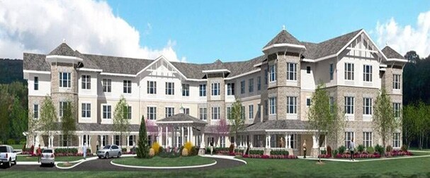
Property Record
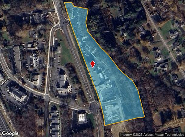
731 Federal Rd, Brookfield, CT 06804
NEARBY LISTINGS FOR SALE OR LEASE
Property Detail
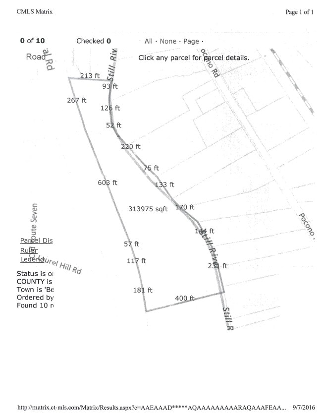
731 Federal Rd
BROO-000008D-000000-000019
Fairfield
Commercialbuilding
Connecticut
AE
19
09001C0131F
7.20 AC
2025
Brookfield
2025
Westchester/So Connecticut
205100
Bridgeport-Stamford-Norwalk, CT
60,042 SF
DEMOGRAPHICS near 731 Federal Rd
1 Mile
3 Mile
5 Mile
2024 Total Population
3,173
22,311
59,811
2029 Population
3,181
22,591
60,279
Pop Growth 2024-2029
+ 0.25%
+ 1.25%
+ 0.78%
Average Age
42
43
43
2024 Total Households
1,200
8,527
22,346
HH Growth 2024-2029
+ 0.17%
+ 1.23%
+ 0.74%
Median Household Inc
$112,762
$123,340
$113,774
Avg Household Size
2.60
2.60
2.60
2024 Avg HH Vehicles
2.00
2.00
2.00
Median Home Value
$407,471
$414,140
$383,942
Median Year Built
1971
1974
1975
Nearby Places
Map Layers
Map Styles
 Street
 Aerial
- Restaurants
- Banks
- Shops
- Fitness
- Groceries
PUBLIC TRANSPORTATION
COMMUTER RAIL
Bethel Station (New Haven Line - Metro-North Commuter Railroad Company (Metro-North))
DRIVE
WALK
Distance
Bethel Station (New Haven Line - Metro-North Commuter Railroad Company (Metro-North))
18 min
8.3 mi
Danbury Station (New Haven Line - Metro-North Commuter Railroad Company (Metro-North))
DRIVE
WALK
Distance
Danbury Station (New Haven Line - Metro-North Commuter Railroad Company (Metro-North))
13 min
8.6 mi
Freight Ports
Port of New Haven
DRIVE
WALK
Distance
Port of New Haven
56 min
36.0 mi
SALE & LEASE HISTORY
LISTING DATE
SALE/LEASE

Sep 24, 2016
For Sale
Nov 22, 2017
For Lease
Apr 06, 2017
For Sale
Nearby Properties
Address
Land Use
TOTAL SIZE
Lot Size
Zoning
Address
Land Use
TOTAL SIZE
Lot Size
Zoning
168,282 SF
22.83 AC
R-60
Address
Land Use
TOTAL SIZE
Lot Size
Zoning
31.57 AC
C-1
Address
Land Use
TOTAL SIZE
Lot Size
Zoning
79.31 AC
R-80
Address
Land Use
TOTAL SIZE
Lot Size
Zoning
4.09 AC
C-1
Address
Land Use
TOTAL SIZE
Lot Size
Zoning
9.39 AC
C-2
Address
Land Use
TOTAL SIZE
Lot Size
Zoning
16.31 AC
C-1
Address
Land Use
TOTAL SIZE
Lot Size
Zoning
123,271 SF
16.06 AC
C-1
Address
Land Use
TOTAL SIZE
Lot Size
Zoning
45.15 AC
I-1 HO
Address
Land Use
TOTAL SIZE
Lot Size
Zoning
12.42 AC
C-1
Address
Land Use
TOTAL SIZE
Lot Size
Zoning
16.09 AC
R-80
Address
Land Use
TOTAL SIZE
Lot Size
Zoning
77,492 SF
30.25 AC
Address
Land Use
TOTAL SIZE
Lot Size
Zoning
6.18 AC
R-60
Address
Land Use
TOTAL SIZE
Lot Size
Zoning
65,027 SF
5.69 AC
C-1
Address
Land Use
TOTAL SIZE
Lot Size
Zoning
2,173 SF
4.76 AC
TCD
Address
Land Use
TOTAL SIZE
Lot Size
Zoning
53,582 SF
7.71 AC
C-2
Address
Land Use
TOTAL SIZE
Lot Size
Zoning
6.54 AC
TCD-P
Address
Land Use
TOTAL SIZE
Lot Size
Zoning
151,200 SF
12.48 AC
I-1
Address
Land Use
TOTAL SIZE
Lot Size
Zoning
6.87 AC
C-1
Address
Land Use
TOTAL SIZE
Lot Size
Zoning
110,200 SF
4.96 AC
I-1 HO
Address
Land Use
TOTAL SIZE
Lot Size
Zoning
99,891 SF
7.01 AC
C-1
Address
Land Use
TOTAL SIZE
Lot Size
Zoning
9.29 AC
R-60
Address
Land Use
TOTAL SIZE
Lot Size
Zoning
57,782 SF
7.14 AC
R-80
Address
Land Use
TOTAL SIZE
Lot Size
Zoning
54.60 AC
R-80
Address
Land Use
TOTAL SIZE
Lot Size
Zoning
4.65 AC
TCD
Address
Land Use
TOTAL SIZE
Lot Size
Zoning
29,862 SF
1.41 AC
TCD
Address
Land Use
TOTAL SIZE
Lot Size
Zoning
58,880 SF
4.08 AC
C-1
Address
Land Use
TOTAL SIZE
Lot Size
Zoning
10.07 AC
I-1
Address
Land Use
TOTAL SIZE
Lot Size
Zoning
17,044 SF
7.36 AC
RA40
Address
Land Use
TOTAL SIZE
Lot Size
Zoning
4.80 AC
I-1
The World's #1 Commercial Real Estate Marketplace
Connect with us
© 2025 CoStar Group
The information above has been obtained from sources believed reliable. While we do not doubt its accuracy we have not verified it and make no guarantee, warranty or representation about it. It is your responsibility to independently confirm its accuracy and completeness. Any projections, opinions, assumptions, or estimates used are for example only and do not represent the current or future performance of the property. The value of this transaction to you depends on tax and other factors which should be evaluated by your tax, financial, and legal advisors. You and your advisors should conduct a careful, independent investigation of the property to determine to your satisfaction the suitability of the property for your needs.