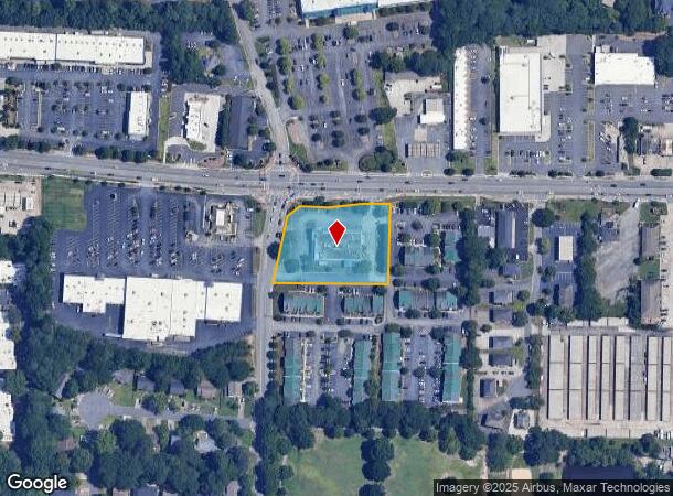
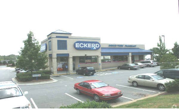
Property Record
731 Whitlock Ave Sw, Marietta, GA 30064
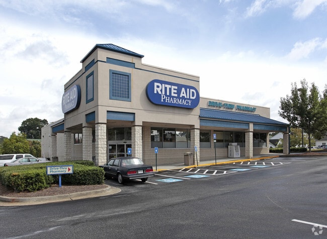

This Property Is For Sale
NEARBY LISTINGS FOR SALE OR LEASE
Property Detail
731 Whitlock Ave Sw
16-1226-0-031-0
Not Shown
Storebuilding
Cobb
X
Georgia
13067C0104H
1226
2025
1.91 AC
2025
Powder Spring/Austell
030907
Atlanta
10,966 SF
Atlanta-Sandy Springs-Roswell, GA
DEMOGRAPHICS near 731 Whitlock Ave Sw
1 Mile
3 Mile
5 Mile
2024 Total Population
7,782
60,304
184,685
2029 Population
7,907
61,686
188,775
Pop Growth 2024-2029
+ 1.61%
+ 2.29%
+ 2.21%
Average Age
43
39
38
2024 Total Households
3,261
23,005
70,588
HH Growth 2024-2029
+ 1.59%
+ 2.29%
+ 2.26%
Median Household Inc
$112,859
$78,303
$72,879
Avg Household Size
2.30
2.50
2.50
2024 Avg HH Vehicles
2.00
2.00
2.00
Median Home Value
$406,108
$380,369
$333,144
Median Year Built
1984
1986
1987
Nearby Places
Map Layers
Map Styles
 Street
 Aerial
- Restaurants
- Banks
- Shops
- Fitness
- Groceries
PUBLIC TRANSPORTATION
AIRPORT
Hartsfield - Jackson Atlanta International
DRIVE
WALK
Distance
Hartsfield - Jackson Atlanta International
44 min
30.4 mi
Nearby Properties
Address
Land Use
TOTAL SIZE
Lot Size
Zoning
Address
Land Use
TOTAL SIZE
Lot Size
Zoning
379,750 SF
11.14 AC
Address
Land Use
TOTAL SIZE
Lot Size
Zoning
283,134 SF
13.10 AC
PVC
Address
Land Use
TOTAL SIZE
Lot Size
Zoning
129,168 SF
0.82 AC
OI
Address
Land Use
TOTAL SIZE
Lot Size
Zoning
284,213 SF
19.85 AC
RM-12
Address
Land Use
TOTAL SIZE
Lot Size
Zoning
225,315 SF
17.10 AC
RM-12
Address
Land Use
TOTAL SIZE
Lot Size
Zoning
236,808 SF
29.38 AC
PRD MF
Address
Land Use
TOTAL SIZE
Lot Size
Zoning
222,906 SF
18.96 AC
RM-12
Address
Land Use
TOTAL SIZE
Lot Size
Zoning
176,350 SF
19.56 AC
PRD MF
Address
Land Use
TOTAL SIZE
Lot Size
Zoning
143,362 SF
1.61 AC
OI
Address
Land Use
TOTAL SIZE
Lot Size
Zoning
213,318 SF
19.28 AC
PRD MF
Address
Land Use
TOTAL SIZE
Lot Size
Zoning
13.17 AC
LI
Address
Land Use
TOTAL SIZE
Lot Size
Zoning
180,508 SF
21.88 AC
RM-8
Address
Land Use
TOTAL SIZE
Lot Size
Zoning
147,029 SF
3.05 AC
PRD MF
Address
Land Use
TOTAL SIZE
Lot Size
Zoning
217,980 SF
12.61 AC
PRD MF
Address
Land Use
TOTAL SIZE
Lot Size
Zoning
200,134 SF
12.60 AC
RM-8
Address
Land Use
TOTAL SIZE
Lot Size
Zoning
188,789 SF
8.88 AC
PRD MF
Address
Land Use
TOTAL SIZE
Lot Size
Zoning
1,093 SF
3.73 AC
RM-8/SLO
Address
Land Use
TOTAL SIZE
Lot Size
Zoning
276,095 SF
13.77 AC
HI
Address
Land Use
TOTAL SIZE
Lot Size
Zoning
133,813 SF
10 AC
RM-12
Address
Land Use
TOTAL SIZE
Lot Size
Zoning
127,776 SF
10.37 AC
RM-12
Address
Land Use
TOTAL SIZE
Lot Size
Zoning
77,699 SF
3.84 AC
O&I/WS
Address
Land Use
TOTAL SIZE
Lot Size
Zoning
109,272 SF
10.20 AC
CRC
Address
Land Use
TOTAL SIZE
Lot Size
Zoning
72,572 SF
0.53 AC
OI
Address
Land Use
TOTAL SIZE
Lot Size
Zoning
131,802 SF
4.76 AC
RM-12
Address
Land Use
TOTAL SIZE
Lot Size
Zoning
157,524 SF
1.97 AC
OI
Address
Land Use
TOTAL SIZE
Lot Size
Zoning
61,455 SF
0.50 AC
OI
Address
Land Use
TOTAL SIZE
Lot Size
Zoning
316,952 SF
3.23 AC
O&I
Address
Land Use
TOTAL SIZE
Lot Size
Zoning
108,827 SF
7.19 AC
PRD MF
Address
Land Use
TOTAL SIZE
Lot Size
Zoning
63,208 SF
2.26 AC
OI
Address
Land Use
TOTAL SIZE
Lot Size
Zoning
126,108 SF
7.71 AC
PRD MF
The World's #1 Commercial Real Estate Marketplace
Connect with us
© 2026 CoStar Group
The information above has been obtained from sources believed reliable. While we do not doubt its accuracy we have not verified it and make no guarantee, warranty or representation about it. It is your responsibility to independently confirm its accuracy and completeness. Any projections, opinions, assumptions, or estimates used are for example only and do not represent the current or future performance of the property. The value of this transaction to you depends on tax and other factors which should be evaluated by your tax, financial, and legal advisors. You and your advisors should conduct a careful, independent investigation of the property to determine to your satisfaction the suitability of the property for your needs.