Property Record
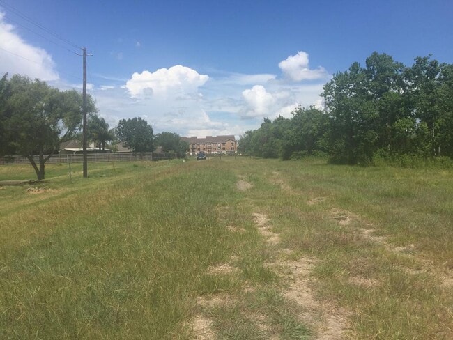
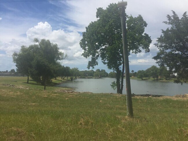
7310 Breda Dr, Baytown, TX 77521

NEARBY LISTINGS FOR SALE OR LEASE
-
-
View all Baytown listings for sale on LoopNet.com
Property Detail
7310 Breda Dr
1394270010001
Breda Crossing
Recreationalentertainmentgeneral
RES A BLK 1 BREDA CROSSING
X
Harris
48201C0765M
Texas
2024
4.41 AC
2025
Northeast Outlier
253101
Houston
16,520 SF
Houston-Pasadena-The Woodlands, TX
DEMOGRAPHICS near 7310 Breda Dr
1 Mile
3 Mile
5 Mile
2024 Total Population
7,823
40,751
97,610
2029 Population
7,954
41,805
100,921
Pop Growth 2024-2029
+ 1.67%
+ 2.59%
+ 3.39%
Average Age
34
35
36
2024 Total Households
2,412
13,833
33,598
HH Growth 2024-2029
+ 1.53%
+ 2.41%
+ 3.29%
Median Household Inc
$89,278
$69,436
$62,764
Avg Household Size
3.20
2.90
2.80
2024 Avg HH Vehicles
2.00
2.00
2.00
Median Home Value
$206,943
$190,362
$195,375
Median Year Built
2003
2001
1991
Nearby Places
Map Layers
Map Styles
 Street
 Aerial
- Restaurants
- Banks
- Shops
- Fitness
- Groceries
PUBLIC TRANSPORTATION
AIRPORT
William P Hobby
DRIVE
WALK
Distance
William P Hobby
45 min
29.0 mi
George Bush Intcntl/Houston
DRIVE
WALK
Distance
George Bush Intcntl/Houston
42 min
33.1 mi
Freight Ports
Port of Houston
DRIVE
WALK
Distance
Port of Houston
32 min
21.0 mi
SALE & LEASE HISTORY
LISTING DATE
SALE/LEASE

Jul 23, 2023
For Sale
Jul 23, 2023
For Sale
Nearby Properties
Address
Land Use
TOTAL SIZE
Lot Size
Zoning
Address
Land Use
TOTAL SIZE
Lot Size
Zoning
383,631 SF
22.45 AC
Address
Land Use
TOTAL SIZE
Lot Size
Zoning
291,462 SF
13.43 AC
Address
Land Use
TOTAL SIZE
Lot Size
Zoning
352,067 SF
19.78 AC
Address
Land Use
TOTAL SIZE
Lot Size
Zoning
284,794 SF
10.18 AC
Address
Land Use
TOTAL SIZE
Lot Size
Zoning
251,498 SF
16.36 AC
Address
Land Use
TOTAL SIZE
Lot Size
Zoning
337,066 SF
25.51 AC
Address
Land Use
TOTAL SIZE
Lot Size
Zoning
103.45 AC
Address
Land Use
TOTAL SIZE
Lot Size
Zoning
279,460 SF
20.62 AC
Address
Land Use
TOTAL SIZE
Lot Size
Zoning
225,497 SF
10.90 AC
Address
Land Use
TOTAL SIZE
Lot Size
Zoning
313,810 SF
20 AC
Address
Land Use
TOTAL SIZE
Lot Size
Zoning
260,750 SF
17.81 AC
Address
Land Use
TOTAL SIZE
Lot Size
Zoning
238,488 SF
13 AC
Address
Land Use
TOTAL SIZE
Lot Size
Zoning
59.21 AC
Address
Land Use
TOTAL SIZE
Lot Size
Zoning
454,992 SF
Address
Land Use
TOTAL SIZE
Lot Size
Zoning
122,554 SF
12.85 AC
Address
Land Use
TOTAL SIZE
Lot Size
Zoning
71,560 SF
17.89 AC
Address
Land Use
TOTAL SIZE
Lot Size
Zoning
103,107 SF
15.56 AC
Address
Land Use
TOTAL SIZE
Lot Size
Zoning
205,859 SF
10.88 AC
Address
Land Use
TOTAL SIZE
Lot Size
Zoning
214,627 SF
13.77 AC
Address
Land Use
TOTAL SIZE
Lot Size
Zoning
294,711 SF
4.34 AC
Address
Land Use
TOTAL SIZE
Lot Size
Zoning
247,218 SF
12.44 AC
Address
Land Use
TOTAL SIZE
Lot Size
Zoning
282,661 SF
14.68 AC
Address
Land Use
TOTAL SIZE
Lot Size
Zoning
100,274 SF
17.63 AC
Address
Land Use
TOTAL SIZE
Lot Size
Zoning
221,571 SF
21.28 AC
Address
Land Use
TOTAL SIZE
Lot Size
Zoning
69,976 SF
7.37 AC
Address
Land Use
TOTAL SIZE
Lot Size
Zoning
138,240 SF
2.95 AC
Address
Land Use
TOTAL SIZE
Lot Size
Zoning
94,350 SF
8 AC
Address
Land Use
TOTAL SIZE
Lot Size
Zoning
42,934 SF
2.60 AC
Address
Land Use
TOTAL SIZE
Lot Size
Zoning
224,472 SF
12 AC
Address
Land Use
TOTAL SIZE
Lot Size
Zoning
178,800 SF
The World's #1 Commercial Real Estate Marketplace
Connect with us
© 2026 CoStar Group
The information above has been obtained from sources believed reliable. While we do not doubt its accuracy we have not verified it and make no guarantee, warranty or representation about it. It is your responsibility to independently confirm its accuracy and completeness. Any projections, opinions, assumptions, or estimates used are for example only and do not represent the current or future performance of the property. The value of this transaction to you depends on tax and other factors which should be evaluated by your tax, financial, and legal advisors. You and your advisors should conduct a careful, independent investigation of the property to determine to your satisfaction the suitability of the property for your needs.