Property Record
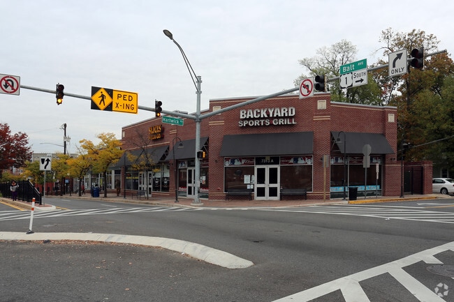
7313 Baltimore Ave, College Park, MD 20740


NEARBY LISTINGS FOR SALE OR LEASE
Property Detail
7313 Baltimore Ave
21-3565793
Terrapin Station
Regionalshoppingcenterormallwithanchorstore
PARCEL A
X
Prince George's
24033C0127E
Maryland
2024
0.39 AC
2025
College Park
980000
Washington, DC
13,600 SF
Washington-Arlington-Alexandria, DC-VA-MD-WV
DEMOGRAPHICS near 7313 Baltimore Ave
1 Mile
3 Mile
5 Mile
2024 Total Population
18,289
193,335
467,039
2029 Population
17,861
188,708
450,944
Pop Growth 2024-2029
(2.34%)
(2.39%)
(3.45%)
Average Age
29
35
37
2024 Total Households
4,950
59,576
160,181
HH Growth 2024-2029
(3.11%)
(2.53%)
(3.85%)
Median Household Inc
$51,498
$71,303
$77,736
Avg Household Size
2.40
3.00
2.70
2024 Avg HH Vehicles
2.00
2.00
2.00
Median Home Value
$584,244
$379,535
$434,061
Median Year Built
1974
1964
1962
Nearby Places
Map Layers
Map Styles
 Street
 Aerial
- Restaurants
- Banks
- Shops
- Fitness
- Groceries
PUBLIC TRANSPORTATION
TRANSIT/SUBWAY
College Park-U Of Md, Green/Yellow Line Center Platform (Metrorail Green Line - WMATA)
DRIVE
WALK
Distance
College Park-U Of Md, Green/Yellow Line Center Platform (Metrorail Green Line - WMATA)
2 min
10 min
0.6 mi
COMMUTER RAIL
College Park Marc Sb (CAMDEN - WASHINGTON - Maryland Transit Administration)
DRIVE
WALK
Distance
College Park Marc Sb (CAMDEN - WASHINGTON - Maryland Transit Administration)
2 min
10 min
0.5 mi
College Park Marc Nb (CAMDEN - WASHINGTON - Maryland Transit Administration)
DRIVE
WALK
Distance
College Park Marc Nb (CAMDEN - WASHINGTON - Maryland Transit Administration)
3 min
11 min
0.6 mi
AIRPORT
Ronald Reagan Washington Ntl
DRIVE
WALK
Distance
Ronald Reagan Washington Ntl
27 min
13.8 mi
Baltimore/Washington International Thurgood Marshall
DRIVE
WALK
Distance
Baltimore/Washington International Thurgood Marshall
39 min
24.0 mi
Washington Dulles International
DRIVE
WALK
Distance
Washington Dulles International
58 min
36.1 mi
Freight Ports
Port of Baltimore
DRIVE
WALK
Distance
Port of Baltimore
45 min
31.7 mi
SALE & LEASE HISTORY
LISTING DATE
SALE/LEASE

Nov 02, 2016
For Lease
Nearby Properties
Address
Land Use
TOTAL SIZE
Lot Size
Zoning
Address
Land Use
TOTAL SIZE
Lot Size
Zoning
2,043 SF
1,011.13 AC
RR
Address
Land Use
TOTAL SIZE
Lot Size
Zoning
13.01 AC
RR
Address
Land Use
TOTAL SIZE
Lot Size
Zoning
2,985,682 SF
4.33 AC
RSF65
Address
Land Use
TOTAL SIZE
Lot Size
Zoning
639,347 SF
2.28 AC
RTOLE
Address
Land Use
TOTAL SIZE
Lot Size
Zoning
1,201,133 SF
41.56 AC
RTOHC
Address
Land Use
TOTAL SIZE
Lot Size
Zoning
398,693 SF
2.57 AC
LTOE
Address
Land Use
TOTAL SIZE
Lot Size
Zoning
74,664 SF
1.83 AC
RTOLE
Address
Land Use
TOTAL SIZE
Lot Size
Zoning
3.53 AC
RTOLE
Address
Land Use
TOTAL SIZE
Lot Size
Zoning
330,003 SF
1.74 AC
RTOLE
Address
Land Use
TOTAL SIZE
Lot Size
Zoning
2.05 AC
RTOLE
Address
Land Use
TOTAL SIZE
Lot Size
Zoning
8,060 SF
1.63 AC
LTOE
Address
Land Use
TOTAL SIZE
Lot Size
Zoning
393,700 SF
1.30 AC
RTOLC
Address
Land Use
TOTAL SIZE
Lot Size
Zoning
3.64 AC
RTOHC
Address
Land Use
TOTAL SIZE
Lot Size
Zoning
578,232 SF
1.43 AC
RTOHC
Address
Land Use
TOTAL SIZE
Lot Size
Zoning
0.79 AC
RTOLE
Address
Land Use
TOTAL SIZE
Lot Size
Zoning
330,555 SF
2.12 AC
NAC
Address
Land Use
TOTAL SIZE
Lot Size
Zoning
337,500 SF
12.48 AC
RTOLE
Address
Land Use
TOTAL SIZE
Lot Size
Zoning
590 SF
20.11 AC
LTOE
Address
Land Use
TOTAL SIZE
Lot Size
Zoning
396 SF
6.80 AC
RTOHE
Address
Land Use
TOTAL SIZE
Lot Size
Zoning
9,184 SF
2.50 AC
LTOE
Address
Land Use
TOTAL SIZE
Lot Size
Zoning
395,538 SF
9.89 AC
RTOLE
Address
Land Use
TOTAL SIZE
Lot Size
Zoning
132,330 SF
3.20 AC
RTOLE
Address
Land Use
TOTAL SIZE
Lot Size
Zoning
15.90 AC
RTOLE
Address
Land Use
TOTAL SIZE
Lot Size
Zoning
309,374 SF
2.01 AC
RTOLE
Address
Land Use
TOTAL SIZE
Lot Size
Zoning
4.30 AC
RTOHE
Address
Land Use
TOTAL SIZE
Lot Size
Zoning
6.39 AC
RMF48
Address
Land Use
TOTAL SIZE
Lot Size
Zoning
190,067 SF
0.72 AC
LTOE
Address
Land Use
TOTAL SIZE
Lot Size
Zoning
5.58 AC
RTOLC
Address
Land Use
TOTAL SIZE
Lot Size
Zoning
2.42 AC
RTOHC
Address
Land Use
TOTAL SIZE
Lot Size
Zoning
569,794 SF
5.70 AC
RMF48
The World's #1 Commercial Real Estate Marketplace
Connect with us
© 2026 CoStar Group
The information above has been obtained from sources believed reliable. While we do not doubt its accuracy we have not verified it and make no guarantee, warranty or representation about it. It is your responsibility to independently confirm its accuracy and completeness. Any projections, opinions, assumptions, or estimates used are for example only and do not represent the current or future performance of the property. The value of this transaction to you depends on tax and other factors which should be evaluated by your tax, financial, and legal advisors. You and your advisors should conduct a careful, independent investigation of the property to determine to your satisfaction the suitability of the property for your needs.