Property Record
7314 S Padre Island Dr, Corpus Christi, TX 78412


NEARBY LISTINGS FOR SALE OR LEASE
Property Detail
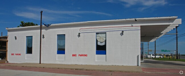
7314 S Padre Island Dr
Corpus Christi, TX
Joslin Tract
249505
JOSLIN TRACT LT 4-B & SW .51 AC OUT OF LT 5-DR BK A
Commercialnec
Nueces
X
Texas
48355C0530G
4b&5d
2024
3.51 AC
2025
South Side
002707
Corpus Christi
8,680 SF
DEMOGRAPHICS near 7314 S Padre Island Dr
1 Mile
3 Mile
5 Mile
2024 Total Population
10,924
68,709
166,917
2029 Population
10,838
68,261
165,756
Pop Growth 2024-2029
(0.79%)
(0.65%)
(0.70%)
Average Age
35
36
37
2024 Total Households
4,616
26,935
63,509
HH Growth 2024-2029
(0.82%)
(0.95%)
(0.89%)
Median Household Inc
$57,919
$65,109
$67,029
Avg Household Size
2.20
2.40
2.50
2024 Avg HH Vehicles
2.00
2.00
2.00
Median Home Value
$180,614
$185,987
$186,699
Median Year Built
1987
1987
1984
Nearby Places
Map Layers
Map Styles
 Street
 Aerial
- Restaurants
- Banks
- Shops
- Fitness
- Groceries
PUBLIC TRANSPORTATION
AIRPORT
Corpus Christi International
DRIVE
WALK
Distance
Corpus Christi International
20 min
13.6 mi
Freight Ports
Port of Corpus Christi
DRIVE
WALK
Distance
Port of Corpus Christi
15 min
9.4 mi
SALE & LEASE HISTORY
LISTING DATE
SALE/LEASE

Aug 07, 2019
For Sale
Nearby Properties
Address
Land Use
TOTAL SIZE
Lot Size
Zoning
Address
Land Use
TOTAL SIZE
Lot Size
Zoning
1 SF
227.13 AC
R1B
Address
Land Use
TOTAL SIZE
Lot Size
Zoning
747,956 SF
39.67 AC
B-4
Address
Land Use
TOTAL SIZE
Lot Size
Zoning
380,000 SF
71.08 AC
Address
Land Use
TOTAL SIZE
Lot Size
Zoning
414,230 SF
42.05 AC
R1A
Address
Land Use
TOTAL SIZE
Lot Size
Zoning
97,505 SF
29.76 AC
B-4
Address
Land Use
TOTAL SIZE
Lot Size
Zoning
245,114 SF
16.86 AC
Address
Land Use
TOTAL SIZE
Lot Size
Zoning
212,125 SF
16.55 AC
Address
Land Use
TOTAL SIZE
Lot Size
Zoning
104,851 SF
18.71 AC
R1B
Address
Land Use
TOTAL SIZE
Lot Size
Zoning
30.95 AC
VI
Address
Land Use
TOTAL SIZE
Lot Size
Zoning
196,076 SF
13.25 AC
Address
Land Use
TOTAL SIZE
Lot Size
Zoning
96,495 SF
6.63 AC
AB
Address
Land Use
TOTAL SIZE
Lot Size
Zoning
96,546 SF
19.99 AC
Address
Land Use
TOTAL SIZE
Lot Size
Zoning
80,354 SF
7.11 AC
R1B
Address
Land Use
TOTAL SIZE
Lot Size
Zoning
97,799 SF
8.35 AC
Address
Land Use
TOTAL SIZE
Lot Size
Zoning
108,694 SF
30.97 AC
Address
Land Use
TOTAL SIZE
Lot Size
Zoning
200,686 SF
17.77 AC
B4
Address
Land Use
TOTAL SIZE
Lot Size
Zoning
213,050 SF
34.44 AC
R1B
Address
Land Use
TOTAL SIZE
Lot Size
Zoning
79,107 SF
9.54 AC
R1B
Address
Land Use
TOTAL SIZE
Lot Size
Zoning
124,511 SF
10.74 AC
B-3
Address
Land Use
TOTAL SIZE
Lot Size
Zoning
192,450 SF
6.45 AC
Address
Land Use
TOTAL SIZE
Lot Size
Zoning
109,344 SF
17.34 AC
R1B
Address
Land Use
TOTAL SIZE
Lot Size
Zoning
71,556 SF
4.11 AC
R1B
Address
Land Use
TOTAL SIZE
Lot Size
Zoning
66,412 SF
4.10 AC
I-2
Address
Land Use
TOTAL SIZE
Lot Size
Zoning
72,436 SF
7.55 AC
B1
Address
Land Use
TOTAL SIZE
Lot Size
Zoning
72,555 SF
10 AC
R1C
Address
Land Use
TOTAL SIZE
Lot Size
Zoning
168,986 SF
16.16 AC
B4
Address
Land Use
TOTAL SIZE
Lot Size
Zoning
227,774 SF
12.70 AC
B4
Address
Land Use
TOTAL SIZE
Lot Size
Zoning
61,181 SF
2.13 AC
Address
Land Use
TOTAL SIZE
Lot Size
Zoning
77,977 SF
11.93 AC
B-4
Address
Land Use
TOTAL SIZE
Lot Size
Zoning
158,613 SF
17.15 AC
The World's #1 Commercial Real Estate Marketplace
Connect with us
© 2026 CoStar Group
The information above has been obtained from sources believed reliable. While we do not doubt its accuracy we have not verified it and make no guarantee, warranty or representation about it. It is your responsibility to independently confirm its accuracy and completeness. Any projections, opinions, assumptions, or estimates used are for example only and do not represent the current or future performance of the property. The value of this transaction to you depends on tax and other factors which should be evaluated by your tax, financial, and legal advisors. You and your advisors should conduct a careful, independent investigation of the property to determine to your satisfaction the suitability of the property for your needs.