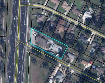
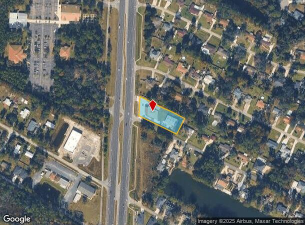
Property Record
7319 Highway 17, Fleming Island, FL 32003


NEARBY LISTINGS FOR SALE OR LEASE
Property Detail
7319 Highway 17
Jacksonville, FL
Floyd Div Flemiisl Grant
38-05-26-014770-001-00
LOTS 1 & 2 RIVER ISL ESTATES A/K/A PT LOT 4 FLOYD DIV FLEMIISL GRANT AS REC OR 4499 PG 7
Lightindustrial
Clay
X
Florida
12109C0150K
1,2,4
2024
0.84 AC
2025
Orange Park/Clay County
030701
Jacksonville (Florida)
8,212 SF
DEMOGRAPHICS near 7319 Highway 17
1 Mile
3 Mile
5 Mile
2024 Total Population
4,686
21,677
58,362
2029 Population
5,084
23,878
65,236
Pop Growth 2024-2029
+ 8.49%
+ 10.15%
+ 11.78%
Average Age
43
41
42
2024 Total Households
1,683
8,017
21,069
HH Growth 2024-2029
+ 8.67%
+ 10.13%
+ 11.56%
Median Household Inc
$103,618
$90,697
$95,607
Avg Household Size
2.70
2.70
2.70
2024 Avg HH Vehicles
2.00
2.00
2.00
Median Home Value
$345,788
$345,372
$346,814
Median Year Built
2002
2002
2000
Nearby Places
Map Layers
Map Styles
 Street
 Aerial
- Restaurants
- Banks
- Shops
- Fitness
- Groceries
PUBLIC TRANSPORTATION
AIRPORT
Jacksonville International
DRIVE
WALK
Distance
Jacksonville International
53 min
37.4 mi
Freight Ports
Jacksonville Port
DRIVE
WALK
Distance
Jacksonville Port
43 min
25.9 mi
SALE & LEASE HISTORY
LISTING DATE
SALE/LEASE

Oct 16, 2020
For Sale
Oct 13, 2020
For Sale
Nearby Properties
Address
Land Use
TOTAL SIZE
Lot Size
Zoning
Address
Land Use
TOTAL SIZE
Lot Size
Zoning
335,398 SF
31.66 AC
Address
Land Use
TOTAL SIZE
Lot Size
Zoning
539,095 SF
68.12 AC
Address
Land Use
TOTAL SIZE
Lot Size
Zoning
171,183 SF
11.37 AC
Address
Land Use
TOTAL SIZE
Lot Size
Zoning
125,572 SF
7.20 AC
Address
Land Use
TOTAL SIZE
Lot Size
Zoning
93,294 SF
30 AC
Address
Land Use
TOTAL SIZE
Lot Size
Zoning
89,070 SF
12.33 AC
PUD
Address
Land Use
TOTAL SIZE
Lot Size
Zoning
73,282 SF
12.51 AC
PUD
Address
Land Use
TOTAL SIZE
Lot Size
Zoning
89,674 SF
25 AC
RB
Address
Land Use
TOTAL SIZE
Lot Size
Zoning
203,600 SF
29.22 AC
PUD
Address
Land Use
TOTAL SIZE
Lot Size
Zoning
597.07 AC
PUD
Address
Land Use
TOTAL SIZE
Lot Size
Zoning
80,352 SF
0.97 AC
Address
Land Use
TOTAL SIZE
Lot Size
Zoning
80,613 SF
15.21 AC
PUD
Address
Land Use
TOTAL SIZE
Lot Size
Zoning
80,690 SF
9.18 AC
PUD
Address
Land Use
TOTAL SIZE
Lot Size
Zoning
41,188 SF
5.45 AC
Address
Land Use
TOTAL SIZE
Lot Size
Zoning
Address
Land Use
TOTAL SIZE
Lot Size
Zoning
42,718 SF
3.56 AC
Address
Land Use
TOTAL SIZE
Lot Size
Zoning
65,959 SF
7.02 AC
PUD
Address
Land Use
TOTAL SIZE
Lot Size
Zoning
Address
Land Use
TOTAL SIZE
Lot Size
Zoning
86,511 SF
4.43 AC
Address
Land Use
TOTAL SIZE
Lot Size
Zoning
80,251 SF
3.51 AC
Address
Land Use
TOTAL SIZE
Lot Size
Zoning
117,968 SF
14.42 AC
PUD
Address
Land Use
TOTAL SIZE
Lot Size
Zoning
93,660 SF
5.97 AC
BB
Address
Land Use
TOTAL SIZE
Lot Size
Zoning
86,423 SF
18.20 AC
Address
Land Use
TOTAL SIZE
Lot Size
Zoning
54,124 SF
4.83 AC
PUD
Address
Land Use
TOTAL SIZE
Lot Size
Zoning
68,727 SF
9.68 AC
Address
Land Use
TOTAL SIZE
Lot Size
Zoning
73,652 SF
11.75 AC
PUD
Address
Land Use
TOTAL SIZE
Lot Size
Zoning
58,376 SF
6.72 AC
Address
Land Use
TOTAL SIZE
Lot Size
Zoning
50,796 SF
5.57 AC
Address
Land Use
TOTAL SIZE
Lot Size
Zoning
46,984 SF
1.85 AC
Address
Land Use
TOTAL SIZE
Lot Size
Zoning
52,764 SF
5.06 AC
The World's #1 Commercial Real Estate Marketplace
Connect with us
© 2025 CoStar Group
The information above has been obtained from sources believed reliable. While we do not doubt its accuracy we have not verified it and make no guarantee, warranty or representation about it. It is your responsibility to independently confirm its accuracy and completeness. Any projections, opinions, assumptions, or estimates used are for example only and do not represent the current or future performance of the property. The value of this transaction to you depends on tax and other factors which should be evaluated by your tax, financial, and legal advisors. You and your advisors should conduct a careful, independent investigation of the property to determine to your satisfaction the suitability of the property for your needs.