Property Record
732 Main St, Sewell, NJ 08080


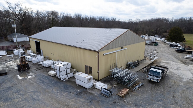
Property Detail
732 Main St
10-00157-0000-00017
Gloucester
Warehouse
New Jersey
R22
17
B and X Area of moderate flood hazard, usually the area between the limits of the 100-year and 500-year floods.
5.80 AC
2024
Gloucester County
2025
Philadelphia
500703
Philadelphia-Camden-Wilmington, PA-NJ-DE-MD
NEARBY LISTINGS FOR SALE OR LEASE
DEMOGRAPHICS near 732 Main St
1 mile
3 mile
5 mile
2025 Total Population
3,490
38,014
129,875
2030 Population
3,568
39,047
133,606
Pop Growth 2025-2030
+ 2.23%
+ 2.72%
+ 2.87%
Average Age
42
42
40
2025 Total Households
1,254
14,520
46,683
HH Growth 2025-2030
+ 2.31%
+ 2.81%
+ 3.04%
Median Household Inc
$110,750
$105,557
$106,387
Avg Household Size
2.70
2.60
2.60
2025 Avg HH Vehicles
2.00
2.00
2.00
Median Home Value
$376,666
$337,123
$343,143
Median Year Built
1981
1978
1981
Nearby Places
Map Layers
Map Styles
 Street
 Aerial
Transit
 Traffic
 Biking
Places
Listings with unknown addresses are not visible on the map
- Restaurants
- Banks
- Shops
- Fitness
- Groceries
PUBLIC TRANSPORTATION
AIRPORT
Philadelphia International
Drive
Walk
Distance
Philadelphia International
38 min
22.4 mi
Freight Ports
Broadway Terminal - Pier 5
Drive
Walk
Distance
Broadway Terminal - Pier 5
22 min
11.3 mi
SALE & LEASE HISTORY
LISTING DATE
SALE/LEASE

Sep 27, 2022
For Sale
Oct 05, 2021
For Sale
Jan 30, 2023
For Sale
Nearby Properties
Address
Land Use
TOTAL SIZE
Lot Size
Zoning
Address
Land Use
TOTAL SIZE
Lot Size
Zoning
228.36 AC
INS
Address
Land Use
TOTAL SIZE
Lot Size
Zoning
32.64 AC
INS
Address
Land Use
TOTAL SIZE
Lot Size
Zoning
80.26 AC
INS
Address
Land Use
TOTAL SIZE
Lot Size
Zoning
63.46 AC
INS
Address
Land Use
TOTAL SIZE
Lot Size
Zoning
4.89 AC
RA
Address
Land Use
TOTAL SIZE
Lot Size
Zoning
15.98 AC
PC
Address
Land Use
TOTAL SIZE
Lot Size
Zoning
1,316 SF
16.04 AC
PC
Address
Land Use
TOTAL SIZE
Lot Size
Zoning
13.76 AC
INS
Address
Land Use
TOTAL SIZE
Lot Size
Zoning
7.01 AC
R11
Address
Land Use
TOTAL SIZE
Lot Size
Zoning
8.89 AC
Address
Land Use
TOTAL SIZE
Lot Size
Zoning
12.01 AC
RA
Address
Land Use
TOTAL SIZE
Lot Size
Zoning
14.14 AC
R11
Address
Land Use
TOTAL SIZE
Lot Size
Zoning
12.73 AC
Address
Land Use
TOTAL SIZE
Lot Size
Zoning
2.62 AC
Address
Land Use
TOTAL SIZE
Lot Size
Zoning
27.40 AC
LI
Address
Land Use
TOTAL SIZE
Lot Size
Zoning
Address
Land Use
TOTAL SIZE
Lot Size
Zoning
76.61 AC
PI
Address
Land Use
TOTAL SIZE
Lot Size
Zoning
11.51 AC
Address
Land Use
TOTAL SIZE
Lot Size
Zoning
14.43 AC
CC
Address
Land Use
TOTAL SIZE
Lot Size
Zoning
7.53 AC
RA
Address
Land Use
TOTAL SIZE
Lot Size
Zoning
Address
Land Use
TOTAL SIZE
Lot Size
Zoning
6.27 AC
INS
Address
Land Use
TOTAL SIZE
Lot Size
Zoning
6.68 AC
FLXP
Address
Land Use
TOTAL SIZE
Lot Size
Zoning
4.52 AC
MUD
Address
Land Use
TOTAL SIZE
Lot Size
Zoning
10.15 AC
LI
Address
Land Use
TOTAL SIZE
Lot Size
Zoning
3.59 AC
CI
Address
Land Use
TOTAL SIZE
Lot Size
Zoning
16.14 AC
PC
Address
Land Use
TOTAL SIZE
Lot Size
Zoning
25.47 AC
I
Address
Land Use
TOTAL SIZE
Lot Size
Zoning
3.79 AC
PRC
Address
Land Use
TOTAL SIZE
Lot Size
Zoning
4.44 AC
R1
The World's #1 Commercial Real Estate Marketplace
Connect with us
© 2026 CoStar Group
The information above has been obtained from sources believed reliable. While we do not doubt its accuracy we have not verified it and make no guarantee, warranty or representation about it. It is your responsibility to independently confirm its accuracy and completeness. Any projections, opinions, assumptions, or estimates used are for example only and do not represent the current or future performance of the property. The value of this transaction to you depends on tax and other factors which should be evaluated by your tax, financial, and legal advisors. You and your advisors should conduct a careful, independent investigation of the property to determine to your satisfaction the suitability of the property for your needs.