Property Record
7320 48Th Ave N, Birmingham, AL 35206

NEARBY LISTINGS FOR SALE OR LEASE
Property Detail
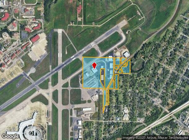
7320 48Th Ave N
Birmingham-Hoover, AL
Trotwood Park 2Nd Add
23-00-10-3-001-001.001
THE N 1300 FT OF NW 1/4 OF SW 1/4 SEC 10 TP 17 R 2W ALSO NW 1/4 OF NE 1/4 OF SD SW 1/4 ALSO LOTS 1-12 BLK 2 TROTWOOD 5/151 ALSO LOTS 1-9 TROTWOOD PARK 2ND ADD AND LOTS 1-2 SAM JONES ADD TO TROTWOOD PARK 52/67 LESS RD R/W EXC PT TO LOT 1 BHAM INTERNAT
Airport
Jefferson
A
Alabama
01073C0403H
1
0
46 AC
2024
Center Point
002100
Birmingham
222,082 SF
DEMOGRAPHICS near 7320 48Th Ave N
1 Mile
3 Mile
5 Mile
2024 Total Population
3,041
45,467
114,575
2029 Population
3,132
45,715
113,477
Pop Growth 2024-2029
+ 2.99%
+ 0.55%
(0.96%)
Average Age
39
38
39
2024 Total Households
1,185
18,144
47,350
HH Growth 2024-2029
+ 2.87%
+ 0.45%
(1.12%)
Median Household Inc
$28,503
$35,113
$48,006
Avg Household Size
2.30
2.30
2.30
2024 Avg HH Vehicles
2.00
2.00
2.00
Median Home Value
$67,907
$112,888
$168,298
Median Year Built
1954
1961
1966
Nearby Places
Map Layers
Map Styles
 Street
 Aerial
- Restaurants
- Banks
- Shops
- Fitness
- Groceries
PUBLIC TRANSPORTATION
COMMUTER RAIL
DRIVE
WALK
Distance
12 min
6.7 mi
AIRPORT
Birmingham-Shuttlesworth International
DRIVE
WALK
Distance
Birmingham-Shuttlesworth International
9 min
4.6 mi
Nearby Properties
Address
Land Use
TOTAL SIZE
Lot Size
Zoning
Address
Land Use
TOTAL SIZE
Lot Size
Zoning
145,865 SF
142 AC
M1-M
Address
Land Use
TOTAL SIZE
Lot Size
Zoning
298,966 SF
73 AC
M1
Address
Land Use
TOTAL SIZE
Lot Size
Zoning
166,863 SF
21 AC
CB2
Address
Land Use
TOTAL SIZE
Lot Size
Zoning
297,391 SF
27.10 AC
CR5
Address
Land Use
TOTAL SIZE
Lot Size
Zoning
225,000 SF
14 AC
B-2
Address
Land Use
TOTAL SIZE
Lot Size
Zoning
345,035 SF
39 AC
M1
Address
Land Use
TOTAL SIZE
Lot Size
Zoning
456,619 SF
27.30 AC
M2
Address
Land Use
TOTAL SIZE
Lot Size
Zoning
22 AC
CB2
Address
Land Use
TOTAL SIZE
Lot Size
Zoning
166,144 SF
12.95 AC
CB2
Address
Land Use
TOTAL SIZE
Lot Size
Zoning
102,748 SF
8.50 AC
CB2
Address
Land Use
TOTAL SIZE
Lot Size
Zoning
113,147 SF
115 AC
M1
Address
Land Use
TOTAL SIZE
Lot Size
Zoning
205,872 SF
12.53 AC
CB2
Address
Land Use
TOTAL SIZE
Lot Size
Zoning
108,813 SF
156 AC
M-1
Address
Land Use
TOTAL SIZE
Lot Size
Zoning
29,095 SF
2.64 AC
B2
Address
Land Use
TOTAL SIZE
Lot Size
Zoning
150,750 SF
12.60 AC
CR5
Address
Land Use
TOTAL SIZE
Lot Size
Zoning
301,531 SF
41 AC
B5
Address
Land Use
TOTAL SIZE
Lot Size
Zoning
366,807 SF
25.30 AC
M2
Address
Land Use
TOTAL SIZE
Lot Size
Zoning
134,840 SF
7.80 AC
C1
Address
Land Use
TOTAL SIZE
Lot Size
Zoning
188,160 SF
14 AC
CB2
Address
Land Use
TOTAL SIZE
Lot Size
Zoning
60,832 SF
162 AC
M1
Address
Land Use
TOTAL SIZE
Lot Size
Zoning
148,165 SF
15.65 AC
M1
Address
Land Use
TOTAL SIZE
Lot Size
Zoning
115,490 SF
3.88 AC
R2
Address
Land Use
TOTAL SIZE
Lot Size
Zoning
126,976 SF
25 AC
M1
Address
Land Use
TOTAL SIZE
Lot Size
Zoning
74,984 SF
1.25 AC
R5
Address
Land Use
TOTAL SIZE
Lot Size
Zoning
71,028 SF
9.90 AC
O-I
Address
Land Use
TOTAL SIZE
Lot Size
Zoning
229,670 SF
12 AC
CM2
Address
Land Use
TOTAL SIZE
Lot Size
Zoning
102 AC
R2
Address
Land Use
TOTAL SIZE
Lot Size
Zoning
89,720 SF
3.75 AC
R8
Address
Land Use
TOTAL SIZE
Lot Size
Zoning
38,955 SF
109.30 AC
M3
The World's #1 Commercial Real Estate Marketplace
Connect with us
© 2026 CoStar Group
The information above has been obtained from sources believed reliable. While we do not doubt its accuracy we have not verified it and make no guarantee, warranty or representation about it. It is your responsibility to independently confirm its accuracy and completeness. Any projections, opinions, assumptions, or estimates used are for example only and do not represent the current or future performance of the property. The value of this transaction to you depends on tax and other factors which should be evaluated by your tax, financial, and legal advisors. You and your advisors should conduct a careful, independent investigation of the property to determine to your satisfaction the suitability of the property for your needs.