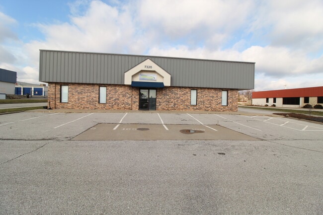
Property Record
7320 W 162Nd St, Stilwell, KS 66085

Current Lease Availabilities
NEARBY LISTINGS FOR SALE OR LEASE
Property Detail
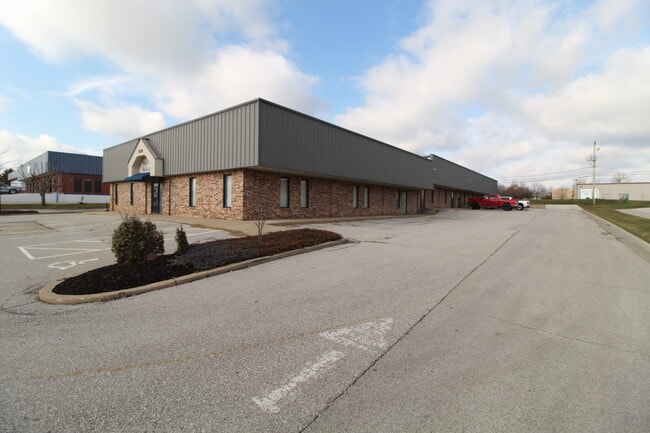
7320 W 162Nd St
Kansas City, MO-KS
Blue Valley Park
NP04550000-0004
BLUE VALLEY PARK LT 4 OPC 717 4
Warehouse
Johnson
X
Kansas
20091C0113G
4
2024
1 AC
2024
Metcalf/SE JoCo
053418
Kansas City
10,800 SF
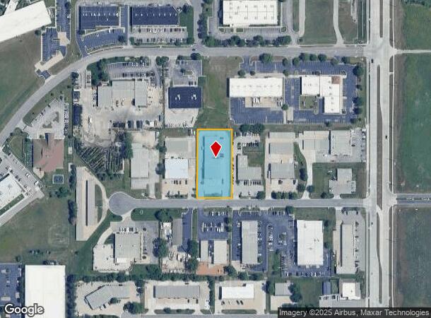
DEMOGRAPHICS near 7320 W 162Nd St
1 Mile
3 Mile
5 Mile
2024 Total Population
6,259
54,030
119,960
2029 Population
6,529
56,610
125,549
Pop Growth 2024-2029
+ 4.31%
+ 4.78%
+ 4.66%
Average Age
39
38
40
2024 Total Households
2,350
18,509
43,928
HH Growth 2024-2029
+ 4.30%
+ 4.85%
+ 4.81%
Median Household Inc
$112,982
$146,673
$133,810
Avg Household Size
2.60
2.90
2.70
2024 Avg HH Vehicles
2.00
2.00
2.00
Median Home Value
$344,736
$484,353
$468,497
Median Year Built
1996
2001
1999
Nearby Places
Map Layers
Map Styles
 Street
 Aerial
- Restaurants
- Banks
- Shops
- Fitness
- Groceries
PUBLIC TRANSPORTATION
AIRPORT
Kansas City International
DRIVE
WALK
Distance
Kansas City International
52 min
41.0 mi
Nearby Properties
Address
Land Use
TOTAL SIZE
Lot Size
Zoning
Address
Land Use
TOTAL SIZE
Lot Size
Zoning
1,173,824 SF
63.09 AC
R-1
Address
Land Use
TOTAL SIZE
Lot Size
Zoning
195,983 SF
20.88 AC
CP-2
Address
Land Use
TOTAL SIZE
Lot Size
Zoning
199,247 SF
50.19 AC
R-1
Address
Land Use
TOTAL SIZE
Lot Size
Zoning
316,630 SF
62.18 AC
RE
Address
Land Use
TOTAL SIZE
Lot Size
Zoning
239,520 SF
35.28 AC
R-1BJ
Address
Land Use
TOTAL SIZE
Lot Size
Zoning
254,535 SF
11.97 AC
RN1
Address
Land Use
TOTAL SIZE
Lot Size
Zoning
122,491 SF
19.30 AC
R-1
Address
Land Use
TOTAL SIZE
Lot Size
Zoning
102,411 SF
17.02 AC
AG
Address
Land Use
TOTAL SIZE
Lot Size
Zoning
185,906 SF
34.09 AC
R-1
Address
Land Use
TOTAL SIZE
Lot Size
Zoning
119,299 SF
43.14 AC
RE
Address
Land Use
TOTAL SIZE
Lot Size
Zoning
84,719 SF
16.12 AC
RURJ
Address
Land Use
TOTAL SIZE
Lot Size
Zoning
76,942 SF
15.10 AC
R-1
Address
Land Use
TOTAL SIZE
Lot Size
Zoning
86,095 SF
16.95 AC
R-1
Address
Land Use
TOTAL SIZE
Lot Size
Zoning
9,508 SF
8.29 AC
RP-1
Address
Land Use
TOTAL SIZE
Lot Size
Zoning
69,077 SF
17.90 AC
R-1
Address
Land Use
TOTAL SIZE
Lot Size
Zoning
115,263 SF
23.66 AC
R-1
Address
Land Use
TOTAL SIZE
Lot Size
Zoning
65,388 SF
19.09 AC
RURJ
Address
Land Use
TOTAL SIZE
Lot Size
Zoning
59,770 SF
8.88 AC
CP-2
Address
Land Use
TOTAL SIZE
Lot Size
Zoning
56,287 SF
7.88 AC
R-1
Address
Land Use
TOTAL SIZE
Lot Size
Zoning
69,455 SF
18.26 AC
RE
Address
Land Use
TOTAL SIZE
Lot Size
Zoning
67,523 SF
11.95 AC
R-1
Address
Land Use
TOTAL SIZE
Lot Size
Zoning
69,540 SF
6.87 AC
R-1
Address
Land Use
TOTAL SIZE
Lot Size
Zoning
26,022 SF
109.48 AC
IP-2J
Address
Land Use
TOTAL SIZE
Lot Size
Zoning
31,890 SF
2.38 AC
R-1
Address
Land Use
TOTAL SIZE
Lot Size
Zoning
64,529 SF
11.46 AC
R-1
Address
Land Use
TOTAL SIZE
Lot Size
Zoning
50,835 SF
5.80 AC
R-1BJ
Address
Land Use
TOTAL SIZE
Lot Size
Zoning
32,158 SF
3.07 AC
RRJ
Address
Land Use
TOTAL SIZE
Lot Size
Zoning
36,711 SF
96.57 AC
RURJ
Address
Land Use
TOTAL SIZE
Lot Size
Zoning
65,479 SF
28.57 AC
RP-3
Address
Land Use
TOTAL SIZE
Lot Size
Zoning
73,251 SF
29.96 AC
RP-3
The World's #1 Commercial Real Estate Marketplace
Connect with us
© 2025 CoStar Group
The information above has been obtained from sources believed reliable. While we do not doubt its accuracy we have not verified it and make no guarantee, warranty or representation about it. It is your responsibility to independently confirm its accuracy and completeness. Any projections, opinions, assumptions, or estimates used are for example only and do not represent the current or future performance of the property. The value of this transaction to you depends on tax and other factors which should be evaluated by your tax, financial, and legal advisors. You and your advisors should conduct a careful, independent investigation of the property to determine to your satisfaction the suitability of the property for your needs.