Property Record
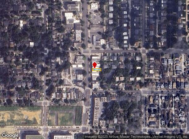
7319 Georgia Ave Nw, Washington, DC 20012
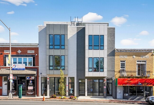
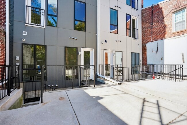
This Property Is For Sale
NEARBY LISTINGS FOR SALE OR LEASE
Property Detail
7319 Georgia Ave Nw
Washington-Arlington-Alexandria, DC-VA-MD-WV
Brightwood
2964-0034
SQUARE 2964 LOT 0034 NBHD: BRIGHTWOOD
Storemultistory
District of Columbia
X
District of Columbia
24033C0110E
34
2025
0.04 AC
2025
Uptown
010300
Washington, DC
3,650 SF
DEMOGRAPHICS near 7319 Georgia Ave Nw
1 Mile
3 Mile
5 Mile
2024 Total Population
32,107
253,178
684,920
2029 Population
30,489
240,457
649,560
Pop Growth 2024-2029
(5.04%)
(5.02%)
(5.16%)
Average Age
39
39
38
2024 Total Households
14,532
97,079
281,335
HH Growth 2024-2029
(4.78%)
(5.49%)
(6.04%)
Median Household Inc
$98,785
$94,279
$103,842
Avg Household Size
2.10
2.50
2.30
2024 Avg HH Vehicles
1.00
1.00
1.00
Median Home Value
$688,510
$696,871
$706,939
Median Year Built
1960
1955
1956
Nearby Places
- Restaurants
- Banks
- Shops
- Fitness
- Groceries
PUBLIC TRANSPORTATION
TRANSIT/SUBWAY
Takoma (Red Line - Washington Metropolitan Area Transit Authority Metrorail (Metrorail))
DRIVE
WALK
Distance
Takoma (Red Line - Washington Metropolitan Area Transit Authority Metrorail (Metrorail))
2 min
13 min
0.7 mi
COMMUTER RAIL
Silver Spring (Brunswick Line - Maryland Area Regional Commuter Trains (The MARC))
DRIVE
WALK
Distance
Silver Spring (Brunswick Line - Maryland Area Regional Commuter Trains (The MARC))
4 min
1.1 mi
Kensington (Brunswick Line - Maryland Area Regional Commuter Trains (The MARC))
DRIVE
WALK
Distance
Kensington (Brunswick Line - Maryland Area Regional Commuter Trains (The MARC))
13 min
4.9 mi
AIRPORT
Ronald Reagan Washington Ntl
DRIVE
WALK
Distance
Ronald Reagan Washington Ntl
26 min
12.0 mi
Washington Dulles International
DRIVE
WALK
Distance
Washington Dulles International
48 min
30.9 mi
Baltimore/Washington International Thurgood Marshall
DRIVE
WALK
Distance
Baltimore/Washington International Thurgood Marshall
43 min
31.4 mi
Freight Ports
Port of Baltimore
DRIVE
WALK
Distance
Port of Baltimore
47 min
34.1 mi
Nearby Properties
Address
Land Use
TOTAL SIZE
Lot Size
Zoning
Address
Land Use
TOTAL SIZE
Lot Size
Zoning
70,860 SF
1,616.16 AC
R-1A;UNZON
Address
Land Use
TOTAL SIZE
Lot Size
Zoning
775,490 SF
14.21 AC
R60
Address
Land Use
TOTAL SIZE
Lot Size
Zoning
1,144,541 SF
30.46 AC
CR2.5
Address
Land Use
TOTAL SIZE
Lot Size
Zoning
919,016 SF
3.25 AC
CR5.0
Address
Land Use
TOTAL SIZE
Lot Size
Zoning
316,393 SF
13.61 AC
R-1A
Address
Land Use
TOTAL SIZE
Lot Size
Zoning
505,000 SF
1.97 AC
CR8.0
Address
Land Use
TOTAL SIZE
Lot Size
Zoning
487,112 SF
3.19 AC
CR3.0
Address
Land Use
TOTAL SIZE
Lot Size
Zoning
869,190 SF
4.97 AC
RA-1
Address
Land Use
TOTAL SIZE
Lot Size
Zoning
302,861 SF
16.30 AC
R-1A
Address
Land Use
TOTAL SIZE
Lot Size
Zoning
400,000 SF
0.93 AC
CR5.0
Address
Land Use
TOTAL SIZE
Lot Size
Zoning
251,733 SF
2.52 AC
RA-4
Address
Land Use
TOTAL SIZE
Lot Size
Zoning
169,500 SF
9.14 AC
RA-1
Address
Land Use
TOTAL SIZE
Lot Size
Zoning
39,276 SF
22.97 AC
R-1A/FH
Address
Land Use
TOTAL SIZE
Lot Size
Zoning
383,000 SF
2.29 AC
WR-3;WR-4
Address
Land Use
TOTAL SIZE
Lot Size
Zoning
14.89 AC
R-1A
Address
Land Use
TOTAL SIZE
Lot Size
Zoning
305,000 SF
1.62 AC
CR5.0
Address
Land Use
TOTAL SIZE
Lot Size
Zoning
247,494 SF
WR-3;WR-5;
Address
Land Use
TOTAL SIZE
Lot Size
Zoning
134,394 SF
6.05 AC
WR-7;WR-8
Address
Land Use
TOTAL SIZE
Lot Size
Zoning
20.96 AC
MU-7B;R-1A
Address
Land Use
TOTAL SIZE
Lot Size
Zoning
299,583 SF
1.09 AC
RA-4
Address
Land Use
TOTAL SIZE
Lot Size
Zoning
756,363 SF
2.66 AC
CR8.0
Address
Land Use
TOTAL SIZE
Lot Size
Zoning
390,851 SF
16.59 AC
RF-1
Address
Land Use
TOTAL SIZE
Lot Size
Zoning
403,200 SF
1.41 AC
CR5.0
Address
Land Use
TOTAL SIZE
Lot Size
Zoning
406,784 SF
1.75 AC
CR3.0
Address
Land Use
TOTAL SIZE
Lot Size
Zoning
590 SF
20.11 AC
LTOE
Address
Land Use
TOTAL SIZE
Lot Size
Zoning
386,567 SF
29.70 AC
R60
Address
Land Use
TOTAL SIZE
Lot Size
Zoning
301,045 SF
13.51 AC
R-1B
Address
Land Use
TOTAL SIZE
Lot Size
Zoning
304,888 SF
1.72 AC
CR5.0
Address
Land Use
TOTAL SIZE
Lot Size
Zoning
310,000 SF
1.01 AC
CR8.0
Address
Land Use
TOTAL SIZE
Lot Size
Zoning
269,319 SF
2.26 AC
MU-4;RA-1
The World's #1 Commercial Real Estate Marketplace
Connect with us
© 2025 CoStar Group
The information above has been obtained from sources believed reliable. While we do not doubt its accuracy we have not verified it and make no guarantee, warranty or representation about it. It is your responsibility to independently confirm its accuracy and completeness. Any projections, opinions, assumptions, or estimates used are for example only and do not represent the current or future performance of the property. The value of this transaction to you depends on tax and other factors which should be evaluated by your tax, financial, and legal advisors. You and your advisors should conduct a careful, independent investigation of the property to determine to your satisfaction the suitability of the property for your needs.