Property Record
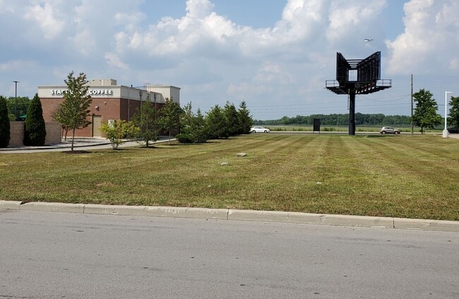
7125 E 96Th St, Indianapolis, IN 46250


Current Lease Availabilities
Property Detail
7125 E 96Th St
49-02-14-118-005.000-400
PT N1/2 S14 T17 R4 BEG 75 S & 163.55 W OF NW COR NW1/4 NE1/4 S267.91 W194.60 N268.44 E195.15 TO BEG 1.200 AC.
Autorepair
MARION
ZO01
Indiana
C and X Area of minimal flood hazard, usually depicted on FIRMs as above the 500-year flood level.
1.20 AC
2024
Castleton
2025
Indianapolis
330103
Indianapolis-Carmel-Greenwood, IN
4,352 SF
NEARBY LISTINGS FOR SALE OR LEASE
DEMOGRAPHICS near 7125 E 96Th St
1 mile
3 mile
5 mile
2025 Total Population
3,444
60,845
159,508
2030 Population
3,466
62,978
165,135
Pop Growth 2025-2030
+ 0.64%
+ 3.51%
+ 3.53%
Average Age
43
40
40
2025 Total Households
1,923
27,976
66,889
HH Growth 2025-2030
+ 0.68%
+ 3.35%
+ 3.45%
Median Household Inc
$64,371
$81,673
$100,918
Avg Household Size
1.70
2.10
2.30
2025 Avg HH Vehicles
1.00
2.00
2.00
Median Home Value
$210,124
$318,216
$371,628
Median Year Built
1985
1988
1990
Nearby Places
Map Layers
Map Styles
 Street
 Aerial
Layers
 Traffic
 Biking
Places
Listings with unknown addresses are not visible on the map
- Restaurants
- Banks
- Shops
- Fitness
- Groceries
PUBLIC TRANSPORTATION
AIRPORT
Indianapolis International
Drive
Walk
Distance
Indianapolis International
50 min
28.6 mi
Nearby Properties
Address
Land Use
TOTAL SIZE
Lot Size
Zoning
Address
Land Use
TOTAL SIZE
Lot Size
Zoning
366,825 SF
26.60 AC
ZO01
Address
Land Use
TOTAL SIZE
Lot Size
Zoning
16,704 SF
109.83 AC
ZO01
Address
Land Use
TOTAL SIZE
Lot Size
Zoning
8,551 SF
45.92 AC
ZO01
Address
Land Use
TOTAL SIZE
Lot Size
Zoning
22,081 SF
27.39 AC
ZO01
Address
Land Use
TOTAL SIZE
Lot Size
Zoning
4,246 SF
89.83 AC
ZO01
Address
Land Use
TOTAL SIZE
Lot Size
Zoning
683,795 SF
25.53 AC
Address
Land Use
TOTAL SIZE
Lot Size
Zoning
10,911 SF
11.56 AC
ZO01
Address
Land Use
TOTAL SIZE
Lot Size
Zoning
21,742 SF
39.35 AC
ZO01
Address
Land Use
TOTAL SIZE
Lot Size
Zoning
426,839 SF
97.65 AC
Address
Land Use
TOTAL SIZE
Lot Size
Zoning
555,234 SF
36.07 AC
Address
Land Use
TOTAL SIZE
Lot Size
Zoning
325,194 SF
8.07 AC
Address
Land Use
TOTAL SIZE
Lot Size
Zoning
372,138 SF
20.71 AC
Address
Land Use
TOTAL SIZE
Lot Size
Zoning
328,241 SF
91.83 AC
Address
Land Use
TOTAL SIZE
Lot Size
Zoning
5,314 SF
13.92 AC
ZO01
Address
Land Use
TOTAL SIZE
Lot Size
Zoning
363,408 SF
30.78 AC
Address
Land Use
TOTAL SIZE
Lot Size
Zoning
290,488 SF
13.72 AC
Address
Land Use
TOTAL SIZE
Lot Size
Zoning
1,904 SF
67.93 AC
ZO01
Address
Land Use
TOTAL SIZE
Lot Size
Zoning
6,229 SF
36.20 AC
ZO01
Address
Land Use
TOTAL SIZE
Lot Size
Zoning
6,252 SF
52.04 AC
ZO01
Address
Land Use
TOTAL SIZE
Lot Size
Zoning
125.31 AC
Address
Land Use
TOTAL SIZE
Lot Size
Zoning
391,181 SF
23.82 AC
Address
Land Use
TOTAL SIZE
Lot Size
Zoning
3,053 SF
10.33 AC
ZO01
Address
Land Use
TOTAL SIZE
Lot Size
Zoning
178,991 SF
0.90 AC
Address
Land Use
TOTAL SIZE
Lot Size
Zoning
6,366 SF
19.32 AC
ZO01
Address
Land Use
TOTAL SIZE
Lot Size
Zoning
188,840 SF
10.02 AC
Address
Land Use
TOTAL SIZE
Lot Size
Zoning
224,368 SF
0.73 AC
Address
Land Use
TOTAL SIZE
Lot Size
Zoning
24,192 SF
5.93 AC
Address
Land Use
TOTAL SIZE
Lot Size
Zoning
318,050 SF
24.67 AC
ZO01
Address
Land Use
TOTAL SIZE
Lot Size
Zoning
140,987 SF
14 AC
Address
Land Use
TOTAL SIZE
Lot Size
Zoning
308,854 SF
13.64 AC
The World's #1 Commercial Real Estate Marketplace
Connect with us
© 2026 CoStar Group
The information above has been obtained from sources believed reliable. While we do not doubt its accuracy we have not verified it and make no guarantee, warranty or representation about it. It is your responsibility to independently confirm its accuracy and completeness. Any projections, opinions, assumptions, or estimates used are for example only and do not represent the current or future performance of the property. The value of this transaction to you depends on tax and other factors which should be evaluated by your tax, financial, and legal advisors. You and your advisors should conduct a careful, independent investigation of the property to determine to your satisfaction the suitability of the property for your needs.