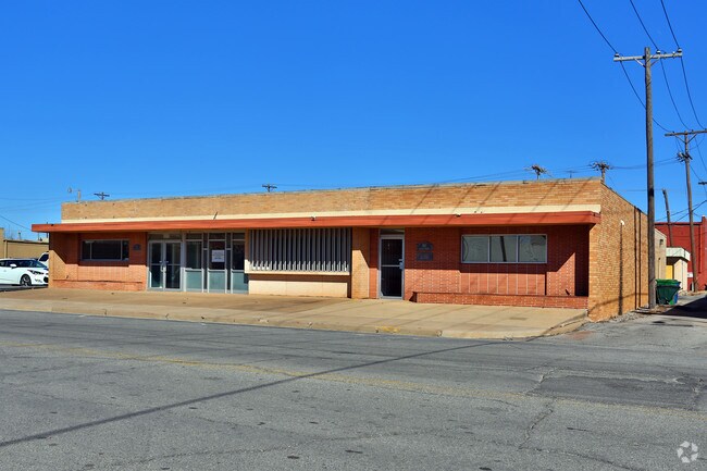
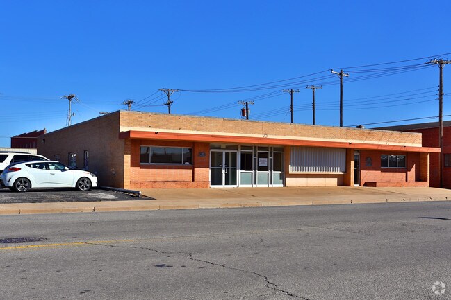
Property Record
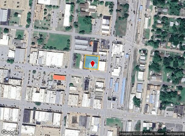
733 W Walnut Ave, Duncan, OK 73533

NEARBY LISTINGS FOR SALE OR LEASE
Property Detail
733 W Walnut Ave
Duncan, OK
City Of Duncan Original Townsite
1001-00-140-030-0-000-00
BLK 140 LOTS 27, 28, 29, 30, 31, 32 DUNCAN CITY
Officebuilding
Stephens
X
Oklahoma
40137C0215F
27-32
2024
0.48 AC
2025
Oklahoma West Area
000300
Other Market Areas
240 SF
DEMOGRAPHICS near 733 W Walnut Ave
1 Mile
3 Mile
5 Mile
2024 Total Population
9,127
22,889
25,992
2029 Population
9,595
23,899
27,075
Pop Growth 2024-2029
+ 5.13%
+ 4.41%
+ 4.17%
Average Age
39
41
42
2024 Total Households
3,537
9,342
10,582
HH Growth 2024-2029
+ 5.06%
+ 4.27%
+ 4.02%
Median Household Inc
$39,419
$48,649
$51,102
Avg Household Size
2.40
2.30
2.40
2024 Avg HH Vehicles
2.00
2.00
2.00
Median Home Value
$71,577
$124,381
$133,412
Median Year Built
1955
1969
1971
Nearby Places
Map Layers
Map Styles
 Street
 Aerial
- Restaurants
- Banks
- Shops
- Fitness
- Groceries
PUBLIC TRANSPORTATION
AIRPORT
Lawton-Fort Sill Regional
DRIVE
WALK
Distance
Lawton-Fort Sill Regional
50 min
35.1 mi
Freight Ports
Tulsa Port Of Catoosa
DRIVE
WALK
Distance
Tulsa Port Of Catoosa
226 min
204.0 mi
SALE & LEASE HISTORY
LISTING DATE
SALE/LEASE

Dec 20, 2024
For Lease
Nearby Properties
Address
Land Use
TOTAL SIZE
Lot Size
Zoning
Address
Land Use
TOTAL SIZE
Lot Size
Zoning
91,737 SF
40 AC
C1
Address
Land Use
TOTAL SIZE
Lot Size
Zoning
4,064 SF
43.23 AC
Address
Land Use
TOTAL SIZE
Lot Size
Zoning
127,660 SF
20 AC
Address
Land Use
TOTAL SIZE
Lot Size
Zoning
63,093 SF
23.46 AC
Address
Land Use
TOTAL SIZE
Lot Size
Zoning
34,192 SF
80.31 AC
Address
Land Use
TOTAL SIZE
Lot Size
Zoning
9,694 SF
5.12 AC
C2
Address
Land Use
TOTAL SIZE
Lot Size
Zoning
825 SF
97.38 AC
Address
Land Use
TOTAL SIZE
Lot Size
Zoning
61,546 SF
22.70 AC
Address
Land Use
TOTAL SIZE
Lot Size
Zoning
28,987 SF
20 AC
R1
Address
Land Use
TOTAL SIZE
Lot Size
Zoning
82,956 SF
11.54 AC
C1
Address
Land Use
TOTAL SIZE
Lot Size
Zoning
86,400 SF
5 AC
C1
Address
Land Use
TOTAL SIZE
Lot Size
Zoning
2,460 SF
123.87 AC
Address
Land Use
TOTAL SIZE
Lot Size
Zoning
2,500 SF
77.76 AC
C1
Address
Land Use
TOTAL SIZE
Lot Size
Zoning
32,998 SF
2.64 AC
C2
Address
Land Use
TOTAL SIZE
Lot Size
Zoning
260 SF
1.93 AC
R1
Address
Land Use
TOTAL SIZE
Lot Size
Zoning
816 SF
8 AC
C2
Address
Land Use
TOTAL SIZE
Lot Size
Zoning
7,478 SF
1.26 AC
R1
Address
Land Use
TOTAL SIZE
Lot Size
Zoning
30,841 SF
3.12 AC
R1
Address
Land Use
TOTAL SIZE
Lot Size
Zoning
1,500 SF
5 AC
C2
Address
Land Use
TOTAL SIZE
Lot Size
Zoning
17,205 SF
160 AC
C2
Address
Land Use
TOTAL SIZE
Lot Size
Zoning
25,732 SF
20 AC
C1
Address
Land Use
TOTAL SIZE
Lot Size
Zoning
1,440 SF
33.58 AC
Address
Land Use
TOTAL SIZE
Lot Size
Zoning
9,014 SF
1.77 AC
C1
Address
Land Use
TOTAL SIZE
Lot Size
Zoning
61,514 SF
2.34 AC
C1
Address
Land Use
TOTAL SIZE
Lot Size
Zoning
33,953 SF
5.94 AC
R1
Address
Land Use
TOTAL SIZE
Lot Size
Zoning
170 SF
4.88 AC
Address
Land Use
TOTAL SIZE
Lot Size
Zoning
18,492 SF
9.89 AC
C1
Address
Land Use
TOTAL SIZE
Lot Size
Zoning
14,352 SF
10 AC
R1
Address
Land Use
TOTAL SIZE
Lot Size
Zoning
20,966 SF
5 AC
R1
Address
Land Use
TOTAL SIZE
Lot Size
Zoning
2,632 SF
120 AC
R1
The World's #1 Commercial Real Estate Marketplace
Connect with us
© 2026 CoStar Group
The information above has been obtained from sources believed reliable. While we do not doubt its accuracy we have not verified it and make no guarantee, warranty or representation about it. It is your responsibility to independently confirm its accuracy and completeness. Any projections, opinions, assumptions, or estimates used are for example only and do not represent the current or future performance of the property. The value of this transaction to you depends on tax and other factors which should be evaluated by your tax, financial, and legal advisors. You and your advisors should conduct a careful, independent investigation of the property to determine to your satisfaction the suitability of the property for your needs.