Property Record
7335 Peppers Ferry Blvd, Radford, VA 24141


Save to a Folder
{{folder.Name}}
{{folder.ListingIds.length}} Properties
{{folder.ListingIds.length}} Property
Create a New Folder
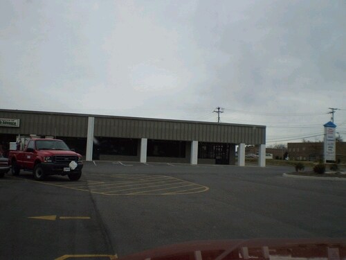
Property Detail
7335 Peppers Ferry Blvd
01147
PARCEL B ON RT 114
Commercialnec
PULASKI
CM1
Virginia
B and X Area of moderate flood hazard, usually the area between the limits of the 100-year and 500-year floods.
1.98 AC
2026
Blacksburg & Wytheville
2026
Other Market Areas
010201
Blacksburg-Christiansburg-Radford, VA
NEARBY LISTINGS FOR SALE OR LEASE
DEMOGRAPHICS near 7335 Peppers Ferry Blvd
1 mile
3 mile
5 mile
2025 Total Population
2,110
18,819
24,636
2030 Population
2,096
19,725
25,580
Pop Growth 2025-2030
(0.66%)
+ 4.81%
+ 3.83%
Average Age
46
38
39
2025 Total Households
978
8,133
10,430
HH Growth 2025-2030
(0.61%)
+ 4.61%
+ 3.75%
Median Household Inc
$58,737
$54,715
$56,361
Avg Household Size
2.10
2.20
2.20
2025 Avg HH Vehicles
2.00
2.00
2.00
Median Home Value
$250,925
$246,746
$243,638
Median Year Built
1972
1975
1977
Nearby Places
Map Layers
Map Styles
 Street
 Aerial
Layers
 Traffic
 Biking
Places
Listings with unknown addresses are not visible on the map
- Restaurants
- Banks
- Shops
- Fitness
- Groceries
SALE & LEASE HISTORY
LISTING DATE
SALE/LEASE

Sep 25, 2016
For Lease
Sep 24, 2016
For Sale
Nearby Properties
Address
Land Use
TOTAL SIZE
Lot Size
Zoning
Address
Land Use
TOTAL SIZE
Lot Size
Zoning
45.01 AC
I1
Address
Land Use
TOTAL SIZE
Lot Size
Zoning
2.75 AC
C1
Address
Land Use
TOTAL SIZE
Lot Size
Zoning
0.64 AC
Address
Land Use
TOTAL SIZE
Lot Size
Zoning
6.69 AC
Address
Land Use
TOTAL SIZE
Lot Size
Zoning
25.18 AC
R3
Address
Land Use
TOTAL SIZE
Lot Size
Zoning
13.84 AC
Address
Land Use
TOTAL SIZE
Lot Size
Zoning
0.25 AC
Address
Land Use
TOTAL SIZE
Lot Size
Zoning
17.95 AC
CM1
Address
Land Use
TOTAL SIZE
Lot Size
Zoning
7.57 AC
Address
Land Use
TOTAL SIZE
Lot Size
Zoning
14.32 AC
CM1
Address
Land Use
TOTAL SIZE
Lot Size
Zoning
8.63 AC
I0
Address
Land Use
TOTAL SIZE
Lot Size
Zoning
0.25 AC
Address
Land Use
TOTAL SIZE
Lot Size
Zoning
13.63 AC
Address
Land Use
TOTAL SIZE
Lot Size
Zoning
15.33 AC
CM1
Address
Land Use
TOTAL SIZE
Lot Size
Zoning
2.96 AC
Address
Land Use
TOTAL SIZE
Lot Size
Zoning
2.44 AC
Address
Land Use
TOTAL SIZE
Lot Size
Zoning
30.09 AC
Address
Land Use
TOTAL SIZE
Lot Size
Zoning
88.40 AC
I0
Address
Land Use
TOTAL SIZE
Lot Size
Zoning
1.66 AC
Address
Land Use
TOTAL SIZE
Lot Size
Zoning
15.52 AC
CM1
Address
Land Use
TOTAL SIZE
Lot Size
Zoning
5.27 AC
R3
Address
Land Use
TOTAL SIZE
Lot Size
Zoning
50.83 AC
Address
Land Use
TOTAL SIZE
Lot Size
Zoning
3.74 AC
Address
Land Use
TOTAL SIZE
Lot Size
Zoning
1.23 AC
A1
Address
Land Use
TOTAL SIZE
Lot Size
Zoning
56.09 AC
CM1
Address
Land Use
TOTAL SIZE
Lot Size
Zoning
7.93 AC
Address
Land Use
TOTAL SIZE
Lot Size
Zoning
3.53 AC
Address
Land Use
TOTAL SIZE
Lot Size
Zoning
3.82 AC
CM1
Address
Land Use
TOTAL SIZE
Lot Size
Zoning
7.07 AC
Address
Land Use
TOTAL SIZE
Lot Size
Zoning
11.41 AC
The World's #1 Commercial Real Estate Marketplace
Connect with us
© 2026 CoStar Group
The information above has been obtained from sources believed reliable. While we do not doubt its accuracy we have not verified it and make no guarantee, warranty or representation about it. It is your responsibility to independently confirm its accuracy and completeness. Any projections, opinions, assumptions, or estimates used are for example only and do not represent the current or future performance of the property. The value of this transaction to you depends on tax and other factors which should be evaluated by your tax, financial, and legal advisors. You and your advisors should conduct a careful, independent investigation of the property to determine to your satisfaction the suitability of the property for your needs.