Property Record
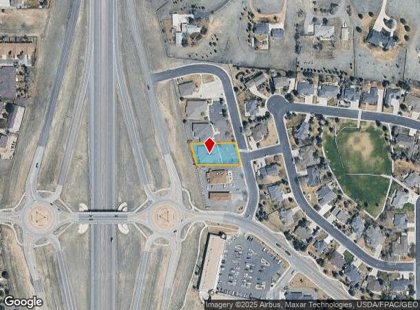
7338 Stockman St, Cheyenne, WY 82009


NEARBY LISTINGS FOR SALE OR LEASE
Property Detail
7338 Stockman St
Cheyenne, WY
Bar X Ranch, The, 3Rd Filing
1-1444-0005-0004-0
BAR X RANCH, THE, 3RD FILING: LOT 4, BLOCK 5
Commercialnec
Laramie
X
Wyoming
56021C1087F
4
2024
0.41 AC
2025
I-80 Corridor/Cheyenne
001200
Other Market Areas
5,516 SF
DEMOGRAPHICS near 7338 Stockman St
1 Mile
3 Mile
5 Mile
2024 Total Population
6,242
23,138
59,380
2029 Population
6,327
23,501
60,467
Pop Growth 2024-2029
+ 1.36%
+ 1.57%
+ 1.83%
Average Age
45
42
41
2024 Total Households
2,504
9,844
25,659
HH Growth 2024-2029
+ 1.44%
+ 1.63%
+ 1.95%
Median Household Inc
$92,050
$77,817
$63,053
Avg Household Size
2.40
2.30
2.20
2024 Avg HH Vehicles
2.00
2.00
2.00
Median Home Value
$362,725
$359,411
$294,127
Median Year Built
1978
1977
1974
Nearby Places
Map Layers
Map Styles
 Street
 Aerial
- Restaurants
- Banks
- Shops
- Fitness
- Groceries
SALE & LEASE HISTORY
LISTING DATE
SALE/LEASE

Nov 15, 2022
For Lease
Nearby Properties
Address
Land Use
TOTAL SIZE
Lot Size
Zoning
Address
Land Use
TOTAL SIZE
Lot Size
Zoning
172,393 SF
12.16 AC
Address
Land Use
TOTAL SIZE
Lot Size
Zoning
Address
Land Use
TOTAL SIZE
Lot Size
Zoning
219,227 SF
21.97 AC
CB
Address
Land Use
TOTAL SIZE
Lot Size
Zoning
118,588 SF
3.20 AC
CB
Address
Land Use
TOTAL SIZE
Lot Size
Zoning
323,835 SF
Address
Land Use
TOTAL SIZE
Lot Size
Zoning
204,822 SF
6.88 AC
HR1
Address
Land Use
TOTAL SIZE
Lot Size
Zoning
76,524 SF
6 AC
Address
Land Use
TOTAL SIZE
Lot Size
Zoning
132,839 SF
6.38 AC
Address
Land Use
TOTAL SIZE
Lot Size
Zoning
85,314 SF
5.50 AC
P
Address
Land Use
TOTAL SIZE
Lot Size
Zoning
142,588 SF
3.54 AC
PUD
Address
Land Use
TOTAL SIZE
Lot Size
Zoning
79,186 SF
3.09 AC
Address
Land Use
TOTAL SIZE
Lot Size
Zoning
67,628 SF
2.23 AC
Address
Land Use
TOTAL SIZE
Lot Size
Zoning
148,152 SF
15.54 AC
CB
Address
Land Use
TOTAL SIZE
Lot Size
Zoning
70,251 SF
0.77 AC
Address
Land Use
TOTAL SIZE
Lot Size
Zoning
137,640 SF
14.43 AC
CB
Address
Land Use
TOTAL SIZE
Lot Size
Zoning
83,059 SF
8.88 AC
CB
Address
Land Use
TOTAL SIZE
Lot Size
Zoning
323,835 SF
Address
Land Use
TOTAL SIZE
Lot Size
Zoning
66,099 SF
4.46 AC
PUD
Address
Land Use
TOTAL SIZE
Lot Size
Zoning
25,369 SF
1.64 AC
PUD
Address
Land Use
TOTAL SIZE
Lot Size
Zoning
100,926 SF
8.46 AC
PUD
Address
Land Use
TOTAL SIZE
Lot Size
Zoning
70,112 SF
5.74 AC
PUD
Address
Land Use
TOTAL SIZE
Lot Size
Zoning
230,988 SF
11.99 AC
CB
Address
Land Use
TOTAL SIZE
Lot Size
Zoning
44,552 SF
2.89 AC
AD
Address
Land Use
TOTAL SIZE
Lot Size
Zoning
42,570 SF
1.50 AC
Address
Land Use
TOTAL SIZE
Lot Size
Zoning
44,917 SF
5.12 AC
CB
Address
Land Use
TOTAL SIZE
Lot Size
Zoning
105,992 SF
6.99 AC
CB
Address
Land Use
TOTAL SIZE
Lot Size
Zoning
39,309 SF
4.40 AC
MR2
Address
Land Use
TOTAL SIZE
Lot Size
Zoning
68,633 SF
5.87 AC
CB
Address
Land Use
TOTAL SIZE
Lot Size
Zoning
22,330 SF
3.86 AC
CB
Address
Land Use
TOTAL SIZE
Lot Size
Zoning
17,086 SF
1.40 AC
NB
The World's #1 Commercial Real Estate Marketplace
Connect with us
© 2026 CoStar Group
The information above has been obtained from sources believed reliable. While we do not doubt its accuracy we have not verified it and make no guarantee, warranty or representation about it. It is your responsibility to independently confirm its accuracy and completeness. Any projections, opinions, assumptions, or estimates used are for example only and do not represent the current or future performance of the property. The value of this transaction to you depends on tax and other factors which should be evaluated by your tax, financial, and legal advisors. You and your advisors should conduct a careful, independent investigation of the property to determine to your satisfaction the suitability of the property for your needs.