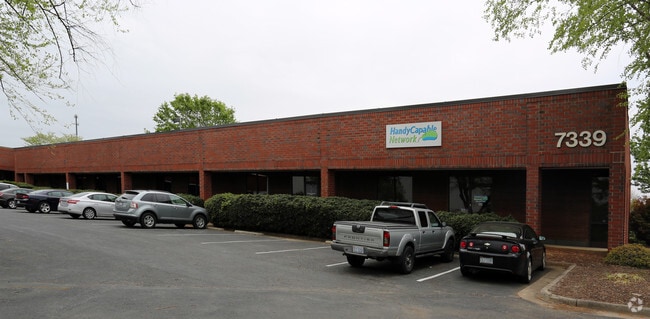
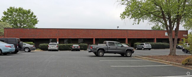
Property Record
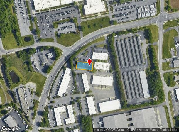
7339 W Friendly Ave, Greensboro, NC 27410
NEARBY LISTINGS FOR SALE OR LEASE
Property Detail
7339 W Friendly Ave
Greensboro-High Point, NC
Stoneleigh Bus Park Sub
0099484
801-808 PB 79-147 STONELEIGH PL:79-147
Industrialgeneral
Guilford
X
North Carolina
3710782500J
801-8
2024
0.31 AC
2025
Airport/W Guilford County
016011
Greensboro/Winston-Salem
11,760 SF
DEMOGRAPHICS near 7339 W Friendly Ave
1 Mile
3 Mile
5 Mile
2024 Total Population
2,236
31,723
119,980
2029 Population
2,279
31,682
119,681
Pop Growth 2024-2029
+ 1.92%
(0.13%)
(0.25%)
Average Age
35
40
40
2024 Total Households
1,181
15,912
52,197
HH Growth 2024-2029
+ 1.95%
(0.13%)
(0.26%)
Median Household Inc
$37,338
$53,269
$71,116
Avg Household Size
1.90
1.90
2.20
2024 Avg HH Vehicles
1.00
1.00
2.00
Median Home Value
$123,636
$182,785
$246,810
Median Year Built
1996
1988
1991
Nearby Places
Map Layers
Map Styles
 Street
 Aerial
- Restaurants
- Banks
- Shops
- Fitness
- Groceries
PUBLIC TRANSPORTATION
AIRPORT
Piedmont Triad International
DRIVE
WALK
Distance
Piedmont Triad International
13 min
6.6 mi
SALE & LEASE HISTORY
LISTING DATE
SALE/LEASE

Mar 15, 2017
For Lease
Jan 23, 2020
For Lease
Nearby Properties
Address
Land Use
TOTAL SIZE
Lot Size
Zoning
Address
Land Use
TOTAL SIZE
Lot Size
Zoning
747,867 SF
349.10 AC
PI
Address
Land Use
TOTAL SIZE
Lot Size
Zoning
404,766 SF
153.35 AC
AR
Address
Land Use
TOTAL SIZE
Lot Size
Zoning
37,237 SF
334.45 AC
HI
Address
Land Use
TOTAL SIZE
Lot Size
Zoning
543,043 SF
62.40 AC
BP
Address
Land Use
TOTAL SIZE
Lot Size
Zoning
905,735 SF
39.66 AC
AR
Address
Land Use
TOTAL SIZE
Lot Size
Zoning
501,140 SF
50.04 AC
PI
Address
Land Use
TOTAL SIZE
Lot Size
Zoning
410,298 SF
33.10 AC
RM-12
Address
Land Use
TOTAL SIZE
Lot Size
Zoning
691,408 SF
58.69 AC
LI
Address
Land Use
TOTAL SIZE
Lot Size
Zoning
186,200 SF
10.58 AC
LI
Address
Land Use
TOTAL SIZE
Lot Size
Zoning
552,314 SF
38.47 AC
PDR
Address
Land Use
TOTAL SIZE
Lot Size
Zoning
230,664 SF
13.69 AC
HI
Address
Land Use
TOTAL SIZE
Lot Size
Zoning
324,931 SF
16.32 AC
PUD
Address
Land Use
TOTAL SIZE
Lot Size
Zoning
374,522 SF
56.55 AC
HI
Address
Land Use
TOTAL SIZE
Lot Size
Zoning
367,819 SF
32.88 AC
C-H
Address
Land Use
TOTAL SIZE
Lot Size
Zoning
509,216 SF
40.85 AC
LI
Address
Land Use
TOTAL SIZE
Lot Size
Zoning
217,594 SF
20.01 AC
RM-18
Address
Land Use
TOTAL SIZE
Lot Size
Zoning
245,192 SF
15.27 AC
RM-12
Address
Land Use
TOTAL SIZE
Lot Size
Zoning
400,000 SF
46.72 AC
LI
Address
Land Use
TOTAL SIZE
Lot Size
Zoning
358,900 SF
60.50 AC
PI
Address
Land Use
TOTAL SIZE
Lot Size
Zoning
488,513 SF
37.16 AC
RM-18
Address
Land Use
TOTAL SIZE
Lot Size
Zoning
229,103 SF
18.76 AC
CZ-I
Address
Land Use
TOTAL SIZE
Lot Size
Zoning
156,800 SF
30.81 AC
R-3
Address
Land Use
TOTAL SIZE
Lot Size
Zoning
683,263 SF
52.92 AC
HI
Address
Land Use
TOTAL SIZE
Lot Size
Zoning
316,205 SF
17.84 AC
CU-RM-18
Address
Land Use
TOTAL SIZE
Lot Size
Zoning
145,105 SF
20.12 AC
C-M
Address
Land Use
TOTAL SIZE
Lot Size
Zoning
341,118 SF
36.48 AC
LI
Address
Land Use
TOTAL SIZE
Lot Size
Zoning
309,749 SF
16.74 AC
CZ-PDM
Address
Land Use
TOTAL SIZE
Lot Size
Zoning
362,708 SF
56.81 AC
LI
Address
Land Use
TOTAL SIZE
Lot Size
Zoning
325.42 AC
HI
Address
Land Use
TOTAL SIZE
Lot Size
Zoning
180,568 SF
0.01 AC
AR
The World's #1 Commercial Real Estate Marketplace
Connect with us
© 2025 CoStar Group
The information above has been obtained from sources believed reliable. While we do not doubt its accuracy we have not verified it and make no guarantee, warranty or representation about it. It is your responsibility to independently confirm its accuracy and completeness. Any projections, opinions, assumptions, or estimates used are for example only and do not represent the current or future performance of the property. The value of this transaction to you depends on tax and other factors which should be evaluated by your tax, financial, and legal advisors. You and your advisors should conduct a careful, independent investigation of the property to determine to your satisfaction the suitability of the property for your needs.