Property Record
1 Pine Ridge Dr, West Columbia, SC 29172

NEARBY LISTINGS FOR SALE OR LEASE
Property Detail
1 Pine Ridge Dr
007833-01-003
TRACT 1 10X300
Commercialacreage
Lexington
X
South Carolina
45063C0286J
0.06 AC
2025
Cayce/West Columbia
2024
Columbia
020707
Columbia, SC
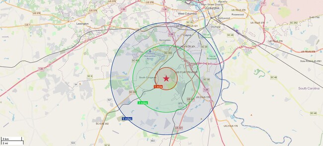
DEMOGRAPHICS near 1 Pine Ridge Dr
1 Mile
3 Mile
5 Mile
2024 Total Population
1,663
13,855
49,153
2029 Population
1,811
15,201
53,755
Pop Growth 2024-2029
+ 8.90%
+ 9.71%
+ 9.36%
Average Age
42
40
40
2024 Total Households
703
5,588
20,013
HH Growth 2024-2029
+ 9.10%
+ 9.81%
+ 9.49%
Median Household Inc
$58,366
$53,489
$56,946
Avg Household Size
2.40
2.40
2.40
2024 Avg HH Vehicles
2.00
2.00
2.00
Median Home Value
$174,186
$150,701
$146,232
Median Year Built
1979
1983
1983
Nearby Places
Map Layers
Map Styles
 Street
 Aerial
- Restaurants
- Banks
- Shops
- Fitness
- Groceries
PUBLIC TRANSPORTATION
COMMUTER RAIL
Columbia Amtrak Station (Silver Star - Amtrak)
DRIVE
WALK
Distance
Columbia Amtrak Station (Silver Star - Amtrak)
18 min
9.2 mi
AIRPORT
Columbia Metro
DRIVE
WALK
Distance
Columbia Metro
16 min
4.1 mi
Freight Ports
North Charleston Terminal
DRIVE
WALK
Distance
North Charleston Terminal
116 min
100.7 mi
SALE & LEASE HISTORY
LISTING DATE
SALE/LEASE

Sep 27, 2023
For Sale
May 08, 2017
For Sale
Nearby Properties
Address
Land Use
TOTAL SIZE
Lot Size
Zoning
Address
Land Use
TOTAL SIZE
Lot Size
Zoning
3,614 SF
1,444.32 AC
ID
Address
Land Use
TOTAL SIZE
Lot Size
Zoning
466,400 SF
52.42 AC
ID
Address
Land Use
TOTAL SIZE
Lot Size
Zoning
297,500 SF
20.26 AC
ID
Address
Land Use
TOTAL SIZE
Lot Size
Zoning
180,000 SF
27.57 AC
ID
Address
Land Use
TOTAL SIZE
Lot Size
Zoning
181,440 SF
10.69 AC
ID
Address
Land Use
TOTAL SIZE
Lot Size
Zoning
9,800 SF
13.52 AC
ID
Address
Land Use
TOTAL SIZE
Lot Size
Zoning
5,502 SF
16.15 AC
ID
Address
Land Use
TOTAL SIZE
Lot Size
Zoning
200,000 SF
10.58 AC
ID
Address
Land Use
TOTAL SIZE
Lot Size
Zoning
200,000 SF
9.66 AC
ID
Address
Land Use
TOTAL SIZE
Lot Size
Zoning
180,000 SF
12.48 AC
ID
Address
Land Use
TOTAL SIZE
Lot Size
Zoning
279,568 SF
11.38 AC
ID
Address
Land Use
TOTAL SIZE
Lot Size
Zoning
254,399 SF
49.79 AC
ID
Address
Land Use
TOTAL SIZE
Lot Size
Zoning
202,029 SF
21.13 AC
ID
Address
Land Use
TOTAL SIZE
Lot Size
Zoning
215,770 SF
24.51 AC
Address
Land Use
TOTAL SIZE
Lot Size
Zoning
50,400 SF
11 AC
ID
Address
Land Use
TOTAL SIZE
Lot Size
Zoning
50,000 SF
6.89 AC
ID
Address
Land Use
TOTAL SIZE
Lot Size
Zoning
67,824 SF
17.27 AC
ID
Address
Land Use
TOTAL SIZE
Lot Size
Zoning
28,210 SF
9.54 AC
Address
Land Use
TOTAL SIZE
Lot Size
Zoning
29,167 SF
3.15 AC
ID
Address
Land Use
TOTAL SIZE
Lot Size
Zoning
40,360 SF
4 AC
ID
Address
Land Use
TOTAL SIZE
Lot Size
Zoning
8,030 SF
1.66 AC
C1
Address
Land Use
TOTAL SIZE
Lot Size
Zoning
57,730 SF
19.74 AC
ID
Address
Land Use
TOTAL SIZE
Lot Size
Zoning
630.08 AC
RD
Address
Land Use
TOTAL SIZE
Lot Size
Zoning
47,126 SF
4.53 AC
Address
Land Use
TOTAL SIZE
Lot Size
Zoning
3,864 SF
20.22 AC
ID
Address
Land Use
TOTAL SIZE
Lot Size
Zoning
181,060 SF
10.61 AC
ID
Address
Land Use
TOTAL SIZE
Lot Size
Zoning
45,822 SF
9.88 AC
ID
Address
Land Use
TOTAL SIZE
Lot Size
Zoning
239,046 SF
25.25 AC
ID
Address
Land Use
TOTAL SIZE
Lot Size
Zoning
23,810 SF
3.95 AC
Address
Land Use
TOTAL SIZE
Lot Size
Zoning
79,800 SF
7.91 AC
M1
The World's #1 Commercial Real Estate Marketplace
Connect with us
© 2025 CoStar Group
The information above has been obtained from sources believed reliable. While we do not doubt its accuracy we have not verified it and make no guarantee, warranty or representation about it. It is your responsibility to independently confirm its accuracy and completeness. Any projections, opinions, assumptions, or estimates used are for example only and do not represent the current or future performance of the property. The value of this transaction to you depends on tax and other factors which should be evaluated by your tax, financial, and legal advisors. You and your advisors should conduct a careful, independent investigation of the property to determine to your satisfaction the suitability of the property for your needs.