Property Record
7343 E Adobe Dr, Scottsdale, AZ 85255
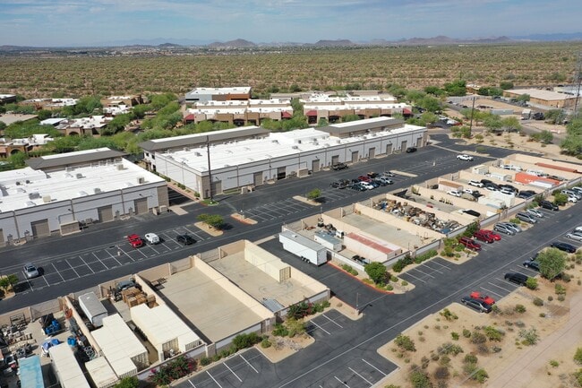

Property Detail
7343 E Adobe Dr
212-03-505
SCOTTSDALE RIDGE BUSINESS CENTER 2 CONDOMINIUMS MCR 929-14
Warehouse
Maricopa
C-G
Arizona
C and X Area of minimal flood hazard, usually depicted on FIRMs as above the 500-year flood level.
145
2025
0.13 AC
2025
Scottsdale/Salt River
216841
Phoenix
39,822 SF
Phoenix-Mesa-Chandler, AZ
NEARBY LISTINGS FOR SALE OR LEASE
-
-
View all Scottsdale listings for lease on LoopNet.com
DEMOGRAPHICS near 7343 E Adobe Dr
1 mile
3 mile
5 mile
2025 Total Population
6,022
41,123
130,391
2030 Population
6,322
44,108
137,913
Pop Growth 2025-2030
+ 4.98%
+ 7.26%
+ 5.77%
Average Age
46
45
44
2025 Total Households
2,444
19,581
56,746
HH Growth 2025-2030
+ 5.11%
+ 7.72%
+ 6.27%
Median Household Inc
$133,725
$117,538
$125,131
Avg Household Size
2.40
2.00
2.20
2025 Avg HH Vehicles
2.00
2.00
2.00
Median Home Value
$846,502
$889,907
$833,736
Median Year Built
1999
2003
1998
Nearby Places
Map Layers
Map Styles
 Street
 Aerial
Layers
 Traffic
 Biking
Places
Listings with unknown addresses are not visible on the map
- Restaurants
- Banks
- Shops
- Fitness
- Groceries
SALE & LEASE HISTORY
LISTING DATE
SALE/LEASE

Sep 21, 2022
For Sale
Sep 07, 2025
For Lease
Oct 30, 2023
For Sale
Nov 17, 2023
For Sale
May 28, 2024
For Sale
Jun 13, 2022
For Sale
Jul 02, 2021
For Lease
Jan 31, 2021
For Lease
Jan 21, 2020
For Sale
Feb 02, 2021
For Lease
Nearby Properties
Address
Land Use
TOTAL SIZE
Lot Size
Zoning
Address
Land Use
TOTAL SIZE
Lot Size
Zoning
1,504,047 SF
40.43 AC
I-P
Address
Land Use
TOTAL SIZE
Lot Size
Zoning
20.98 AC
Address
Land Use
TOTAL SIZE
Lot Size
Zoning
13.01 AC
Address
Land Use
TOTAL SIZE
Lot Size
Zoning
35.76 AC
R1-18
Address
Land Use
TOTAL SIZE
Lot Size
Zoning
14.58 AC
Address
Land Use
TOTAL SIZE
Lot Size
Zoning
1,479,005 SF
12.55 AC
PC
Address
Land Use
TOTAL SIZE
Lot Size
Zoning
1,162,283 SF
115.23 AC
C-C
Address
Land Use
TOTAL SIZE
Lot Size
Zoning
Address
Land Use
TOTAL SIZE
Lot Size
Zoning
Address
Land Use
TOTAL SIZE
Lot Size
Zoning
694,644 SF
34.41 AC
C-C
Address
Land Use
TOTAL SIZE
Lot Size
Zoning
670,926 SF
20.92 AC
I-P
Address
Land Use
TOTAL SIZE
Lot Size
Zoning
229,856 SF
7.71 AC
C-T
Address
Land Use
TOTAL SIZE
Lot Size
Zoning
368,657 SF
40.11 AC
Address
Land Use
TOTAL SIZE
Lot Size
Zoning
734,840 SF
33.12 AC
M-H
Address
Land Use
TOTAL SIZE
Lot Size
Zoning
487,786 SF
18.42 AC
S1
Address
Land Use
TOTAL SIZE
Lot Size
Zoning
884,258 SF
30.63 AC
PCD
Address
Land Use
TOTAL SIZE
Lot Size
Zoning
90.73 AC
O-S
Address
Land Use
TOTAL SIZE
Lot Size
Zoning
539,135 SF
15.11 AC
R3A
Address
Land Use
TOTAL SIZE
Lot Size
Zoning
530,588 SF
20.58 AC
C-C
Address
Land Use
TOTAL SIZE
Lot Size
Zoning
495,877 SF
21.08 AC
C-C
Address
Land Use
TOTAL SIZE
Lot Size
Zoning
525,073 SF
8.51 AC
R4
Address
Land Use
TOTAL SIZE
Lot Size
Zoning
255,313 SF
22.54 AC
PNC
Address
Land Use
TOTAL SIZE
Lot Size
Zoning
385,376 SF
13.65 AC
PAD
Address
Land Use
TOTAL SIZE
Lot Size
Zoning
702,652 SF
4.58 AC
Address
Land Use
TOTAL SIZE
Lot Size
Zoning
375,257 SF
12 AC
M-H
Address
Land Use
TOTAL SIZE
Lot Size
Zoning
41.63 AC
I-1
Address
Land Use
TOTAL SIZE
Lot Size
Zoning
498,417 SF
5.12 AC
PRC
Address
Land Use
TOTAL SIZE
Lot Size
Zoning
240,187 SF
14.26 AC
S1
Address
Land Use
TOTAL SIZE
Lot Size
Zoning
731,843 SF
29.85 AC
M-H
Address
Land Use
TOTAL SIZE
Lot Size
Zoning
328,616 SF
10.56 AC
PAD
The World's #1 Commercial Real Estate Marketplace
Connect with us
© 2026 CoStar Group
The information above has been obtained from sources believed reliable. While we do not doubt its accuracy we have not verified it and make no guarantee, warranty or representation about it. It is your responsibility to independently confirm its accuracy and completeness. Any projections, opinions, assumptions, or estimates used are for example only and do not represent the current or future performance of the property. The value of this transaction to you depends on tax and other factors which should be evaluated by your tax, financial, and legal advisors. You and your advisors should conduct a careful, independent investigation of the property to determine to your satisfaction the suitability of the property for your needs.