Property Record
735 Air Park Rd, Edgewater, FL 32132
Save to a Folder
{{folder.Name}}
{{folder.ListingIds.length}} Properties
{{folder.ListingIds.length}} Property
Create a New Folder
Property Detail
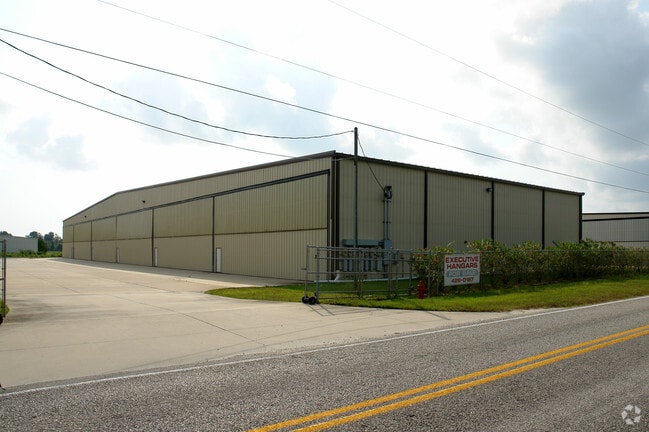
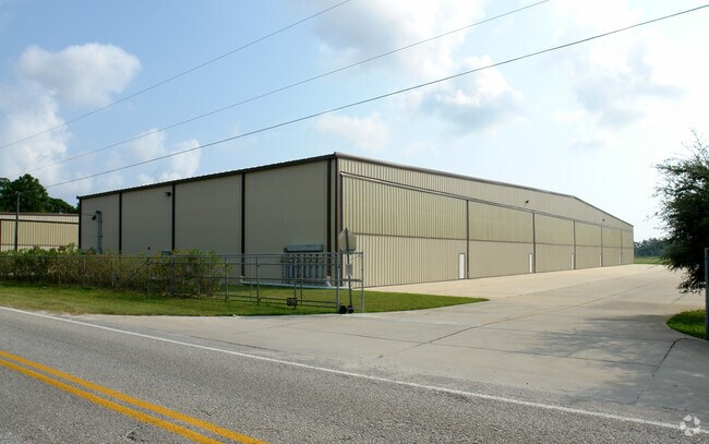
735 Air Park Rd
8438-07-01-0010
UNIT 2 BLDG A AIR PARK CONDO PHASE II PER OR 4830 PGS 2943-2958 INC PER OR 7789 PG 3951
Aircraft
VOLUSIA
B and X Area of moderate flood hazard, usually the area between the limits of the 100-year and 500-year floods.
Florida
2025
0.09 AC
2026
South Beach Cities
083009
Deltona/Daytona Beach
3,960 SF
Deltona-Daytona Beach-Ormond Beach, FL
NEARBY LISTINGS FOR SALE OR LEASE
-
-
View all Edgewater listings for lease on LoopNet.com
DEMOGRAPHICS near 735 Air Park Rd
1 mile
3 mile
5 mile
2025 Total Population
2,403
27,627
61,356
2030 Population
2,586
29,567
67,249
Pop Growth 2025-2030
+ 7.62%
+ 7.02%
+ 9.60%
Average Age
46
46
50
2025 Total Households
1,016
11,776
28,384
HH Growth 2025-2030
+ 7.48%
+ 7.01%
+ 9.90%
Median Household Inc
$51,071
$57,704
$67,969
Avg Household Size
2.30
2.20
2.10
2025 Avg HH Vehicles
2.00
2.00
2.00
Median Home Value
$282,133
$308,475
$366,450
Median Year Built
1985
1985
1986
Nearby Places
Map Layers
Map Styles
 Street
 Aerial
Layers
 Traffic
 Biking
Places
Listings with unknown addresses are not visible on the map
- Restaurants
- Banks
- Shops
- Fitness
- Groceries
PUBLIC TRANSPORTATION
AIRPORT
Daytona Beach International
Drive
Walk
Distance
Daytona Beach International
33 min
22.6 mi
Orlando Sanford International
Drive
Walk
Distance
Orlando Sanford International
54 min
36.4 mi
Freight Ports
Port Canaveral
Drive
Walk
Distance
Port Canaveral
68 min
55.3 mi
SALE & LEASE HISTORY
LISTING DATE
SALE/LEASE

Sep 25, 2016
For Lease
Nearby Properties
Address
Land Use
TOTAL SIZE
Lot Size
Zoning
Address
Land Use
TOTAL SIZE
Lot Size
Zoning
360,394 SF
65.63 AC
01R4
Address
Land Use
TOTAL SIZE
Lot Size
Zoning
177,619 SF
6.91 AC
10R2
Address
Land Use
TOTAL SIZE
Lot Size
Zoning
209,027 SF
29.13 AC
10R2A
Address
Land Use
TOTAL SIZE
Lot Size
Zoning
150,044 SF
19.80 AC
R4
Address
Land Use
TOTAL SIZE
Lot Size
Zoning
91,509 SF
4.06 AC
I1
Address
Land Use
TOTAL SIZE
Lot Size
Zoning
91,759 SF
10.15 AC
10B2
Address
Land Use
TOTAL SIZE
Lot Size
Zoning
5,249 SF
0.42 AC
01MH5
Address
Land Use
TOTAL SIZE
Lot Size
Zoning
94,251 SF
18.51 AC
Address
Land Use
TOTAL SIZE
Lot Size
Zoning
111,686 SF
10.03 AC
10B5
Address
Land Use
TOTAL SIZE
Lot Size
Zoning
55,587 SF
85.39 AC
R4
Address
Land Use
TOTAL SIZE
Lot Size
Zoning
119,537 SF
12.06 AC
PUD
Address
Land Use
TOTAL SIZE
Lot Size
Zoning
229,941 SF
0.57 AC
10R2A
Address
Land Use
TOTAL SIZE
Lot Size
Zoning
2,628 SF
3.04 AC
Address
Land Use
TOTAL SIZE
Lot Size
Zoning
64,123 SF
6.94 AC
07B5
Address
Land Use
TOTAL SIZE
Lot Size
Zoning
98,105 SF
8.03 AC
07B3
Address
Land Use
TOTAL SIZE
Lot Size
Zoning
108,762 SF
11.60 AC
RA
Address
Land Use
TOTAL SIZE
Lot Size
Zoning
70,088 SF
0.30 AC
10R5
Address
Land Use
TOTAL SIZE
Lot Size
Zoning
73,711 SF
7.06 AC
R2
Address
Land Use
TOTAL SIZE
Lot Size
Zoning
89,757 SF
12.19 AC
07B5
Address
Land Use
TOTAL SIZE
Lot Size
Zoning
91.24 AC
RC
Address
Land Use
TOTAL SIZE
Lot Size
Zoning
79,518 SF
8.69 AC
B3
Address
Land Use
TOTAL SIZE
Lot Size
Zoning
56,841 SF
8.81 AC
B4C
Address
Land Use
TOTAL SIZE
Lot Size
Zoning
71,824 SF
2.01 AC
10R5
Address
Land Use
TOTAL SIZE
Lot Size
Zoning
99,241 SF
8.11 AC
B4
Address
Land Use
TOTAL SIZE
Lot Size
Zoning
31,765 SF
27.25 AC
Address
Land Use
TOTAL SIZE
Lot Size
Zoning
86,492 SF
6.15 AC
07I2
Address
Land Use
TOTAL SIZE
Lot Size
Zoning
60,370 SF
6.20 AC
10B4
Address
Land Use
TOTAL SIZE
Lot Size
Zoning
3,231 SF
18 AC
MH1
Address
Land Use
TOTAL SIZE
Lot Size
Zoning
26,869 SF
3.85 AC
B3
Address
Land Use
TOTAL SIZE
Lot Size
Zoning
41,356 SF
2.91 AC
01B5
The World's #1 Commercial Real Estate Marketplace
Connect with us
© 2026 CoStar Group
The information above has been obtained from sources believed reliable. While we do not doubt its accuracy we have not verified it and make no guarantee, warranty or representation about it. It is your responsibility to independently confirm its accuracy and completeness. Any projections, opinions, assumptions, or estimates used are for example only and do not represent the current or future performance of the property. The value of this transaction to you depends on tax and other factors which should be evaluated by your tax, financial, and legal advisors. You and your advisors should conduct a careful, independent investigation of the property to determine to your satisfaction the suitability of the property for your needs.