Property Record
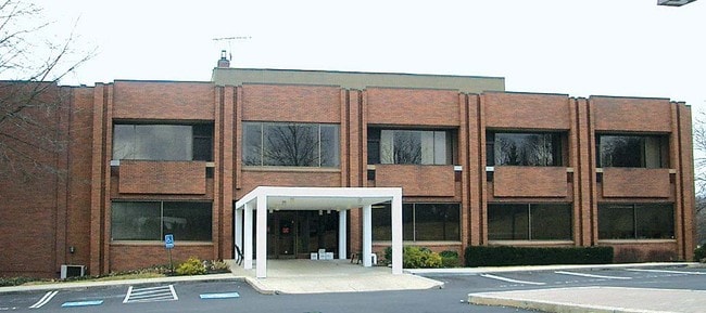
735 Davisville Rd, Southampton, PA 18966


NEARBY LISTINGS FOR SALE OR LEASE
Property Detail
735 Davisville Rd
48-003-055
6.4406A LOT S S T363 320 FT W ELSIE DR
Officebuilding
Bucks
X
Pennsylvania
42091C0316G
s
2024
6.44 AC
2025
Lower Bucks County
101506
Philadelphia
34,365 SF
Philadelphia-Camden-Wilmington, PA-NJ-DE-MD
DEMOGRAPHICS near 735 Davisville Rd
1 Mile
3 Mile
5 Mile
2024 Total Population
12,183
72,898
196,445
2029 Population
12,369
73,751
197,177
Pop Growth 2024-2029
+ 1.53%
+ 1.17%
+ 0.37%
Average Age
46
44
43
2024 Total Households
4,990
28,610
75,348
HH Growth 2024-2029
+ 1.86%
+ 1.33%
+ 0.44%
Median Household Inc
$79,460
$93,241
$94,611
Avg Household Size
2.40
2.50
2.50
2024 Avg HH Vehicles
2.00
2.00
2.00
Median Home Value
$352,241
$371,655
$367,356
Median Year Built
1969
1969
1969
Nearby Places
Map Layers
Map Styles
 Street
 Aerial
- Restaurants
- Banks
- Shops
- Fitness
- Groceries
PUBLIC TRANSPORTATION
COMMUTER RAIL
Warminster (R2 - Southeastern Pennsylvania Transportation Authority Regional Rail (SEPTA Regional Rail))
DRIVE
WALK
Distance
Warminster (R2 - Southeastern Pennsylvania Transportation Authority Regional Rail (SEPTA Regional Rail))
5 min
2.2 mi
Hatboro (R2 - Southeastern Pennsylvania Transportation Authority Regional Rail (SEPTA Regional Rail))
DRIVE
WALK
Distance
Hatboro (R2 - Southeastern Pennsylvania Transportation Authority Regional Rail (SEPTA Regional Rail))
7 min
3.5 mi
AIRPORT
Trenton Mercer
DRIVE
WALK
Distance
Trenton Mercer
32 min
18.5 mi
Philadelphia International
DRIVE
WALK
Distance
Philadelphia International
52 min
30.7 mi
Lehigh Valley International
DRIVE
WALK
Distance
Lehigh Valley International
74 min
44.4 mi
Freight Ports
Port of Philadelphia
DRIVE
WALK
Distance
Port of Philadelphia
30 min
16.5 mi
Nearby Properties
Address
Land Use
TOTAL SIZE
Lot Size
Zoning
Address
Land Use
TOTAL SIZE
Lot Size
Zoning
377,044 SF
58.73 AC
INST
Address
Land Use
TOTAL SIZE
Lot Size
Zoning
251,655 SF
48.95 AC
SC
Address
Land Use
TOTAL SIZE
Lot Size
Zoning
256,679 SF
14 AC
MI
Address
Land Use
TOTAL SIZE
Lot Size
Zoning
420,736 SF
29.47 AC
LI
Address
Land Use
TOTAL SIZE
Lot Size
Zoning
110,198 SF
12.18 AC
R2
Address
Land Use
TOTAL SIZE
Lot Size
Zoning
273,531 SF
11.11 AC
INST
Address
Land Use
TOTAL SIZE
Lot Size
Zoning
91,814 SF
38.63 AC
RC
Address
Land Use
TOTAL SIZE
Lot Size
Zoning
240,682 SF
4.81 AC
HI
Address
Land Use
TOTAL SIZE
Lot Size
Zoning
220,338 SF
16.76 AC
M
Address
Land Use
TOTAL SIZE
Lot Size
Zoning
60,945 SF
74.12 AC
Address
Land Use
TOTAL SIZE
Lot Size
Zoning
318,625 SF
19.01 AC
I
Address
Land Use
TOTAL SIZE
Lot Size
Zoning
125,387 SF
4.10 AC
RC2
Address
Land Use
TOTAL SIZE
Lot Size
Zoning
84,000 SF
14.17 AC
LI
Address
Land Use
TOTAL SIZE
Lot Size
Zoning
162,363 SF
2.72 AC
HI
Address
Land Use
TOTAL SIZE
Lot Size
Zoning
91,446 SF
2.53 AC
R7
Address
Land Use
TOTAL SIZE
Lot Size
Zoning
257,048 SF
36.13 AC
C
Address
Land Use
TOTAL SIZE
Lot Size
Zoning
69,680 SF
19 AC
LI
Address
Land Use
TOTAL SIZE
Lot Size
Zoning
64,000 SF
11.94 AC
LI
Address
Land Use
TOTAL SIZE
Lot Size
Zoning
74,764 SF
10.17 AC
SC
Address
Land Use
TOTAL SIZE
Lot Size
Zoning
29,308 SF
15.96 AC
I
Address
Land Use
TOTAL SIZE
Lot Size
Zoning
56,595 SF
3.89 AC
Address
Land Use
TOTAL SIZE
Lot Size
Zoning
44,144 SF
7.30 AC
L
Address
Land Use
TOTAL SIZE
Lot Size
Zoning
87,120 SF
1.51 AC
RC2
Address
Land Use
TOTAL SIZE
Lot Size
Zoning
85,060 SF
8.63 AC
I
Address
Land Use
TOTAL SIZE
Lot Size
Zoning
14,130 SF
83.31 AC
INST
Address
Land Use
TOTAL SIZE
Lot Size
Zoning
56,668 SF
3.68 AC
R4
Address
Land Use
TOTAL SIZE
Lot Size
Zoning
22,386 SF
15.52 AC
INST
Address
Land Use
TOTAL SIZE
Lot Size
Zoning
25,572 SF
3.42 AC
R2
Address
Land Use
TOTAL SIZE
Lot Size
Zoning
89,071 SF
8.13 AC
I
Address
Land Use
TOTAL SIZE
Lot Size
Zoning
30,921 SF
2.15 AC
L
The World's #1 Commercial Real Estate Marketplace
Connect with us
© 2026 CoStar Group
The information above has been obtained from sources believed reliable. While we do not doubt its accuracy we have not verified it and make no guarantee, warranty or representation about it. It is your responsibility to independently confirm its accuracy and completeness. Any projections, opinions, assumptions, or estimates used are for example only and do not represent the current or future performance of the property. The value of this transaction to you depends on tax and other factors which should be evaluated by your tax, financial, and legal advisors. You and your advisors should conduct a careful, independent investigation of the property to determine to your satisfaction the suitability of the property for your needs.