Property Record
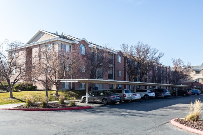
735 E 11000 S, Sandy, UT 84094


Property Detail
735 E 11000 S
28-17-355-011-0000
LOT 1, SILVER SAGE BUSINESS PARK; LESS & EXCEPT BEG N 895923 E 58.38 FT & N 00037 W 40 FT FR SW COR SEC 17, T3S, R1E, SLM; N 540446 W 26.99 FT; N 02922 E 315.27 FT; S 894744 E 4.57 FT; S 02401 E 28.63 FT; S 20629W 84.07 FT; S 04441 W 186.25 FT; S 440
Governmentalpublicusegeneral
Salt Lake
RM
Utah
B and X Area of moderate flood hazard, usually the area between the limits of the 100-year and 500-year floods.
1
2024
5.32 AC
2025
Outer Sandy/Cottonwood Hts
112804
Salt Lake City
43,245 SF
Salt Lake City-Murray, UT
NEARBY LISTINGS FOR SALE OR LEASE
-
-
View all Sandy listings for sale on LoopNet.com
DEMOGRAPHICS near 735 E 11000 S
1 mile
3 mile
5 mile
2025 Total Population
17,966
100,575
252,523
2030 Population
18,338
102,738
258,352
Pop Growth 2025-2030
+ 2.07%
+ 2.15%
+ 2.31%
Average Age
39
38
39
2025 Total Households
5,809
33,672
84,659
HH Growth 2025-2030
+ 2.22%
+ 2.27%
+ 2.51%
Median Household Inc
$111,154
$114,771
$109,854
Avg Household Size
3.00
2.90
2.90
2025 Avg HH Vehicles
2.00
2.00
2.00
Median Home Value
$632,738
$691,855
$694,312
Median Year Built
1988
1992
1992
Nearby Places
Map Layers
Map Styles
 Street
 Aerial
Layers
 Traffic
 Biking
Places
Listings with unknown addresses are not visible on the map
- Restaurants
- Banks
- Shops
- Fitness
- Groceries
PUBLIC TRANSPORTATION
TRANSIT/SUBWAY
Crescent View Station (Blue Line - Utah Transit Authority (UTA))
Drive
Walk
Distance
Crescent View Station (Blue Line - Utah Transit Authority (UTA))
3 min
17 min
0.9 mi
COMMUTER RAIL
South Jordan Station (FrontRunner - Utah Transit Authority (UTA))
Drive
Walk
Distance
South Jordan Station (FrontRunner - Utah Transit Authority (UTA))
6 min
2.6 mi
Draper Station (FrontRunner - Utah Transit Authority (UTA))
Drive
Walk
Distance
Draper Station (FrontRunner - Utah Transit Authority (UTA))
10 min
4.7 mi
AIRPORT
Salt Lake City International
Drive
Walk
Distance
Salt Lake City International
28 min
21.4 mi
Provo Municipal
Drive
Walk
Distance
Provo Municipal
44 min
32.0 mi
Freight Ports
Port of Stockton
Drive
Walk
Distance
Port of Stockton
729 min
711.8 mi
Nearby Properties
Address
Land Use
TOTAL SIZE
Lot Size
Zoning
Address
Land Use
TOTAL SIZE
Lot Size
Zoning
512,301 SF
25.39 AC
SD(H)
Address
Land Use
TOTAL SIZE
Lot Size
Zoning
258,000 SF
13.25 AC
1D
Address
Land Use
TOTAL SIZE
Lot Size
Zoning
552,994 SF
13.64 AC
SD-X
Address
Land Use
TOTAL SIZE
Lot Size
Zoning
774,515 SF
87.50 AC
M-1
Address
Land Use
TOTAL SIZE
Lot Size
Zoning
1,055,572 SF
8.31 AC
CR
Address
Land Use
TOTAL SIZE
Lot Size
Zoning
210,421 SF
6.87 AC
CR
Address
Land Use
TOTAL SIZE
Lot Size
Zoning
566,327 SF
7.02 AC
CBD-O
Address
Land Use
TOTAL SIZE
Lot Size
Zoning
458,458 SF
6.05 AC
MU
Address
Land Use
TOTAL SIZE
Lot Size
Zoning
224,049 SF
5.29 AC
MU
Address
Land Use
TOTAL SIZE
Lot Size
Zoning
372,355 SF
13.80 AC
C-F
Address
Land Use
TOTAL SIZE
Lot Size
Zoning
106,318 SF
4.46 AC
CBD-O
Address
Land Use
TOTAL SIZE
Lot Size
Zoning
398,320 SF
40 AC
1110
Address
Land Use
TOTAL SIZE
Lot Size
Zoning
392,144 SF
30.63 AC
1113
Address
Land Use
TOTAL SIZE
Lot Size
Zoning
124,434 SF
13.64 AC
PUD-15
Address
Land Use
TOTAL SIZE
Lot Size
Zoning
186,651 SF
35.87 AC
C-R
Address
Land Use
TOTAL SIZE
Lot Size
Zoning
280,668 SF
12 AC
CBD
Address
Land Use
TOTAL SIZE
Lot Size
Zoning
81,865 SF
19.46 AC
Z-C-FF
Address
Land Use
TOTAL SIZE
Lot Size
Zoning
277,938 SF
13.90 AC
CSD-DD
Address
Land Use
TOTAL SIZE
Lot Size
Zoning
197,645 SF
19.51 AC
1122
Address
Land Use
TOTAL SIZE
Lot Size
Zoning
34,872 SF
11.59 AC
c-f
Address
Land Use
TOTAL SIZE
Lot Size
Zoning
379,911 SF
5.78 AC
mu
Address
Land Use
TOTAL SIZE
Lot Size
Zoning
192,626 SF
5.72 AC
CF
Address
Land Use
TOTAL SIZE
Lot Size
Zoning
126,531 SF
11.50 AC
1244
Address
Land Use
TOTAL SIZE
Lot Size
Zoning
551,648 SF
31.71 AC
C B D
Address
Land Use
TOTAL SIZE
Lot Size
Zoning
311,202 SF
0.01 AC
4180
Address
Land Use
TOTAL SIZE
Lot Size
Zoning
176,826 SF
6.13 AC
SD(H)
Address
Land Use
TOTAL SIZE
Lot Size
Zoning
101,790 SF
5.69 AC
PUD(16
Address
Land Use
TOTAL SIZE
Lot Size
Zoning
198,479 SF
2.52 AC
MU
Address
Land Use
TOTAL SIZE
Lot Size
Zoning
185,116 SF
14.49 AC
PUD-10
Address
Land Use
TOTAL SIZE
Lot Size
Zoning
200,922 SF
3.82 AC
2000
The World's #1 Commercial Real Estate Marketplace
Connect with us
© 2026 CoStar Group
The information above has been obtained from sources believed reliable. While we do not doubt its accuracy we have not verified it and make no guarantee, warranty or representation about it. It is your responsibility to independently confirm its accuracy and completeness. Any projections, opinions, assumptions, or estimates used are for example only and do not represent the current or future performance of the property. The value of this transaction to you depends on tax and other factors which should be evaluated by your tax, financial, and legal advisors. You and your advisors should conduct a careful, independent investigation of the property to determine to your satisfaction the suitability of the property for your needs.