Property Record
735 E Arrow Hwy, Azusa, CA 91702
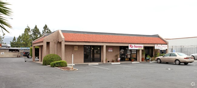

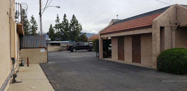

Property Detail
735 E Arrow Hwy
8622-024-020
FOR DESC SEE ASSESSORS MAPS*POR OF S 1/2 OF S 1/2 OF SE 1/4 SEC 2 T1S R10W
Officebuilding
Los Angeles
AZC3*
California
B and X Area of moderate flood hazard, usually the area between the limits of the 100-year and 500-year floods.
s2
2024
0.46 AC
2025
Eastern SGV
404100
Los Angeles
3,412 SF
Los Angeles-Long Beach-Glendale, CA
NEARBY LISTINGS FOR SALE OR LEASE
DEMOGRAPHICS near 735 E Arrow Hwy
1 mile
3 mile
5 mile
2025 Total Population
30,274
191,237
363,569
2030 Population
29,760
189,414
359,345
Pop Growth 2025-2030
(1.70%)
(0.95%)
(1.16%)
Average Age
39
40
41
2025 Total Households
8,652
58,684
110,588
HH Growth 2025-2030
(1.91%)
(1.16%)
(1.36%)
Median Household Inc
$91,122
$93,906
$97,499
Avg Household Size
3.40
3.10
3.20
2025 Avg HH Vehicles
2.00
2.00
2.00
Median Home Value
$704,545
$725,089
$750,078
Median Year Built
1958
1961
1963
Nearby Places
Map Layers
Map Styles
 Street
 Aerial
Layers
 Traffic
 Biking
Places
Listings with unknown addresses are not visible on the map
- Restaurants
- Banks
- Shops
- Fitness
- Groceries
PUBLIC TRANSPORTATION
COMMUTER RAIL
Covina (San Bernardino Line - Southern California Regional Rail Authority (Metrolink))
Drive
Walk
Distance
Covina (San Bernardino Line - Southern California Regional Rail Authority (Metrolink))
3 min
1.4 mi
Baldwin Park (San Bernardino Line - Southern California Regional Rail Authority (Metrolink))
Drive
Walk
Distance
Baldwin Park (San Bernardino Line - Southern California Regional Rail Authority (Metrolink))
8 min
5.1 mi
AIRPORT
Ontario International
Drive
Walk
Distance
Ontario International
29 min
20.6 mi
Long Beach (Daugherty Field)
Drive
Walk
Distance
Long Beach (Daugherty Field)
43 min
32.0 mi
Bob Hope
Drive
Walk
Distance
Bob Hope
42 min
32.7 mi
Freight Ports
Port of Long Beach
Drive
Walk
Distance
Port of Long Beach
49 min
37.7 mi
SALE & LEASE HISTORY
LISTING DATE
SALE/LEASE

Sep 24, 2016
For Lease
Sep 05, 2023
For Lease
Apr 01, 2019
For Sale
Nearby Properties
Address
Land Use
TOTAL SIZE
Lot Size
Zoning
Address
Land Use
TOTAL SIZE
Lot Size
Zoning
836,910 SF
75.03 AC
IRM25*
Address
Land Use
TOTAL SIZE
Lot Size
Zoning
83,337 SF
38.49 AC
WCCR*
Address
Land Use
TOTAL SIZE
Lot Size
Zoning
533,650 SF
5.27 AC
GDCM
Address
Land Use
TOTAL SIZE
Lot Size
Zoning
190,824 SF
8.21 AC
WCR3-MF20*
Address
Land Use
TOTAL SIZE
Lot Size
Zoning
1,104,998 SF
28 AC
IRM2*
Address
Land Use
TOTAL SIZE
Lot Size
Zoning
250,688 SF
13.90 AC
LCRA8000*
Address
Land Use
TOTAL SIZE
Lot Size
Zoning
221,911 SF
2.24 AC
AZCBD*
Address
Land Use
TOTAL SIZE
Lot Size
Zoning
748,778 SF
11.48 AC
CVC3A*
Address
Land Use
TOTAL SIZE
Lot Size
Zoning
184,820 SF
IRM1*
Address
Land Use
TOTAL SIZE
Lot Size
Zoning
862,213 SF
21.22 AC
WCSP
Address
Land Use
TOTAL SIZE
Lot Size
Zoning
627,908 SF
23.08 AC
IRM1*
Address
Land Use
TOTAL SIZE
Lot Size
Zoning
270,111 SF
12.79 AC
IRM2*
Address
Land Use
TOTAL SIZE
Lot Size
Zoning
200,000 SF
11.41 AC
AZM2*
Address
Land Use
TOTAL SIZE
Lot Size
Zoning
822,602 SF
20.93 AC
AZM1
Address
Land Use
TOTAL SIZE
Lot Size
Zoning
160,000 SF
6.74 AC
AZM2*
Address
Land Use
TOTAL SIZE
Lot Size
Zoning
110,640 SF
2.94 AC
GDMS
Address
Land Use
TOTAL SIZE
Lot Size
Zoning
63,919 SF
2.97 AC
CVCP*
Address
Land Use
TOTAL SIZE
Lot Size
Zoning
141,780 SF
7.76 AC
CVRD
Address
Land Use
TOTAL SIZE
Lot Size
Zoning
154,820 SF
3.68 AC
WCRA
Address
Land Use
TOTAL SIZE
Lot Size
Zoning
459,461 SF
1.40 AC
WCCR*
Address
Land Use
TOTAL SIZE
Lot Size
Zoning
294,391 SF
16.90 AC
WCC5*
Address
Land Use
TOTAL SIZE
Lot Size
Zoning
73,908 SF
7.70 AC
IRM1*
Address
Land Use
TOTAL SIZE
Lot Size
Zoning
145,468 SF
21.59 AC
AZC2*
Address
Land Use
TOTAL SIZE
Lot Size
Zoning
108,544 SF
6.24 AC
LCC4*
Address
Land Use
TOTAL SIZE
Lot Size
Zoning
717,472 SF
16.11 AC
AZC3*
Address
Land Use
TOTAL SIZE
Lot Size
Zoning
104,253 SF
2.88 AC
CVRD2000*
Address
Land Use
TOTAL SIZE
Lot Size
Zoning
120,588 SF
4.50 AC
WCR3-MF20*
Address
Land Use
TOTAL SIZE
Lot Size
Zoning
184,800 SF
4.73 AC
CVTCP*
Address
Land Use
TOTAL SIZE
Lot Size
Zoning
105,936 SF
5.24 AC
WCR3-MF20*
The World's #1 Commercial Real Estate Marketplace
Connect with us
© 2026 CoStar Group
The information above has been obtained from sources believed reliable. While we do not doubt its accuracy we have not verified it and make no guarantee, warranty or representation about it. It is your responsibility to independently confirm its accuracy and completeness. Any projections, opinions, assumptions, or estimates used are for example only and do not represent the current or future performance of the property. The value of this transaction to you depends on tax and other factors which should be evaluated by your tax, financial, and legal advisors. You and your advisors should conduct a careful, independent investigation of the property to determine to your satisfaction the suitability of the property for your needs.