Property Record
7351 N Keystone Ave, Indianapolis, IN 46240

NEARBY LISTINGS FOR SALE OR LEASE
Property Detail
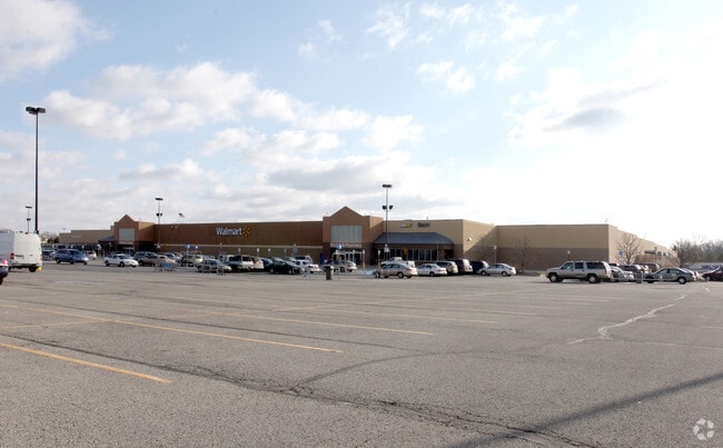
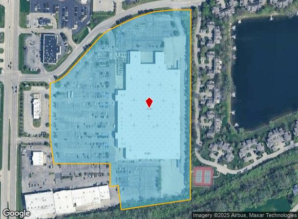
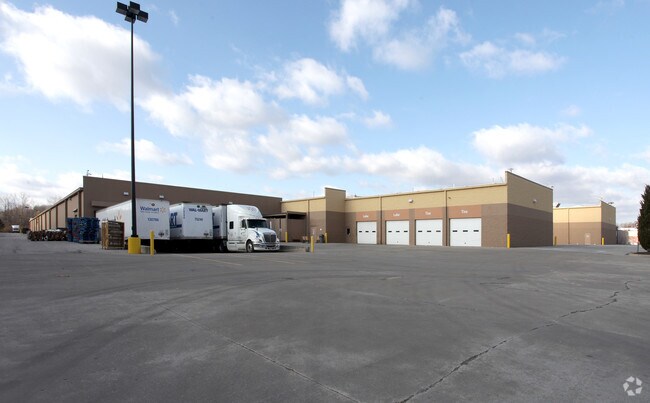
7351 N Keystone Ave
49-02-30-121-003.000-800
S1160'W430.78' TO BEG 18.578AC
Regionalshoppingcenterormallwithanchorstore
Marion
AE
Indiana
18097C0063F
18.58 AC
2023
Keystone Crossing
2024
Indianapolis
320202
Indianapolis-Carmel-Greenwood, IN
217,344 SF
DEMOGRAPHICS near 7351 N Keystone Ave
1 Mile
3 Mile
5 Mile
2024 Total Population
7,655
66,538
207,292
2029 Population
7,547
65,835
208,107
Pop Growth 2024-2029
(1.41%)
(1.06%)
+ 0.39%
Average Age
42
40
39
2024 Total Households
3,764
32,239
92,564
HH Growth 2024-2029
(1.43%)
(1.18%)
+ 0.20%
Median Household Inc
$81,720
$83,708
$68,963
Avg Household Size
2.00
2.00
2.10
2024 Avg HH Vehicles
2.00
2.00
2.00
Median Home Value
$257,342
$301,727
$265,792
Median Year Built
1967
1968
1970
Nearby Places
Map Layers
Map Styles
 Street
 Aerial
- Restaurants
- Banks
- Shops
- Fitness
- Groceries
PUBLIC TRANSPORTATION
AIRPORT
Indianapolis International
DRIVE
WALK
Distance
Indianapolis International
44 min
23.9 mi
Nearby Properties
Address
Land Use
TOTAL SIZE
Lot Size
Zoning
Address
Land Use
TOTAL SIZE
Lot Size
Zoning
8,551 SF
45.92 AC
ZO01
Address
Land Use
TOTAL SIZE
Lot Size
Zoning
16,704 SF
109.83 AC
ZO01
Address
Land Use
TOTAL SIZE
Lot Size
Zoning
4,146 SF
45.91 AC
ZO01
Address
Land Use
TOTAL SIZE
Lot Size
Zoning
315,968 SF
0.06 AC
ZO01
Address
Land Use
TOTAL SIZE
Lot Size
Zoning
117,212 SF
2.81 AC
Address
Land Use
TOTAL SIZE
Lot Size
Zoning
345 SF
6.39 AC
ZO01
Address
Land Use
TOTAL SIZE
Lot Size
Zoning
107,078 SF
15.66 AC
ZO01
Address
Land Use
TOTAL SIZE
Lot Size
Zoning
8,157 SF
113.93 AC
ZO01
Address
Land Use
TOTAL SIZE
Lot Size
Zoning
288 SF
7.35 AC
ZO01
Address
Land Use
TOTAL SIZE
Lot Size
Zoning
158,839 SF
0.06 AC
Address
Land Use
TOTAL SIZE
Lot Size
Zoning
1,904 SF
67.93 AC
ZO01
Address
Land Use
TOTAL SIZE
Lot Size
Zoning
3,316 SF
8.91 AC
ZO01
Address
Land Use
TOTAL SIZE
Lot Size
Zoning
229,554 SF
11.78 AC
ZO01
Address
Land Use
TOTAL SIZE
Lot Size
Zoning
235,807 SF
12.92 AC
Address
Land Use
TOTAL SIZE
Lot Size
Zoning
10,514 SF
15.75 AC
ZO01
Address
Land Use
TOTAL SIZE
Lot Size
Zoning
1,700 SF
33.14 AC
ZO01
Address
Land Use
TOTAL SIZE
Lot Size
Zoning
5,149 SF
10.56 AC
ZO01
Address
Land Use
TOTAL SIZE
Lot Size
Zoning
127,922 SF
3.35 AC
ZO01
Address
Land Use
TOTAL SIZE
Lot Size
Zoning
50,698 SF
13.58 AC
Address
Land Use
TOTAL SIZE
Lot Size
Zoning
182,869 SF
7 AC
ZO01
Address
Land Use
TOTAL SIZE
Lot Size
Zoning
277,186 SF
23.90 AC
Address
Land Use
TOTAL SIZE
Lot Size
Zoning
76,657 SF
9.45 AC
ZO01
Address
Land Use
TOTAL SIZE
Lot Size
Zoning
118,729 SF
13.39 AC
ZO01
Address
Land Use
TOTAL SIZE
Lot Size
Zoning
318,950 SF
28.62 AC
ZO01
Address
Land Use
TOTAL SIZE
Lot Size
Zoning
24,112 SF
5.22 AC
ZO01
Address
Land Use
TOTAL SIZE
Lot Size
Zoning
176,870 SF
7.37 AC
ZO01
Address
Land Use
TOTAL SIZE
Lot Size
Zoning
272,688 SF
14.60 AC
ZO01
Address
Land Use
TOTAL SIZE
Lot Size
Zoning
138,637 SF
0.06 AC
Address
Land Use
TOTAL SIZE
Lot Size
Zoning
2,156 SF
0.46 AC
ZO01
Address
Land Use
TOTAL SIZE
Lot Size
Zoning
158,095 SF
5.78 AC
ZO01
The World's #1 Commercial Real Estate Marketplace
Connect with us
© 2026 CoStar Group
The information above has been obtained from sources believed reliable. While we do not doubt its accuracy we have not verified it and make no guarantee, warranty or representation about it. It is your responsibility to independently confirm its accuracy and completeness. Any projections, opinions, assumptions, or estimates used are for example only and do not represent the current or future performance of the property. The value of this transaction to you depends on tax and other factors which should be evaluated by your tax, financial, and legal advisors. You and your advisors should conduct a careful, independent investigation of the property to determine to your satisfaction the suitability of the property for your needs.