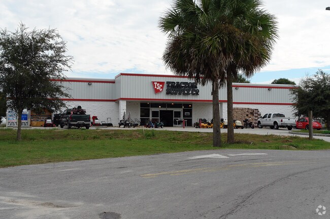
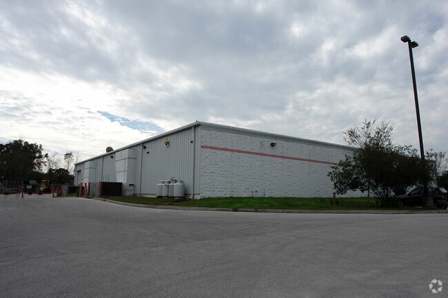
Property Record
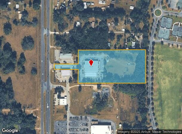
7351 N Us Highway 441, Ocala, FL 34475
NEARBY LISTINGS FOR SALE OR LEASE
Property Detail
7351 N Us Highway 441
Ocala, FL
Tkc Xxxvii
14713-000-00
SEC 19 TWP 14 RGE 22 PLAT BOOK 006 PAGE 075 TKC XXXVII LOT 1
Storebuilding
Marion
X
Florida
12083C0319D
1
2025
7.12 AC
2025
Outlying Marion County
000302
Ocala
22,113 SF
DEMOGRAPHICS near 7351 N Us Highway 441
1 Mile
3 Mile
5 Mile
2024 Total Population
1,647
11,499
42,772
2029 Population
1,856
12,932
48,121
Pop Growth 2024-2029
+ 12.69%
+ 12.46%
+ 12.51%
Average Age
40
40
41
2024 Total Households
645
4,391
16,502
HH Growth 2024-2029
+ 12.71%
+ 12.53%
+ 12.76%
Median Household Inc
$41,518
$44,424
$48,564
Avg Household Size
2.50
2.50
2.40
2024 Avg HH Vehicles
2.00
2.00
2.00
Median Home Value
$228,125
$223,826
$173,080
Median Year Built
1989
1986
1985
Nearby Places
Map Layers
Map Styles
 Street
 Aerial
- Restaurants
- Banks
- Shops
- Fitness
- Groceries
Nearby Properties
Address
Land Use
TOTAL SIZE
Lot Size
Zoning
Address
Land Use
TOTAL SIZE
Lot Size
Zoning
140,920 SF
28.09 AC
M2
Address
Land Use
TOTAL SIZE
Lot Size
Zoning
384,930 SF
17.76 AC
M1
Address
Land Use
TOTAL SIZE
Lot Size
Zoning
116,876 SF
23.78 AC
M2
Address
Land Use
TOTAL SIZE
Lot Size
Zoning
47,984 SF
486.37 AC
PUD
Address
Land Use
TOTAL SIZE
Lot Size
Zoning
73,361 SF
23.20 AC
GU
Address
Land Use
TOTAL SIZE
Lot Size
Zoning
66,531 SF
26.96 AC
B2
Address
Land Use
TOTAL SIZE
Lot Size
Zoning
44,100 SF
9.60 AC
R3
Address
Land Use
TOTAL SIZE
Lot Size
Zoning
72,855 SF
47.31 AC
B2
Address
Land Use
TOTAL SIZE
Lot Size
Zoning
57,558 SF
9.18 AC
B4
Address
Land Use
TOTAL SIZE
Lot Size
Zoning
115,909 SF
11.09 AC
RPUD
Address
Land Use
TOTAL SIZE
Lot Size
Zoning
41,195 SF
4 AC
B5
Address
Land Use
TOTAL SIZE
Lot Size
Zoning
31,259 SF
5.06 AC
PD
Address
Land Use
TOTAL SIZE
Lot Size
Zoning
16,430 SF
59.07 AC
A3
Address
Land Use
TOTAL SIZE
Lot Size
Zoning
43,737 SF
4.02 AC
B4
Address
Land Use
TOTAL SIZE
Lot Size
Zoning
27,776 SF
6.18 AC
A1
Address
Land Use
TOTAL SIZE
Lot Size
Zoning
21,519 SF
35.86 AC
B3
Address
Land Use
TOTAL SIZE
Lot Size
Zoning
49,915 SF
5 AC
PUD
Address
Land Use
TOTAL SIZE
Lot Size
Zoning
60,556 SF
11.73 AC
M1
Address
Land Use
TOTAL SIZE
Lot Size
Zoning
9,117 SF
18.84 AC
B3
Address
Land Use
TOTAL SIZE
Lot Size
Zoning
45,850 SF
3.64 AC
B4
Address
Land Use
TOTAL SIZE
Lot Size
Zoning
23,100 SF
4.18 AC
B2
Address
Land Use
TOTAL SIZE
Lot Size
Zoning
79,087 SF
11.02 AC
M1
Address
Land Use
TOTAL SIZE
Lot Size
Zoning
19,802 SF
10 AC
A1
Address
Land Use
TOTAL SIZE
Lot Size
Zoning
36,528 SF
25.84 AC
GU
Address
Land Use
TOTAL SIZE
Lot Size
Zoning
14,418 SF
8.39 AC
B5
Address
Land Use
TOTAL SIZE
Lot Size
Zoning
25,250 SF
14.96 AC
A1
Address
Land Use
TOTAL SIZE
Lot Size
Zoning
13,213 SF
4.60 AC
B2
Address
Land Use
TOTAL SIZE
Lot Size
Zoning
13,494 SF
40.14 AC
A1
Address
Land Use
TOTAL SIZE
Lot Size
Zoning
37,400 SF
9.59 AC
B5
Address
Land Use
TOTAL SIZE
Lot Size
Zoning
14,401 SF
1.99 AC
B4
The World's #1 Commercial Real Estate Marketplace
Connect with us
© 2026 CoStar Group
The information above has been obtained from sources believed reliable. While we do not doubt its accuracy we have not verified it and make no guarantee, warranty or representation about it. It is your responsibility to independently confirm its accuracy and completeness. Any projections, opinions, assumptions, or estimates used are for example only and do not represent the current or future performance of the property. The value of this transaction to you depends on tax and other factors which should be evaluated by your tax, financial, and legal advisors. You and your advisors should conduct a careful, independent investigation of the property to determine to your satisfaction the suitability of the property for your needs.