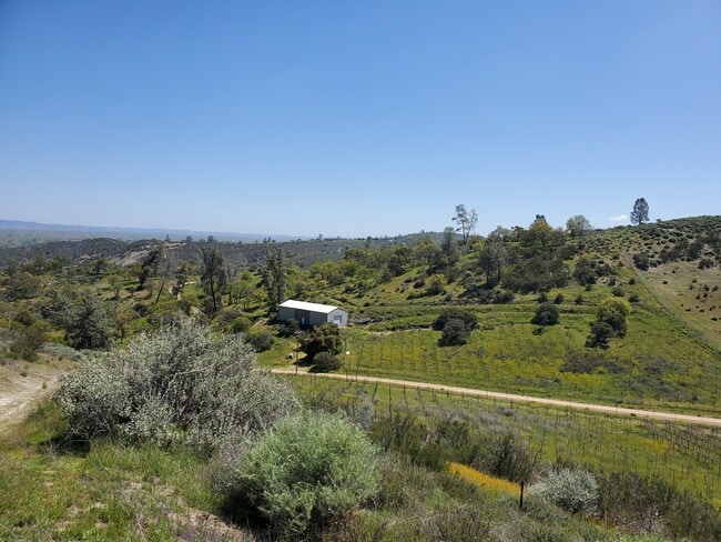
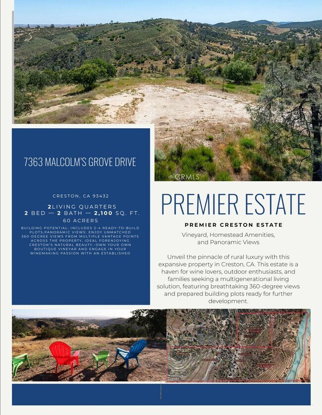
Property Record
7363 Malcolms Grove Dr, Creston, CA 93432

Current Lease Availabilities
Property Detail
7363 Malcolms Grove Dr
043-201-028
T28S R14E PTN SEC 13 LESS 50% MIN RTS IN PTN
Agriculturalland
SAN LUIS OBISPO
AG
California
A Areas with a 1% annual chance of flooding and a 26% chance of flooding over the life of a 30-year mortgage.
50 AC
2024
Outlying SLO County
2025
San Luis Obispo/Paso Robles
010301
San Luis Obispo-Paso Robles, CA
NEARBY LISTINGS FOR SALE OR LEASE
-
-
View all Creston listings for lease on LoopNet.com
DEMOGRAPHICS near 7363 Malcolms Grove Dr
1 mile
3 mile
5 mile
2025 Total Population
17
249
556
2030 Population
16
237
531
Pop Growth 2025-2030
(5.88%)
(4.82%)
(4.50%)
Average Age
42
44
44
2025 Total Households
6
92
212
HH Growth 2025-2030
0.00%
(5.43%)
(5.19%)
Median Household Inc
$137,500
$72,499
$102,734
Avg Household Size
2.40
2.60
2.60
2025 Avg HH Vehicles
3.00
3.00
3.00
Median Home Value
$1,100,000
$1,062,791
$1,055,851
Median Year Built
1989
1987
1992
Nearby Places
Map Layers
Map Styles
 Street
 Aerial
Layers
 Traffic
 Biking
Places
Listings with unknown addresses are not visible on the map
- Restaurants
- Banks
- Shops
- Fitness
- Groceries
PUBLIC TRANSPORTATION
AIRPORT
San Luis County Regional
Drive
Walk
Distance
San Luis County Regional
56 min
36.8 mi
Freight Ports
The Port of Hueneme
Drive
Walk
Distance
The Port of Hueneme
213 min
163.8 mi
Nearby Properties
Address
Land Use
TOTAL SIZE
Lot Size
Zoning
Address
Land Use
TOTAL SIZE
Lot Size
Zoning
4,189 SF
11.17 AC
RR
Address
Land Use
TOTAL SIZE
Lot Size
Zoning
160 AC
AG
Address
Land Use
TOTAL SIZE
Lot Size
Zoning
Address
Land Use
TOTAL SIZE
Lot Size
Zoning
480 AC
Address
Land Use
TOTAL SIZE
Lot Size
Zoning
Address
Land Use
TOTAL SIZE
Lot Size
Zoning
160 AC
AG
Address
Land Use
TOTAL SIZE
Lot Size
Zoning
19.23 AC
RR
Address
Land Use
TOTAL SIZE
Lot Size
Zoning
82.40 AC
AG
Address
Land Use
TOTAL SIZE
Lot Size
Zoning
1,848 SF
40 AC
AG
Address
Land Use
TOTAL SIZE
Lot Size
Zoning
40 AC
RL
Address
Land Use
TOTAL SIZE
Lot Size
Zoning
29.77 AC
Address
Land Use
TOTAL SIZE
Lot Size
Zoning
17.52 AC
RR
Address
Land Use
TOTAL SIZE
Lot Size
Zoning
160 AC
AG
Address
Land Use
TOTAL SIZE
Lot Size
Zoning
Address
Land Use
TOTAL SIZE
Lot Size
Zoning
Address
Land Use
TOTAL SIZE
Lot Size
Zoning
17.45 AC
AG
Address
Land Use
TOTAL SIZE
Lot Size
Zoning
1,552 SF
8.36 AC
RR
Address
Land Use
TOTAL SIZE
Lot Size
Zoning
Address
Land Use
TOTAL SIZE
Lot Size
Zoning
478.59 AC
AG
Address
Land Use
TOTAL SIZE
Lot Size
Zoning
10.35 AC
Address
Land Use
TOTAL SIZE
Lot Size
Zoning
Address
Land Use
TOTAL SIZE
Lot Size
Zoning
4.41 AC
RR
Address
Land Use
TOTAL SIZE
Lot Size
Zoning
546.60 AC
AG
Address
Land Use
TOTAL SIZE
Lot Size
Zoning
160 AC
Address
Land Use
TOTAL SIZE
Lot Size
Zoning
Address
Land Use
TOTAL SIZE
Lot Size
Zoning
320 AC
AG
Address
Land Use
TOTAL SIZE
Lot Size
Zoning
166.50 AC
AG
Address
Land Use
TOTAL SIZE
Lot Size
Zoning
Address
Land Use
TOTAL SIZE
Lot Size
Zoning
165.20 AC
AG
The World's #1 Commercial Real Estate Marketplace
Connect with us
© 2026 CoStar Group
The information above has been obtained from sources believed reliable. While we do not doubt its accuracy we have not verified it and make no guarantee, warranty or representation about it. It is your responsibility to independently confirm its accuracy and completeness. Any projections, opinions, assumptions, or estimates used are for example only and do not represent the current or future performance of the property. The value of this transaction to you depends on tax and other factors which should be evaluated by your tax, financial, and legal advisors. You and your advisors should conduct a careful, independent investigation of the property to determine to your satisfaction the suitability of the property for your needs.