Property Record
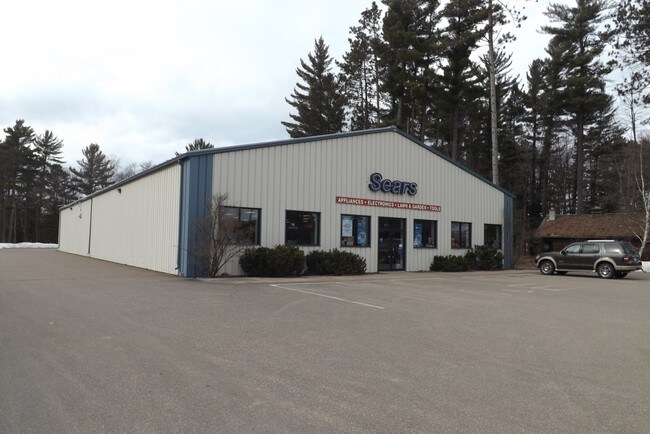
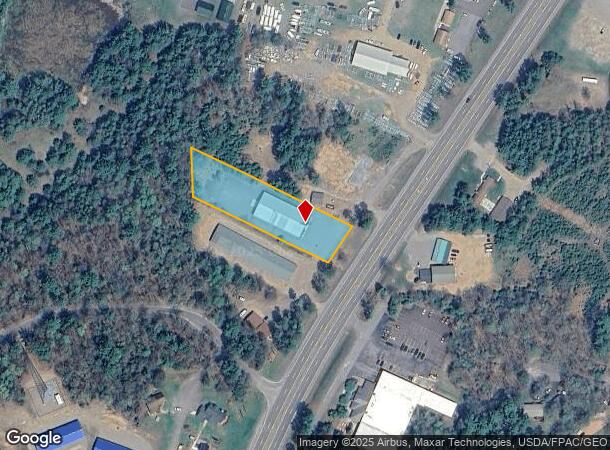
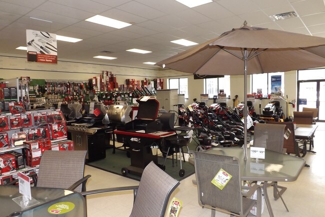
7363 Ush 51 S, Minocqua, WI 54548
NEARBY LISTINGS FOR SALE OR LEASE
Property Detail
7363 Ush 51 S
Other Market Areas
Certified Survey Map No 1713
MI 2498 4
DOC 795435/791766 PT NE SW & NW SE LOT 2 CSM V6 P1713 1.24CA/1.24SA SCRIV ERR DOC 795435
Commercialnec
Oneida
X
Wisconsin
55085C0305C
2
2024
1.24 AC
2024
Wisconsin North Area
971002
DEMOGRAPHICS near 7363 Ush 51 S
1 Mile
3 Mile
5 Mile
2024 Total Population
498
2,443
5,349
2029 Population
501
2,509
5,501
Pop Growth 2024-2029
+ 0.60%
+ 2.70%
+ 2.84%
Average Age
46
48
49
2024 Total Households
205
1,061
2,489
HH Growth 2024-2029
+ 0.49%
+ 2.64%
+ 2.61%
Median Household Inc
$70,473
$78,546
$73,794
Avg Household Size
2.20
2.20
2.10
2024 Avg HH Vehicles
2.00
2.00
2.00
Median Home Value
$239,655
$275,855
$275,519
Median Year Built
1989
1989
1988
Nearby Places
Map Layers
Map Styles
 Street
 Aerial
- Restaurants
- Banks
- Shops
- Fitness
- Groceries
SALE & LEASE HISTORY
LISTING DATE
SALE/LEASE

Sep 24, 2016
For Sale
May 14, 2019
For Sale
Jan 19, 2018
For Sale
Nearby Properties
Address
Land Use
TOTAL SIZE
Lot Size
Zoning
Address
Land Use
TOTAL SIZE
Lot Size
Zoning
18.78 AC
Address
Land Use
TOTAL SIZE
Lot Size
Zoning
8.99 AC
Address
Land Use
TOTAL SIZE
Lot Size
Zoning
24.37 AC
Address
Land Use
TOTAL SIZE
Lot Size
Zoning
30.91 AC
Address
Land Use
TOTAL SIZE
Lot Size
Zoning
7.35 AC
Address
Land Use
TOTAL SIZE
Lot Size
Zoning
30.20 AC
Address
Land Use
TOTAL SIZE
Lot Size
Zoning
49.46 AC
Address
Land Use
TOTAL SIZE
Lot Size
Zoning
Address
Land Use
TOTAL SIZE
Lot Size
Zoning
17.92 AC
Address
Land Use
TOTAL SIZE
Lot Size
Zoning
29.31 AC
Address
Land Use
TOTAL SIZE
Lot Size
Zoning
Address
Land Use
TOTAL SIZE
Lot Size
Zoning
2.96 AC
Address
Land Use
TOTAL SIZE
Lot Size
Zoning
Address
Land Use
TOTAL SIZE
Lot Size
Zoning
4.49 AC
Address
Land Use
TOTAL SIZE
Lot Size
Zoning
6.79 AC
Address
Land Use
TOTAL SIZE
Lot Size
Zoning
5.46 AC
Address
Land Use
TOTAL SIZE
Lot Size
Zoning
5.29 AC
Address
Land Use
TOTAL SIZE
Lot Size
Zoning
3.04 AC
Address
Land Use
TOTAL SIZE
Lot Size
Zoning
3.45 AC
Address
Land Use
TOTAL SIZE
Lot Size
Zoning
Address
Land Use
TOTAL SIZE
Lot Size
Zoning
1.71 AC
Address
Land Use
TOTAL SIZE
Lot Size
Zoning
0.84 AC
Address
Land Use
TOTAL SIZE
Lot Size
Zoning
18.12 AC
Address
Land Use
TOTAL SIZE
Lot Size
Zoning
19.36 AC
Address
Land Use
TOTAL SIZE
Lot Size
Zoning
1.30 AC
Address
Land Use
TOTAL SIZE
Lot Size
Zoning
4.84 AC
Address
Land Use
TOTAL SIZE
Lot Size
Zoning
1.89 AC
Address
Land Use
TOTAL SIZE
Lot Size
Zoning
2.37 AC
Address
Land Use
TOTAL SIZE
Lot Size
Zoning
1.50 AC
Address
Land Use
TOTAL SIZE
Lot Size
Zoning
8.59 AC
The World's #1 Commercial Real Estate Marketplace
Connect with us
© 2025 CoStar Group
The information above has been obtained from sources believed reliable. While we do not doubt its accuracy we have not verified it and make no guarantee, warranty or representation about it. It is your responsibility to independently confirm its accuracy and completeness. Any projections, opinions, assumptions, or estimates used are for example only and do not represent the current or future performance of the property. The value of this transaction to you depends on tax and other factors which should be evaluated by your tax, financial, and legal advisors. You and your advisors should conduct a careful, independent investigation of the property to determine to your satisfaction the suitability of the property for your needs.