Property Record
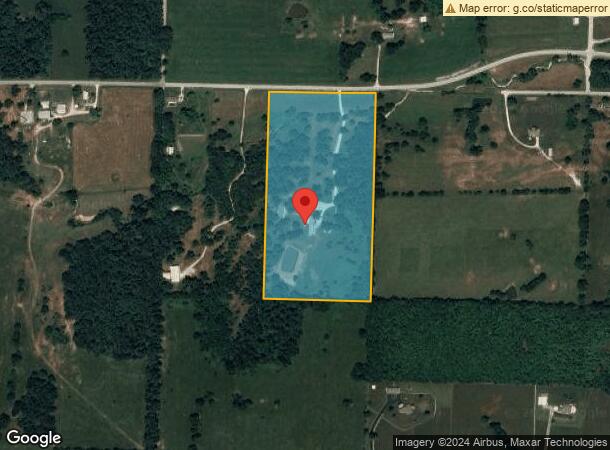
7368 W Farm Road 186, Republic, MO 65738


NEARBY LISTINGS FOR SALE OR LEASE
Property Detail
7368 W Farm Road 186
17-27-200-007
20A M/L E1/2 NW1/4 NW1/4 27/28/23
Commercialnec
Greene
A
Missouri
29043C0030D
20 AC
2025
Outlying Greene County
2025
Springfield
004804
Springfield, MO
DEMOGRAPHICS near 7368 W Farm Road 186
1 Mile
3 Mile
5 Mile
2024 Total Population
2,496
20,776
33,483
2029 Population
2,592
21,746
35,156
Pop Growth 2024-2029
+ 3.85%
+ 4.67%
+ 5.00%
Average Age
36
36
38
2024 Total Households
892
7,817
12,544
HH Growth 2024-2029
+ 3.92%
+ 4.85%
+ 5.11%
Median Household Inc
$62,480
$63,275
$71,939
Avg Household Size
2.80
2.60
2.60
2024 Avg HH Vehicles
2.00
2.00
2.00
Median Home Value
$159,291
$177,956
$196,808
Median Year Built
1990
1994
1997
Nearby Places
Map Layers
Map Styles
 Street
 Aerial
- Restaurants
- Banks
- Shops
- Fitness
- Groceries
PUBLIC TRANSPORTATION
AIRPORT
Springfield-Branson Ntl
DRIVE
WALK
Distance
Springfield-Branson Ntl
32 min
15.9 mi
Freight Ports
Tulsa Port of Inola
DRIVE
WALK
Distance
Tulsa Port of Inola
192 min
167.8 mi
SALE & LEASE HISTORY
LISTING DATE
SALE/LEASE

Jun 16, 2021
For Sale
Nearby Properties
Address
Land Use
TOTAL SIZE
Lot Size
Zoning
Address
Land Use
TOTAL SIZE
Lot Size
Zoning
157,134 SF
18.35 AC
INC
Address
Land Use
TOTAL SIZE
Lot Size
Zoning
129,624 SF
10.94 AC
INC
Address
Land Use
TOTAL SIZE
Lot Size
Zoning
Address
Land Use
TOTAL SIZE
Lot Size
Zoning
136,508 SF
16.42 AC
INC
Address
Land Use
TOTAL SIZE
Lot Size
Zoning
1,881 SF
3.45 AC
INC
Address
Land Use
TOTAL SIZE
Lot Size
Zoning
12.09 AC
Address
Land Use
TOTAL SIZE
Lot Size
Zoning
43,092 SF
5.51 AC
INC
Address
Land Use
TOTAL SIZE
Lot Size
Zoning
1,315 SF
7.58 AC
Address
Land Use
TOTAL SIZE
Lot Size
Zoning
5.24 AC
Address
Land Use
TOTAL SIZE
Lot Size
Zoning
8.65 AC
INC
Address
Land Use
TOTAL SIZE
Lot Size
Zoning
3.56 AC
INC
Address
Land Use
TOTAL SIZE
Lot Size
Zoning
50,472 SF
4.03 AC
INC
Address
Land Use
TOTAL SIZE
Lot Size
Zoning
80,344 SF
5.31 AC
INC
Address
Land Use
TOTAL SIZE
Lot Size
Zoning
1.94 AC
INC.
Address
Land Use
TOTAL SIZE
Lot Size
Zoning
10,726 SF
1.92 AC
INC
Address
Land Use
TOTAL SIZE
Lot Size
Zoning
2.65 AC
INC
Address
Land Use
TOTAL SIZE
Lot Size
Zoning
9,960 SF
5.09 AC
INC
Address
Land Use
TOTAL SIZE
Lot Size
Zoning
46,775 SF
4.60 AC
INC
Address
Land Use
TOTAL SIZE
Lot Size
Zoning
27,924 SF
2.04 AC
INC
Address
Land Use
TOTAL SIZE
Lot Size
Zoning
76,794 SF
6.46 AC
INC
Address
Land Use
TOTAL SIZE
Lot Size
Zoning
2,400 SF
5.29 AC
INC
Address
Land Use
TOTAL SIZE
Lot Size
Zoning
17,848 SF
1.15 AC
INC
Address
Land Use
TOTAL SIZE
Lot Size
Zoning
1.28 AC
INC
Address
Land Use
TOTAL SIZE
Lot Size
Zoning
23,336 SF
4 AC
INC
Address
Land Use
TOTAL SIZE
Lot Size
Zoning
14,493 SF
2.33 AC
INC
Address
Land Use
TOTAL SIZE
Lot Size
Zoning
18.89 AC
INC
Address
Land Use
TOTAL SIZE
Lot Size
Zoning
Address
Land Use
TOTAL SIZE
Lot Size
Zoning
10,742 SF
2.21 AC
INC
Address
Land Use
TOTAL SIZE
Lot Size
Zoning
41,504 SF
2.70 AC
INC
Address
Land Use
TOTAL SIZE
Lot Size
Zoning
45,756 SF
11.25 AC
INC
The World's #1 Commercial Real Estate Marketplace
Connect with us
© 2026 CoStar Group
The information above has been obtained from sources believed reliable. While we do not doubt its accuracy we have not verified it and make no guarantee, warranty or representation about it. It is your responsibility to independently confirm its accuracy and completeness. Any projections, opinions, assumptions, or estimates used are for example only and do not represent the current or future performance of the property. The value of this transaction to you depends on tax and other factors which should be evaluated by your tax, financial, and legal advisors. You and your advisors should conduct a careful, independent investigation of the property to determine to your satisfaction the suitability of the property for your needs.