Property Record
7370 N Hanley Rd, Hazelwood, MO 63042


NEARBY LISTINGS FOR SALE OR LEASE
Property Detail
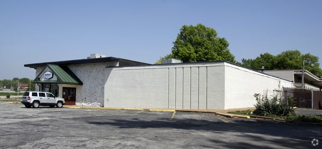
7370 N Hanley Rd
St. Louis, MO-IL
Vibha
09K-32-4453
VIBHA LOT 1
Restaurantbuilding
St. Louis
X
Missouri
29183C0325G
1
2024
1.23 AC
2025
North County
211600
St. Louis
10,458 SF
DEMOGRAPHICS near 7370 N Hanley Rd
1 Mile
3 Mile
5 Mile
2024 Total Population
11,041
81,764
218,780
2029 Population
10,929
80,404
216,228
Pop Growth 2024-2029
(1.01%)
(1.66%)
(1.17%)
Average Age
38
39
39
2024 Total Households
4,594
32,988
88,949
HH Growth 2024-2029
(1.04%)
(1.73%)
(1.22%)
Median Household Inc
$42,535
$54,961
$52,039
Avg Household Size
2.30
2.40
2.40
2024 Avg HH Vehicles
2.00
2.00
2.00
Median Home Value
$83,393
$130,944
$130,321
Median Year Built
1959
1961
1962
Nearby Places
Map Layers
Map Styles
 Street
 Aerial
- Restaurants
- Banks
- Shops
- Fitness
- Groceries
PUBLIC TRANSPORTATION
COMMUTER RAIL
Lambert Airport East Terminal (Lambert Airport Shiloh-Scott - St. Louis MetroLink (MetroLink))
DRIVE
WALK
Distance
Lambert Airport East Terminal (Lambert Airport Shiloh-Scott - St. Louis MetroLink (MetroLink))
7 min
4.2 mi
North Hanley (Lambert Airport Shiloh-Scott - St. Louis MetroLink (MetroLink))
DRIVE
WALK
Distance
North Hanley (Lambert Airport Shiloh-Scott - St. Louis MetroLink (MetroLink))
8 min
4.6 mi
AIRPORT
St Louis Lambert International
DRIVE
WALK
Distance
St Louis Lambert International
6 min
2.6 mi
Scott AFB/Midamerica St Louis
DRIVE
WALK
Distance
Scott AFB/Midamerica St Louis
57 min
38.9 mi
SALE & LEASE HISTORY
LISTING DATE
SALE/LEASE

Sep 07, 2022
For Sale
Nearby Properties
Address
Land Use
TOTAL SIZE
Lot Size
Zoning
Address
Land Use
TOTAL SIZE
Lot Size
Zoning
1,770,455 SF
1,090.47 AC
NU
Address
Land Use
TOTAL SIZE
Lot Size
Zoning
1,817,830 SF
75.99 AC
M1
Address
Land Use
TOTAL SIZE
Lot Size
Zoning
2,640,818 SF
159.97 AC
7M-1
Address
Land Use
TOTAL SIZE
Lot Size
Zoning
4,416 SF
54.81 AC
80B
Address
Land Use
TOTAL SIZE
Lot Size
Zoning
25,545 SF
82.84 AC
R1B
Address
Land Use
TOTAL SIZE
Lot Size
Zoning
71.29 AC
24R4
Address
Land Use
TOTAL SIZE
Lot Size
Zoning
893,188 SF
71.88 AC
G
Address
Land Use
TOTAL SIZE
Lot Size
Zoning
815,658 SF
28.70 AC
M1
Address
Land Use
TOTAL SIZE
Lot Size
Zoning
816,783 SF
37.97 AC
7M-1
Address
Land Use
TOTAL SIZE
Lot Size
Zoning
528,000 SF
21.10 AC
80I
Address
Land Use
TOTAL SIZE
Lot Size
Zoning
35.96 AC
R2
Address
Land Use
TOTAL SIZE
Lot Size
Zoning
309,486 SF
10.73 AC
7M-1
Address
Land Use
TOTAL SIZE
Lot Size
Zoning
136,258 SF
263.16 AC
7M-1
Address
Land Use
TOTAL SIZE
Lot Size
Zoning
277,926 SF
12.61 AC
67C-2
Address
Land Use
TOTAL SIZE
Lot Size
Zoning
15.37 AC
R
Address
Land Use
TOTAL SIZE
Lot Size
Zoning
406,000 SF
18.82 AC
80CA
Address
Land Use
TOTAL SIZE
Lot Size
Zoning
271,184 SF
13.67 AC
B3
Address
Land Use
TOTAL SIZE
Lot Size
Zoning
335,294 SF
33.83 AC
24MFD
Address
Land Use
TOTAL SIZE
Lot Size
Zoning
6.88 AC
H
Address
Land Use
TOTAL SIZE
Lot Size
Zoning
18,734 SF
38.83 AC
24R4
Address
Land Use
TOTAL SIZE
Lot Size
Zoning
1,428 SF
131.27 AC
C
Address
Land Use
TOTAL SIZE
Lot Size
Zoning
206,787 SF
37.07 AC
72R1
Address
Land Use
TOTAL SIZE
Lot Size
Zoning
293,622 SF
28.06 AC
H
Address
Land Use
TOTAL SIZE
Lot Size
Zoning
354,790 SF
22.46 AC
B6
Address
Land Use
TOTAL SIZE
Lot Size
Zoning
659,138 SF
1,142.84 AC
M1
Address
Land Use
TOTAL SIZE
Lot Size
Zoning
262,938 SF
11.32 AC
80H
Address
Land Use
TOTAL SIZE
Lot Size
Zoning
269,258 SF
89.80 AC
80F
Address
Land Use
TOTAL SIZE
Lot Size
Zoning
214,280 SF
22.39 AC
NU
Address
Land Use
TOTAL SIZE
Lot Size
Zoning
218,766 SF
13.34 AC
7M-1
Address
Land Use
TOTAL SIZE
Lot Size
Zoning
17.37 AC
B
The World's #1 Commercial Real Estate Marketplace
Connect with us
© 2025 CoStar Group
The information above has been obtained from sources believed reliable. While we do not doubt its accuracy we have not verified it and make no guarantee, warranty or representation about it. It is your responsibility to independently confirm its accuracy and completeness. Any projections, opinions, assumptions, or estimates used are for example only and do not represent the current or future performance of the property. The value of this transaction to you depends on tax and other factors which should be evaluated by your tax, financial, and legal advisors. You and your advisors should conduct a careful, independent investigation of the property to determine to your satisfaction the suitability of the property for your needs.