Property Record
7388 N Liberty Dr, Middletown, OH 45044

Property Detail
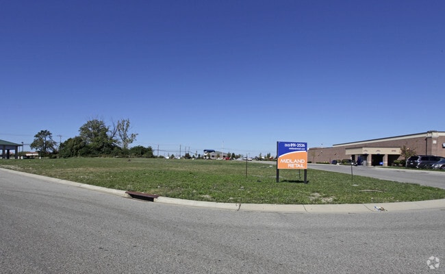
7388 N Liberty Dr
D2020-290-000-003
3 ENT LIBERTY COMMONS UNIV PTE TIF SEE PCL 003T
Restaurantdrivein
BUTLER
ADV
Ohio
B and X Area of moderate flood hazard, usually the area between the limits of the 100-year and 500-year floods.
1.04 AC
2024
Butler County
2025
Cincinnati/Dayton
011120
Cincinnati, OH-KY-IN
2,768 SF
NEARBY LISTINGS FOR SALE OR LEASE
DEMOGRAPHICS near 7388 N Liberty Dr
1 mile
3 mile
5 mile
2025 Total Population
6,091
55,992
139,997
2030 Population
6,301
57,658
144,541
Pop Growth 2025-2030
+ 3.45%
+ 2.98%
+ 3.25%
Average Age
39
39
40
2025 Total Households
2,298
19,553
49,330
HH Growth 2025-2030
+ 3.48%
+ 3.08%
+ 3.31%
Median Household Inc
$119,809
$125,320
$127,411
Avg Household Size
2.60
2.80
2.80
2025 Avg HH Vehicles
2.00
2.00
2.00
Median Home Value
$350,964
$394,216
$391,163
Median Year Built
1995
1994
1994
Nearby Places
Map Layers
Map Styles
 Street
 Aerial
Layers
 Traffic
 Biking
Places
Listings with unknown addresses are not visible on the map
- Restaurants
- Banks
- Shops
- Fitness
- Groceries
PUBLIC TRANSPORTATION
AIRPORT
Cincinnati/Northern Kentucky International
Drive
Walk
Distance
Cincinnati/Northern Kentucky International
54 min
35.2 mi
SALE & LEASE HISTORY
LISTING DATE
SALE/LEASE

Sep 24, 2016
For Sale
Dec 15, 2016
For Sale
Nearby Properties
Address
Land Use
TOTAL SIZE
Lot Size
Zoning
Address
Land Use
TOTAL SIZE
Lot Size
Zoning
21,549 SF
30.60 AC
Address
Land Use
TOTAL SIZE
Lot Size
Zoning
1,764 SF
17.27 AC
Address
Land Use
TOTAL SIZE
Lot Size
Zoning
431,936 SF
14.27 AC
Address
Land Use
TOTAL SIZE
Lot Size
Zoning
136,681 SF
22.56 AC
Address
Land Use
TOTAL SIZE
Lot Size
Zoning
300,943 SF
23.01 AC
Address
Land Use
TOTAL SIZE
Lot Size
Zoning
52,013 SF
48.54 AC
Address
Land Use
TOTAL SIZE
Lot Size
Zoning
179,048 SF
12.32 AC
Address
Land Use
TOTAL SIZE
Lot Size
Zoning
62.02 AC
Address
Land Use
TOTAL SIZE
Lot Size
Zoning
188,177 SF
4.62 AC
Address
Land Use
TOTAL SIZE
Lot Size
Zoning
262,173 SF
2.32 AC
Address
Land Use
TOTAL SIZE
Lot Size
Zoning
158,680 SF
22.49 AC
Address
Land Use
TOTAL SIZE
Lot Size
Zoning
82,493 SF
26.57 AC
Address
Land Use
TOTAL SIZE
Lot Size
Zoning
178,374 SF
2.14 AC
Address
Land Use
TOTAL SIZE
Lot Size
Zoning
107,304 SF
0.70 AC
Address
Land Use
TOTAL SIZE
Lot Size
Zoning
Address
Land Use
TOTAL SIZE
Lot Size
Zoning
159,456 SF
19.19 AC
Address
Land Use
TOTAL SIZE
Lot Size
Zoning
78,895 SF
5.98 AC
Address
Land Use
TOTAL SIZE
Lot Size
Zoning
222,920 SF
22.73 AC
Address
Land Use
TOTAL SIZE
Lot Size
Zoning
46,835 SF
4.43 AC
Address
Land Use
TOTAL SIZE
Lot Size
Zoning
197,448 SF
2.73 AC
Address
Land Use
TOTAL SIZE
Lot Size
Zoning
88,569 SF
3.67 AC
ADV
Address
Land Use
TOTAL SIZE
Lot Size
Zoning
89,025 SF
10.14 AC
Address
Land Use
TOTAL SIZE
Lot Size
Zoning
71,526 SF
2.35 AC
Address
Land Use
TOTAL SIZE
Lot Size
Zoning
254,196 SF
56.15 AC
Address
Land Use
TOTAL SIZE
Lot Size
Zoning
39,399 SF
18.19 AC
Address
Land Use
TOTAL SIZE
Lot Size
Zoning
44,073 SF
0.74 AC
Address
Land Use
TOTAL SIZE
Lot Size
Zoning
30,118 SF
36.92 AC
Address
Land Use
TOTAL SIZE
Lot Size
Zoning
201,141 SF
2.83 AC
Address
Land Use
TOTAL SIZE
Lot Size
Zoning
138,750 SF
14.93 AC
Address
Land Use
TOTAL SIZE
Lot Size
Zoning
233,623 SF
25.18 AC
The World's #1 Commercial Real Estate Marketplace
Connect with us
© 2026 CoStar Group
The information above has been obtained from sources believed reliable. While we do not doubt its accuracy we have not verified it and make no guarantee, warranty or representation about it. It is your responsibility to independently confirm its accuracy and completeness. Any projections, opinions, assumptions, or estimates used are for example only and do not represent the current or future performance of the property. The value of this transaction to you depends on tax and other factors which should be evaluated by your tax, financial, and legal advisors. You and your advisors should conduct a careful, independent investigation of the property to determine to your satisfaction the suitability of the property for your needs.