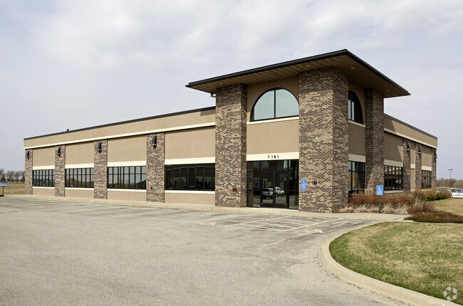
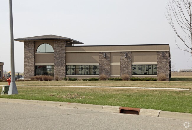
Property Record
7320 Airport View Dr Sw, Rochester, MN 55902
NEARBY LISTINGS FOR SALE OR LEASE
-
-
View all Rochester listings for lease on LoopNet.com
Property Detail
7320 Airport View Dr Sw
Rochester, MN
City Lands 105-14-10
54.10.21.045305
SECT-10 TWP-105 RANGE-014 CITY LANDS 105-14-10 120.00 AC S12 NE14 & NE14 NW14 SEC 10-105-14
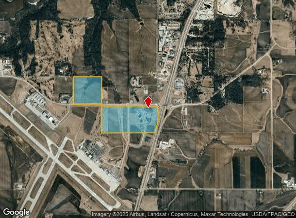
Airport
Olmsted
X
Minnesota
27109C0315D
226.32 AC
0
Historic Southwest
2024
Other Market Areas
002200
DEMOGRAPHICS near 7320 Airport View Dr Sw
1 Mile
3 Mile
5 Mile
2024 Total Population
222
3,713
18,546
2029 Population
219
3,788
18,900
Pop Growth 2024-2029
(1.35%)
+ 2.02%
+ 1.91%
Average Age
41
38
38
2024 Total Households
85
1,333
6,860
HH Growth 2024-2029
(1.18%)
+ 1.88%
+ 1.76%
Median Household Inc
$95,535
$132,738
$106,572
Avg Household Size
2.60
2.80
2.70
2024 Avg HH Vehicles
3.00
2.00
2.00
Median Home Value
$357,499
$393,749
$330,968
Median Year Built
1996
2004
1995
Nearby Places
- Restaurants
- Banks
- Shops
- Fitness
- Groceries
PUBLIC TRANSPORTATION
AIRPORT
Rochester International
DRIVE
WALK
Distance
Rochester International
2 min
0.9 mi
Freight Ports
Port Milwaukee
DRIVE
WALK
Distance
Port Milwaukee
306 min
279.9 mi
SALE & LEASE HISTORY
LISTING DATE
SALE/LEASE

Apr 01, 2019
For Lease
Nearby Properties
Address
Land Use
TOTAL SIZE
Lot Size
Zoning
Address
Land Use
TOTAL SIZE
Lot Size
Zoning
6.83 AC
Address
Land Use
TOTAL SIZE
Lot Size
Zoning
5.93 AC
Address
Land Use
TOTAL SIZE
Lot Size
Zoning
81,875 SF
155.34 AC
Address
Land Use
TOTAL SIZE
Lot Size
Zoning
306,910 SF
25.68 AC
Address
Land Use
TOTAL SIZE
Lot Size
Zoning
57.26 AC
Address
Land Use
TOTAL SIZE
Lot Size
Zoning
174,907 SF
13.16 AC
Address
Land Use
TOTAL SIZE
Lot Size
Zoning
159,417 SF
12.17 AC
Address
Land Use
TOTAL SIZE
Lot Size
Zoning
22,106 SF
2.02 AC
Address
Land Use
TOTAL SIZE
Lot Size
Zoning
39,650 SF
5.68 AC
Address
Land Use
TOTAL SIZE
Lot Size
Zoning
60,228 SF
7.51 AC
Address
Land Use
TOTAL SIZE
Lot Size
Zoning
103,813 SF
9.30 AC
Address
Land Use
TOTAL SIZE
Lot Size
Zoning
63,714 SF
17.42 AC
Address
Land Use
TOTAL SIZE
Lot Size
Zoning
22,320 SF
2.72 AC
Address
Land Use
TOTAL SIZE
Lot Size
Zoning
14,000 SF
5.32 AC
Address
Land Use
TOTAL SIZE
Lot Size
Zoning
30,607 SF
3.68 AC
Address
Land Use
TOTAL SIZE
Lot Size
Zoning
39,300 SF
3.18 AC
Address
Land Use
TOTAL SIZE
Lot Size
Zoning
7,896 SF
7.51 AC
Address
Land Use
TOTAL SIZE
Lot Size
Zoning
6,048 SF
4.79 AC
Address
Land Use
TOTAL SIZE
Lot Size
Zoning
22,493 SF
1.43 AC
Address
Land Use
TOTAL SIZE
Lot Size
Zoning
61,607 SF
3.60 AC
Address
Land Use
TOTAL SIZE
Lot Size
Zoning
28,609 SF
6 AC
Address
Land Use
TOTAL SIZE
Lot Size
Zoning
35,533 SF
3.11 AC
Address
Land Use
TOTAL SIZE
Lot Size
Zoning
25,600 SF
8.62 AC
Address
Land Use
TOTAL SIZE
Lot Size
Zoning
11,100 SF
1.93 AC
Address
Land Use
TOTAL SIZE
Lot Size
Zoning
12,160 SF
1.38 AC
Address
Land Use
TOTAL SIZE
Lot Size
Zoning
21,600 SF
4.93 AC
Address
Land Use
TOTAL SIZE
Lot Size
Zoning
24,880 SF
4.80 AC
Address
Land Use
TOTAL SIZE
Lot Size
Zoning
39,016 SF
2.72 AC
Address
Land Use
TOTAL SIZE
Lot Size
Zoning
46,346 SF
14.06 AC
Address
Land Use
TOTAL SIZE
Lot Size
Zoning
4,200 SF
3.69 AC
The World's #1 Commercial Real Estate Marketplace
Connect with us
© 2025 CoStar Group
The information above has been obtained from sources believed reliable. While we do not doubt its accuracy we have not verified it and make no guarantee, warranty or representation about it. It is your responsibility to independently confirm its accuracy and completeness. Any projections, opinions, assumptions, or estimates used are for example only and do not represent the current or future performance of the property. The value of this transaction to you depends on tax and other factors which should be evaluated by your tax, financial, and legal advisors. You and your advisors should conduct a careful, independent investigation of the property to determine to your satisfaction the suitability of the property for your needs.