Property Record
739 W Cherry St, Sunbury, OH 43074


NEARBY LISTINGS FOR SALE OR LEASE
-
-
View all Sunbury listings for lease on LoopNet.com
Property Detail
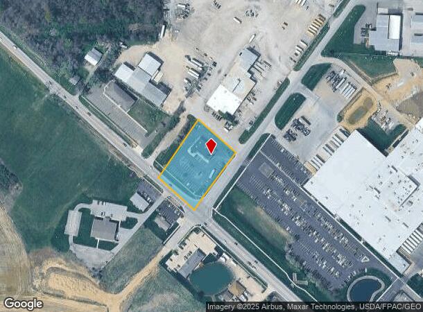
739 W Cherry St
Columbus, OH
Us Military Lands
417-134-01-005-000
LANDS 17 4 1 7
Storebuilding
Delaware
X
Ohio
39117C0325E
7
2024
1.51 AC
2024
Outlying Delaware County
011604
Columbus
5,204 SF
DEMOGRAPHICS near 739 W Cherry St
1 Mile
3 Mile
5 Mile
2024 Total Population
3,317
12,543
26,139
2029 Population
3,790
14,470
30,073
Pop Growth 2024-2029
+ 14.26%
+ 15.36%
+ 15.05%
Average Age
37
38
39
2024 Total Households
1,191
4,419
8,952
HH Growth 2024-2029
+ 14.53%
+ 15.46%
+ 15.23%
Median Household Inc
$101,766
$103,202
$120,654
Avg Household Size
2.70
2.80
2.90
2024 Avg HH Vehicles
2.00
2.00
2.00
Median Home Value
$342,136
$361,847
$412,087
Median Year Built
2010
2005
2003
Nearby Places
Map Layers
Map Styles
 Street
 Aerial
- Restaurants
- Banks
- Shops
- Fitness
- Groceries
PUBLIC TRANSPORTATION
AIRPORT
John Glenn Columbus International
DRIVE
WALK
Distance
John Glenn Columbus International
33 min
22.1 mi
Freight Ports
Port of Toledo
DRIVE
WALK
Distance
Port of Toledo
161 min
130.3 mi
SALE & LEASE HISTORY
LISTING DATE
SALE/LEASE

Jul 19, 2023
For Lease
Aug 23, 2023
For Lease
Aug 16, 2017
For Lease
Nearby Properties
Address
Land Use
TOTAL SIZE
Lot Size
Zoning
Address
Land Use
TOTAL SIZE
Lot Size
Zoning
388,229 SF
61.33 AC
Address
Land Use
TOTAL SIZE
Lot Size
Zoning
363,747 SF
103.50 AC
Address
Land Use
TOTAL SIZE
Lot Size
Zoning
142,469 SF
18.53 AC
Address
Land Use
TOTAL SIZE
Lot Size
Zoning
142,469 SF
13.53 AC
Address
Land Use
TOTAL SIZE
Lot Size
Zoning
51,527 SF
12.38 AC
Address
Land Use
TOTAL SIZE
Lot Size
Zoning
107,459 SF
36.42 AC
Address
Land Use
TOTAL SIZE
Lot Size
Zoning
76,049 SF
20.69 AC
Address
Land Use
TOTAL SIZE
Lot Size
Zoning
172.18 AC
Address
Land Use
TOTAL SIZE
Lot Size
Zoning
72,104 SF
10.92 AC
Address
Land Use
TOTAL SIZE
Lot Size
Zoning
62,412 SF
5.82 AC
Address
Land Use
TOTAL SIZE
Lot Size
Zoning
31,600 SF
17.39 AC
Address
Land Use
TOTAL SIZE
Lot Size
Zoning
39,200 SF
19.47 AC
Address
Land Use
TOTAL SIZE
Lot Size
Zoning
90,237 SF
11.44 AC
Address
Land Use
TOTAL SIZE
Lot Size
Zoning
35,922 SF
12.79 AC
Address
Land Use
TOTAL SIZE
Lot Size
Zoning
1,584 SF
38.90 AC
Address
Land Use
TOTAL SIZE
Lot Size
Zoning
76,291 SF
52.68 AC
Address
Land Use
TOTAL SIZE
Lot Size
Zoning
43,194 SF
10.80 AC
Address
Land Use
TOTAL SIZE
Lot Size
Zoning
86.70 AC
Address
Land Use
TOTAL SIZE
Lot Size
Zoning
109,394 SF
8.05 AC
Address
Land Use
TOTAL SIZE
Lot Size
Zoning
287,118 SF
38.68 AC
Address
Land Use
TOTAL SIZE
Lot Size
Zoning
125.82 AC
Address
Land Use
TOTAL SIZE
Lot Size
Zoning
4,580 SF
155.16 AC
Address
Land Use
TOTAL SIZE
Lot Size
Zoning
25,026 SF
11.17 AC
Address
Land Use
TOTAL SIZE
Lot Size
Zoning
90,530 SF
5 AC
Address
Land Use
TOTAL SIZE
Lot Size
Zoning
92,417 SF
15.15 AC
Address
Land Use
TOTAL SIZE
Lot Size
Zoning
2,304 SF
114.10 AC
Address
Land Use
TOTAL SIZE
Lot Size
Zoning
167.28 AC
Address
Land Use
TOTAL SIZE
Lot Size
Zoning
12,932 SF
251.45 AC
Address
Land Use
TOTAL SIZE
Lot Size
Zoning
30,736 SF
17.59 AC
Address
Land Use
TOTAL SIZE
Lot Size
Zoning
25,540 SF
22.37 AC
The World's #1 Commercial Real Estate Marketplace
Connect with us
© 2025 CoStar Group
The information above has been obtained from sources believed reliable. While we do not doubt its accuracy we have not verified it and make no guarantee, warranty or representation about it. It is your responsibility to independently confirm its accuracy and completeness. Any projections, opinions, assumptions, or estimates used are for example only and do not represent the current or future performance of the property. The value of this transaction to you depends on tax and other factors which should be evaluated by your tax, financial, and legal advisors. You and your advisors should conduct a careful, independent investigation of the property to determine to your satisfaction the suitability of the property for your needs.