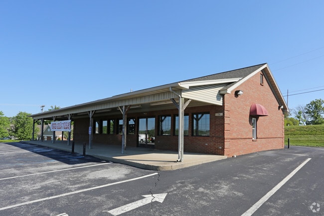
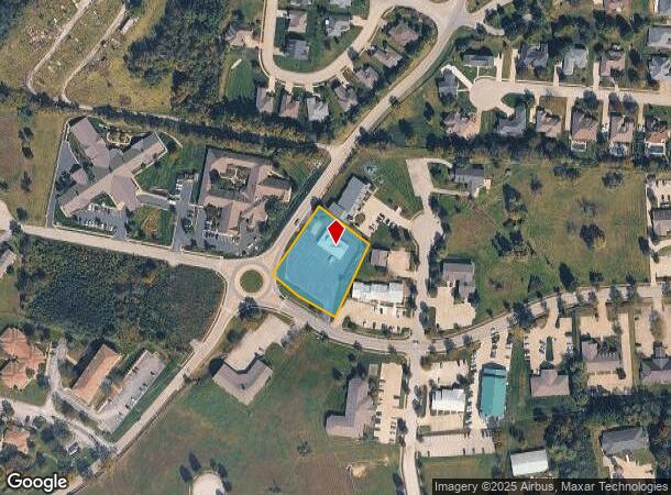
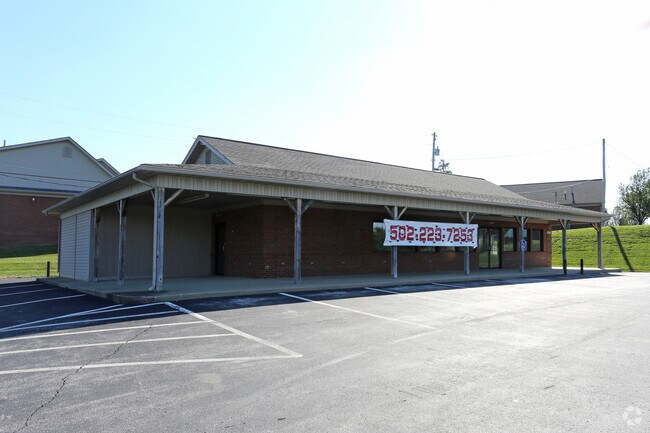
Property Record
74 C Michael Davenport Blvd, Frankfort, KY 40601
NEARBY LISTINGS FOR SALE OR LEASE
Property Detail
74 C Michael Davenport Blvd
Frankfort, KY
Prevention Park 3
036-00-00-011.07
PREVENTION PARK 3 PT OF 7
Miscellaneous
Franklin
X
Kentucky
21073C0116D
7
2025
1.03 AC
2025
Kentucky East Area
070405
Other Market Areas
DEMOGRAPHICS near 74 C Michael Davenport Blvd
1 Mile
3 Mile
5 Mile
2024 Total Population
3,483
15,453
29,859
2029 Population
3,494
15,519
30,133
Pop Growth 2024-2029
+ 0.32%
+ 0.43%
+ 0.92%
Average Age
43
42
41
2024 Total Households
1,652
6,734
12,670
HH Growth 2024-2029
+ 0.48%
+ 0.55%
+ 0.99%
Median Household Inc
$53,715
$61,432
$56,214
Avg Household Size
2.00
2.20
2.20
2024 Avg HH Vehicles
2.00
2.00
2.00
Median Home Value
$190,205
$181,615
$165,360
Median Year Built
1978
1976
1972
Nearby Places
Map Layers
Map Styles
 Street
 Aerial
- Restaurants
- Banks
- Shops
- Fitness
- Groceries
PUBLIC TRANSPORTATION
AIRPORT
Blue Grass
DRIVE
WALK
Distance
Blue Grass
33 min
23.6 mi
Freight Ports
Port of Toledo
DRIVE
WALK
Distance
Port of Toledo
349 min
299.2 mi
SALE & LEASE HISTORY
LISTING DATE
SALE/LEASE

Sep 24, 2016
For Sale
Dec 13, 2016
For Sale
Nearby Properties
Address
Land Use
TOTAL SIZE
Lot Size
Zoning
Address
Land Use
TOTAL SIZE
Lot Size
Zoning
Address
Land Use
TOTAL SIZE
Lot Size
Zoning
17.60 AC
Address
Land Use
TOTAL SIZE
Lot Size
Zoning
455.67 AC
Address
Land Use
TOTAL SIZE
Lot Size
Zoning
88.76 AC
Address
Land Use
TOTAL SIZE
Lot Size
Zoning
Address
Land Use
TOTAL SIZE
Lot Size
Zoning
14.61 AC
Address
Land Use
TOTAL SIZE
Lot Size
Zoning
14.80 AC
Address
Land Use
TOTAL SIZE
Lot Size
Zoning
Address
Land Use
TOTAL SIZE
Lot Size
Zoning
15.56 AC
Address
Land Use
TOTAL SIZE
Lot Size
Zoning
132.90 AC
Address
Land Use
TOTAL SIZE
Lot Size
Zoning
6.97 AC
Address
Land Use
TOTAL SIZE
Lot Size
Zoning
13.32 AC
Address
Land Use
TOTAL SIZE
Lot Size
Zoning
Address
Land Use
TOTAL SIZE
Lot Size
Zoning
Address
Land Use
TOTAL SIZE
Lot Size
Zoning
1.54 AC
Address
Land Use
TOTAL SIZE
Lot Size
Zoning
Address
Land Use
TOTAL SIZE
Lot Size
Zoning
Address
Land Use
TOTAL SIZE
Lot Size
Zoning
4.47 AC
Address
Land Use
TOTAL SIZE
Lot Size
Zoning
Address
Land Use
TOTAL SIZE
Lot Size
Zoning
Address
Land Use
TOTAL SIZE
Lot Size
Zoning
Address
Land Use
TOTAL SIZE
Lot Size
Zoning
Address
Land Use
TOTAL SIZE
Lot Size
Zoning
Address
Land Use
TOTAL SIZE
Lot Size
Zoning
Address
Land Use
TOTAL SIZE
Lot Size
Zoning
Address
Land Use
TOTAL SIZE
Lot Size
Zoning
Address
Land Use
TOTAL SIZE
Lot Size
Zoning
7.23 AC
Address
Land Use
TOTAL SIZE
Lot Size
Zoning
3.90 AC
Address
Land Use
TOTAL SIZE
Lot Size
Zoning
Address
Land Use
TOTAL SIZE
Lot Size
Zoning
The World's #1 Commercial Real Estate Marketplace
Connect with us
© 2025 CoStar Group
The information above has been obtained from sources believed reliable. While we do not doubt its accuracy we have not verified it and make no guarantee, warranty or representation about it. It is your responsibility to independently confirm its accuracy and completeness. Any projections, opinions, assumptions, or estimates used are for example only and do not represent the current or future performance of the property. The value of this transaction to you depends on tax and other factors which should be evaluated by your tax, financial, and legal advisors. You and your advisors should conduct a careful, independent investigation of the property to determine to your satisfaction the suitability of the property for your needs.