Property Record
74 Dowd Rd, Bangor, ME 04401
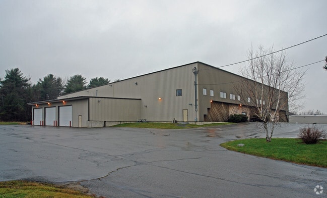

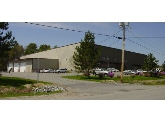
Property Detail
74 Dowd Rd
BANG-000010R-000000-000007-J000000
Penobscot
Commercialbuilding
Maine
I&S
7-j
B and X Area of moderate flood hazard, usually the area between the limits of the 100-year and 500-year floods.
3.77 AC
2024
Maine North & Bangor
2024
Other Market Areas
000700
Bangor, ME
61,100 SF
NEARBY LISTINGS FOR SALE OR LEASE
DEMOGRAPHICS near 74 Dowd Rd
1 mile
3 mile
5 mile
2025 Total Population
65
20,658
51,855
2030 Population
77
21,336
52,822
Pop Growth 2025-2030
+ 18.46%
+ 3.28%
+ 1.86%
Average Age
46
43
43
2025 Total Households
30
9,565
22,931
HH Growth 2025-2030
+ 20.00%
+ 3.42%
+ 1.88%
Median Household Inc
$54,166
$62,038
$66,028
Avg Household Size
1.90
2.00
2.10
2025 Avg HH Vehicles
2.00
1.00
2.00
Median Home Value
$233,333
$246,325
$258,277
Median Year Built
2011
1962
1968
Nearby Places
Map Layers
Map Styles
 Street
 Aerial
Transit
 Traffic
 Biking
Places
Listings with unknown addresses are not visible on the map
- Restaurants
- Banks
- Shops
- Fitness
- Groceries
PUBLIC TRANSPORTATION
AIRPORT
Bangor International
Drive
Walk
Distance
Bangor International
9 min
3.3 mi
Freight Ports
Searsport, ME
Drive
Walk
Distance
Searsport, ME
51 min
32.4 mi
SALE & LEASE HISTORY
LISTING DATE
SALE/LEASE

Oct 27, 2016
For Lease
Jul 28, 2020
For Lease
Jul 28, 2020
For Sale
Nearby Properties
Address
Land Use
TOTAL SIZE
Lot Size
Zoning
Address
Land Use
TOTAL SIZE
Lot Size
Zoning
466.65 AC
ADD
Address
Land Use
TOTAL SIZE
Lot Size
Zoning
186,220 SF
93.91 AC
G&SD
Address
Land Use
TOTAL SIZE
Lot Size
Zoning
609,180 SF
6.68 AC
USD
Address
Land Use
TOTAL SIZE
Lot Size
Zoning
6.37 AC
UID
Address
Land Use
TOTAL SIZE
Lot Size
Zoning
243,694 SF
2.95 AC
G&ISD
Address
Land Use
TOTAL SIZE
Lot Size
Zoning
54,122 SF
82.18 AC
12 - R
Address
Land Use
TOTAL SIZE
Lot Size
Zoning
87,750 SF
ADD
Address
Land Use
TOTAL SIZE
Lot Size
Zoning
400 SF
3.44 AC
WDD
Address
Land Use
TOTAL SIZE
Lot Size
Zoning
12,950 SF
23.39 AC
31 - I
Address
Land Use
TOTAL SIZE
Lot Size
Zoning
168,615 SF
19.44 AC
MDR-1
Address
Land Use
TOTAL SIZE
Lot Size
Zoning
38 AC
G&ISD
Address
Land Use
TOTAL SIZE
Lot Size
Zoning
Address
Land Use
TOTAL SIZE
Lot Size
Zoning
115,044 SF
13.30 AC
G&ISD
Address
Land Use
TOTAL SIZE
Lot Size
Zoning
184,000 SF
16.43 AC
31 - I
Address
Land Use
TOTAL SIZE
Lot Size
Zoning
110,031 SF
3.81 AC
GC&S
Address
Land Use
TOTAL SIZE
Lot Size
Zoning
119,930 SF
9.50 AC
S&PS
Address
Land Use
TOTAL SIZE
Lot Size
Zoning
144,000 SF
111.04 AC
32 - I
Address
Land Use
TOTAL SIZE
Lot Size
Zoning
109,507 SF
1.96 AC
G&ISD
Address
Land Use
TOTAL SIZE
Lot Size
Zoning
7 AC
WDD
Address
Land Use
TOTAL SIZE
Lot Size
Zoning
246,766 SF
22.44 AC
S&PS
Address
Land Use
TOTAL SIZE
Lot Size
Zoning
13.58 AC
Address
Land Use
TOTAL SIZE
Lot Size
Zoning
39.32 AC
CB
Address
Land Use
TOTAL SIZE
Lot Size
Zoning
69,703 SF
7.92 AC
USD
Address
Land Use
TOTAL SIZE
Lot Size
Zoning
55,514 SF
1.86 AC
G&ISD
Address
Land Use
TOTAL SIZE
Lot Size
Zoning
56,910 SF
15 AC
G&ISD
Address
Land Use
TOTAL SIZE
Lot Size
Zoning
33,608 SF
18.10 AC
G&ISD
Address
Land Use
TOTAL SIZE
Lot Size
Zoning
66,333 SF
5.31 AC
GC&S
Address
Land Use
TOTAL SIZE
Lot Size
Zoning
192,225 SF
2.41 AC
DDD
Address
Land Use
TOTAL SIZE
Lot Size
Zoning
69.23 AC
Address
Land Use
TOTAL SIZE
Lot Size
Zoning
76,143 SF
1.20 AC
ADD
The World's #1 Commercial Real Estate Marketplace
Connect with us
© 2026 CoStar Group
The information above has been obtained from sources believed reliable. While we do not doubt its accuracy we have not verified it and make no guarantee, warranty or representation about it. It is your responsibility to independently confirm its accuracy and completeness. Any projections, opinions, assumptions, or estimates used are for example only and do not represent the current or future performance of the property. The value of this transaction to you depends on tax and other factors which should be evaluated by your tax, financial, and legal advisors. You and your advisors should conduct a careful, independent investigation of the property to determine to your satisfaction the suitability of the property for your needs.